Property Record
5464 Ethel Way, Sacramento, CA 95820


NEARBY LISTINGS FOR SALE OR LEASE
Property Detail
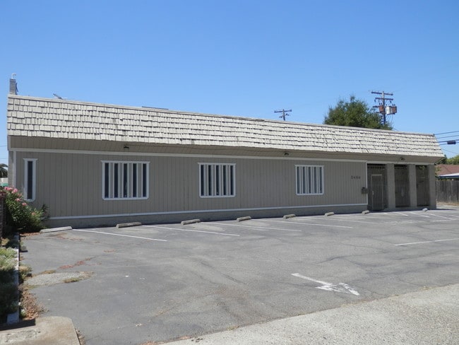
5464 Ethel Way
Sacramento--Roseville--Arden-Arcade, CA
City Farms 03
022-0262-005
N100 FT LOT G FRUITRIDGE OAKS UNIT 4
Officebuilding
Sacramento
X
California
06067C0190H
g
2024
0.28 AC
2025
South Sacramento
004401
Sacramento
3,576 SF
DEMOGRAPHICS near 5464 Ethel Way
1 Mile
3 Mile
5 Mile
2024 Total Population
26,900
174,920
417,856
2029 Population
27,138
176,246
421,386
Pop Growth 2024-2029
+ 0.88%
+ 0.76%
+ 0.84%
Average Age
36
37
38
2024 Total Households
8,329
61,300
157,252
HH Growth 2024-2029
+ 0.82%
+ 0.75%
+ 0.98%
Median Household Inc
$52,730
$62,537
$68,950
Avg Household Size
3.10
2.70
2.50
2024 Avg HH Vehicles
2.00
2.00
2.00
Median Home Value
$337,547
$397,428
$450,723
Median Year Built
1957
1960
1969
Nearby Places
Map Layers
Map Styles
 Street
 Aerial
- Restaurants
- Banks
- Shops
- Fitness
- Groceries
PUBLIC TRANSPORTATION
COMMUTER RAIL
Sacramento (Capitol Corridor - Capitol Corridor Joint Powers Authority)
DRIVE
WALK
Distance
Sacramento (Capitol Corridor - Capitol Corridor Joint Powers Authority)
11 min
6.4 mi
AIRPORT
Sacramento International
DRIVE
WALK
Distance
Sacramento International
25 min
17.2 mi
Freight Ports
Port of Stockton
DRIVE
WALK
Distance
Port of Stockton
55 min
44.9 mi
SALE & LEASE HISTORY
LISTING DATE
SALE/LEASE

Mar 31, 2020
For Lease
Mar 23, 2019
For Sale
Jun 26, 2018
For Sale
Jun 24, 2024
For Sale
Jul 28, 2017
For Sale
Jul 21, 2017
For Sale
Jul 17, 2017
For Lease
Jul 17, 2017
For Sale
Feb 13, 2024
For Sale
Dec 03, 2019
For Sale
Nearby Properties
Address
Land Use
TOTAL SIZE
Lot Size
Zoning
Address
Land Use
TOTAL SIZE
Lot Size
Zoning
7,742 SF
12.66 AC
M-1S-SWR
Address
Land Use
TOTAL SIZE
Lot Size
Zoning
299,943 SF
4.95 AC
H
Address
Land Use
TOTAL SIZE
Lot Size
Zoning
1.33 AC
R-1
Address
Land Use
TOTAL SIZE
Lot Size
Zoning
9.29 AC
R-1 OB-R-P
Address
Land Use
TOTAL SIZE
Lot Size
Zoning
1.15 AC
R-1
Address
Land Use
TOTAL SIZE
Lot Size
Zoning
31,163 SF
1.57 AC
C-2-TO-SPD
Address
Land Use
TOTAL SIZE
Lot Size
Zoning
350,049 SF
8.51 AC
MRD-SWR
Address
Land Use
TOTAL SIZE
Lot Size
Zoning
45.93 AC
M-2S
Address
Land Use
TOTAL SIZE
Lot Size
Zoning
281,448 SF
13.42 AC
RMX-TO R-2
Address
Land Use
TOTAL SIZE
Lot Size
Zoning
320,072 SF
2.65 AC
C-2
Address
Land Use
TOTAL SIZE
Lot Size
Zoning
2.59 AC
OB-R
Address
Land Use
TOTAL SIZE
Lot Size
Zoning
122,425 SF
0.59 AC
C-2-SPD
Address
Land Use
TOTAL SIZE
Lot Size
Zoning
1.15 AC
R-1
Address
Land Use
TOTAL SIZE
Lot Size
Zoning
156,462 SF
8.36 AC
R-3
Address
Land Use
TOTAL SIZE
Lot Size
Zoning
280,519 SF
2.50 AC
C-2-SPD
Address
Land Use
TOTAL SIZE
Lot Size
Zoning
141,251 SF
4.86 AC
C-2-SPD RM
Address
Land Use
TOTAL SIZE
Lot Size
Zoning
164,981 SF
3.95 AC
OB-SWR-PUD
Address
Land Use
TOTAL SIZE
Lot Size
Zoning
53,386 SF
7.75 AC
C-2-SPD
Address
Land Use
TOTAL SIZE
Lot Size
Zoning
171,405 SF
13.80 AC
R-1
Address
Land Use
TOTAL SIZE
Lot Size
Zoning
192,308 SF
5.42 AC
C-2
Address
Land Use
TOTAL SIZE
Lot Size
Zoning
128,950 SF
0.75 AC
RMX-TO-SPD
Address
Land Use
TOTAL SIZE
Lot Size
Zoning
261,350 SF
14.41 AC
M-2S
Address
Land Use
TOTAL SIZE
Lot Size
Zoning
146,643 SF
4.55 AC
RMX-TO-SPD
Address
Land Use
TOTAL SIZE
Lot Size
Zoning
159,121 SF
10.38 AC
C-2-TO
Address
Land Use
TOTAL SIZE
Lot Size
Zoning
213,445 SF
18.25 AC
SC
Address
Land Use
TOTAL SIZE
Lot Size
Zoning
87,402 SF
3.94 AC
R-3
Address
Land Use
TOTAL SIZE
Lot Size
Zoning
138,779 SF
44.77 AC
M-2S
Address
Land Use
TOTAL SIZE
Lot Size
Zoning
Address
Land Use
TOTAL SIZE
Lot Size
Zoning
55,344 SF
4.75 AC
M-2S
Address
Land Use
TOTAL SIZE
Lot Size
Zoning
150,652 SF
4.10 AC
OB-SWR-PUD
The World's #1 Commercial Real Estate Marketplace
Connect with us
© 2026 CoStar Group
The information above has been obtained from sources believed reliable. While we do not doubt its accuracy we have not verified it and make no guarantee, warranty or representation about it. It is your responsibility to independently confirm its accuracy and completeness. Any projections, opinions, assumptions, or estimates used are for example only and do not represent the current or future performance of the property. The value of this transaction to you depends on tax and other factors which should be evaluated by your tax, financial, and legal advisors. You and your advisors should conduct a careful, independent investigation of the property to determine to your satisfaction the suitability of the property for your needs.