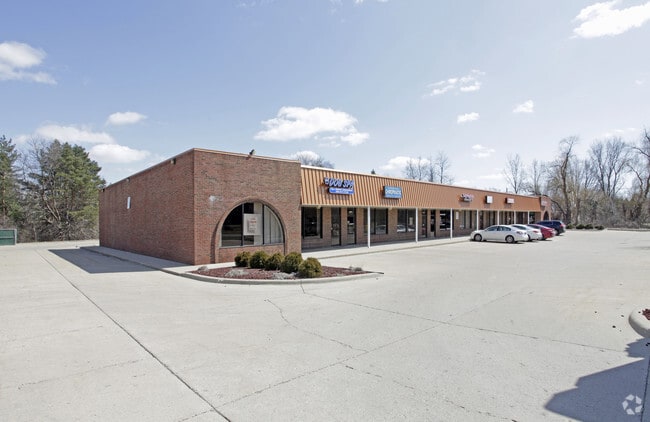
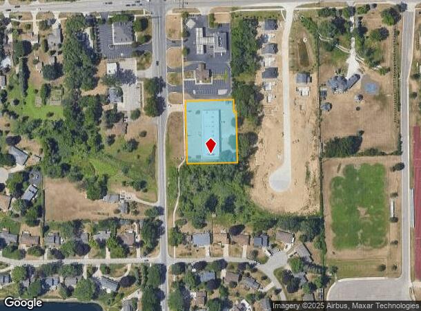
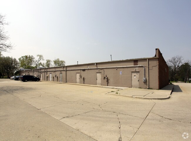
Property Record
54750 Mound Rd, Shelby Township, MI 48316
Current Lease Availabilities
NEARBY LISTINGS FOR SALE OR LEASE
Property Detail
54750 Mound Rd
23-07-09-101-016
T3N, R12E, SEC 9; COMM AT NW COR SEC 9; TH S00*44?22?W 410.00 FT; TH S89*11?40?E 102.00 FT TO POB; TH S89*11?40?E 200.00 FT;
Commercialnec
Macomb
X
Michigan
26099C0208H
1.25 AC
2024
Macomb West
2025
Detroit
225200
Detroit-Warren-Dearborn, MI
13,125 SF
DEMOGRAPHICS near 54750 Mound Rd
1 Mile
3 Mile
5 Mile
2024 Total Population
9,320
55,030
145,136
2029 Population
9,222
54,520
143,830
Pop Growth 2024-2029
(1.05%)
(0.93%)
(0.90%)
Average Age
43
42
42
2024 Total Households
3,924
21,160
57,162
HH Growth 2024-2029
(0.82%)
(0.90%)
(0.94%)
Median Household Inc
$90,549
$95,855
$92,681
Avg Household Size
2.30
2.60
2.50
2024 Avg HH Vehicles
2.00
2.00
2.00
Median Home Value
$356,981
$362,782
$341,676
Median Year Built
1994
1992
1989
Nearby Places
Map Layers
Map Styles
 Street
 Aerial
- Restaurants
- Banks
- Shops
- Fitness
- Groceries
PUBLIC TRANSPORTATION
AIRPORT
Windsor International
DRIVE
WALK
Distance
Windsor International
67 min
40.6 mi
Freight Ports
Port of Toledo
DRIVE
WALK
Distance
Port of Toledo
117 min
91.1 mi
Nearby Properties
Address
Land Use
TOTAL SIZE
Lot Size
Zoning
Address
Land Use
TOTAL SIZE
Lot Size
Zoning
998,316 SF
85.99 AC
CK MAP
Address
Land Use
TOTAL SIZE
Lot Size
Zoning
57.84 AC
AV
Address
Land Use
TOTAL SIZE
Lot Size
Zoning
332,286 SF
CK MAP
Address
Land Use
TOTAL SIZE
Lot Size
Zoning
371,520 SF
21.91 AC
CK MAP
Address
Land Use
TOTAL SIZE
Lot Size
Zoning
13.61 AC
C-2
Address
Land Use
TOTAL SIZE
Lot Size
Zoning
35.60 AC
R-12
Address
Land Use
TOTAL SIZE
Lot Size
Zoning
Address
Land Use
TOTAL SIZE
Lot Size
Zoning
190,996 SF
33.80 AC
LM
Address
Land Use
TOTAL SIZE
Lot Size
Zoning
29,394 SF
33.83 AC
CK MAP
Address
Land Use
TOTAL SIZE
Lot Size
Zoning
181,725 SF
CK MAP
Address
Land Use
TOTAL SIZE
Lot Size
Zoning
224,323 SF
22.15 AC
C-3
Address
Land Use
TOTAL SIZE
Lot Size
Zoning
167,747 SF
CK MAP
Address
Land Use
TOTAL SIZE
Lot Size
Zoning
10.28 AC
CK MAP
Address
Land Use
TOTAL SIZE
Lot Size
Zoning
9.47 AC
R-9
Address
Land Use
TOTAL SIZE
Lot Size
Zoning
217,654 SF
26.88 AC
CONSENT-GC
Address
Land Use
TOTAL SIZE
Lot Size
Zoning
117,856 SF
13.51 AC
C-3
Address
Land Use
TOTAL SIZE
Lot Size
Zoning
234,542 SF
37.18 AC
LM
Address
Land Use
TOTAL SIZE
Lot Size
Zoning
8.81 AC
C-6
Address
Land Use
TOTAL SIZE
Lot Size
Zoning
128,299 SF
6.92 AC
V1
Address
Land Use
TOTAL SIZE
Lot Size
Zoning
17.80 AC
C-2
Address
Land Use
TOTAL SIZE
Lot Size
Zoning
134,400 SF
7.55 AC
CK MAP
Address
Land Use
TOTAL SIZE
Lot Size
Zoning
960 SF
18.63 AC
R-8
Address
Land Use
TOTAL SIZE
Lot Size
Zoning
188,047 SF
24.76 AC
RM2
Address
Land Use
TOTAL SIZE
Lot Size
Zoning
125,426 SF
11.87 AC
R-1-B
Address
Land Use
TOTAL SIZE
Lot Size
Zoning
96,460 SF
17.50 AC
Address
Land Use
TOTAL SIZE
Lot Size
Zoning
122,540 SF
CK MAP
Address
Land Use
TOTAL SIZE
Lot Size
Zoning
90,519 SF
4.12 AC
V1
Address
Land Use
TOTAL SIZE
Lot Size
Zoning
95,977 SF
4.24 AC
V1
Address
Land Use
TOTAL SIZE
Lot Size
Zoning
6.96 AC
C-3
Address
Land Use
TOTAL SIZE
Lot Size
Zoning
9.84 AC
R-9
The World's #1 Commercial Real Estate Marketplace
Connect with us
© 2025 CoStar Group
The information above has been obtained from sources believed reliable. While we do not doubt its accuracy we have not verified it and make no guarantee, warranty or representation about it. It is your responsibility to independently confirm its accuracy and completeness. Any projections, opinions, assumptions, or estimates used are for example only and do not represent the current or future performance of the property. The value of this transaction to you depends on tax and other factors which should be evaluated by your tax, financial, and legal advisors. You and your advisors should conduct a careful, independent investigation of the property to determine to your satisfaction the suitability of the property for your needs.