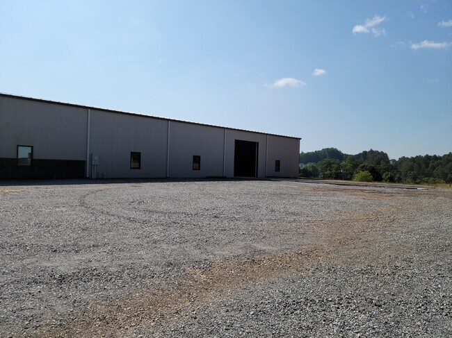
Property Record
5477 Old Haywood Rd, Mills River, NC 28759


NEARBY LISTINGS FOR SALE OR LEASE
Property Detail
5477 Old Haywood Rd
Asheville, NC
Survey For Riteway Express Inc Of North
9938990
NC191 ON PLUNRE-CORDED UNBRADLEY BU96-132
Industrialgeneral
Henderson
X
North Carolina
3700963200J
9133
2025
12.07 AC
2025
Henderson County
930701
Asheville
10,400 SF
DEMOGRAPHICS near 5477 Old Haywood Rd
1 Mile
3 Mile
5 Mile
2024 Total Population
1,605
10,169
40,995
2029 Population
1,673
10,602
42,711
Pop Growth 2024-2029
+ 4.24%
+ 4.26%
+ 4.19%
Average Age
46
44
42
2024 Total Households
651
4,147
16,972
HH Growth 2024-2029
+ 4.15%
+ 4.00%
+ 3.94%
Median Household Inc
$89,673
$81,886
$73,535
Avg Household Size
2.50
2.40
2.40
2024 Avg HH Vehicles
2.00
2.00
2.00
Median Home Value
$392,433
$351,727
$342,696
Median Year Built
1998
1996
1998
Nearby Places
Map Layers
Map Styles
 Street
 Aerial
- Restaurants
- Banks
- Shops
- Fitness
- Groceries
PUBLIC TRANSPORTATION
AIRPORT
Asheville Regional
DRIVE
WALK
Distance
Asheville Regional
7 min
4.1 mi
Freight Ports
North Charleston Terminal
DRIVE
WALK
Distance
North Charleston Terminal
277 min
245.8 mi
SALE & LEASE HISTORY
LISTING DATE
SALE/LEASE

May 04, 2021
For Lease
Nearby Properties
Address
Land Use
TOTAL SIZE
Lot Size
Zoning
Address
Land Use
TOTAL SIZE
Lot Size
Zoning
107,063 SF
567.34 AC
AI
Address
Land Use
TOTAL SIZE
Lot Size
Zoning
281,505 SF
38.35 AC
10000070~M
Address
Land Use
TOTAL SIZE
Lot Size
Zoning
107,408 SF
21.92 AC
R-3
Address
Land Use
TOTAL SIZE
Lot Size
Zoning
198,705 SF
32.46 AC
HB
Address
Land Use
TOTAL SIZE
Lot Size
Zoning
21.70 AC
10005690~M
Address
Land Use
TOTAL SIZE
Lot Size
Zoning
365,659 SF
38.28 AC
9958527~M-
Address
Land Use
TOTAL SIZE
Lot Size
Zoning
86,393 SF
15.44 AC
PS
Address
Land Use
TOTAL SIZE
Lot Size
Zoning
14,704 SF
3.31 AC
10007972~M
Address
Land Use
TOTAL SIZE
Lot Size
Zoning
39.98 AC
10007822~M
Address
Land Use
TOTAL SIZE
Lot Size
Zoning
107,698 SF
25.53 AC
PS
Address
Land Use
TOTAL SIZE
Lot Size
Zoning
3,000 SF
48.13 AC
10010496~M
Address
Land Use
TOTAL SIZE
Lot Size
Zoning
13,525 SF
1.84 AC
LODG EXP
Address
Land Use
TOTAL SIZE
Lot Size
Zoning
15,493 SF
2.01 AC
EMP
Address
Land Use
TOTAL SIZE
Lot Size
Zoning
28,183 SF
5.88 AC
10010086~C
Address
Land Use
TOTAL SIZE
Lot Size
Zoning
112,100 SF
14.22 AC
9975597~MR
Address
Land Use
TOTAL SIZE
Lot Size
Zoning
14,024 SF
2 AC
HB
Address
Land Use
TOTAL SIZE
Lot Size
Zoning
83,741 SF
24.39 AC
9959040~MR
Address
Land Use
TOTAL SIZE
Lot Size
Zoning
178,825 SF
25.05 AC
1016341~MR
Address
Land Use
TOTAL SIZE
Lot Size
Zoning
237,185 SF
17.57 AC
9962196~MR
Address
Land Use
TOTAL SIZE
Lot Size
Zoning
51,090 SF
5.18 AC
1007612~C-
Address
Land Use
TOTAL SIZE
Lot Size
Zoning
345,310 SF
16.60 AC
R-2
Address
Land Use
TOTAL SIZE
Lot Size
Zoning
3,190 SF
21.46 AC
1016340~MR
Address
Land Use
TOTAL SIZE
Lot Size
Zoning
90,000 SF
9.43 AC
1001311~MR
Address
Land Use
TOTAL SIZE
Lot Size
Zoning
47,129 SF
42.82 AC
10005418~M
Address
Land Use
TOTAL SIZE
Lot Size
Zoning
12.51 AC
1018240~MR
Address
Land Use
TOTAL SIZE
Lot Size
Zoning
137,491 SF
15.68 AC
HB
Address
Land Use
TOTAL SIZE
Lot Size
Zoning
404,414 SF
27.75 AC
IND
Address
Land Use
TOTAL SIZE
Lot Size
Zoning
57,827 SF
1.68 AC
1017417~C-
Address
Land Use
TOTAL SIZE
Lot Size
Zoning
109,243 SF
22.63 AC
AI
Address
Land Use
TOTAL SIZE
Lot Size
Zoning
123,362 SF
11.70 AC
HB
The World's #1 Commercial Real Estate Marketplace
Connect with us
© 2025 CoStar Group
The information above has been obtained from sources believed reliable. While we do not doubt its accuracy we have not verified it and make no guarantee, warranty or representation about it. It is your responsibility to independently confirm its accuracy and completeness. Any projections, opinions, assumptions, or estimates used are for example only and do not represent the current or future performance of the property. The value of this transaction to you depends on tax and other factors which should be evaluated by your tax, financial, and legal advisors. You and your advisors should conduct a careful, independent investigation of the property to determine to your satisfaction the suitability of the property for your needs.