Property Record
548 Shattuck Rd, Saginaw, MI 48604


This Property Is For Sale
NEARBY LISTINGS FOR SALE OR LEASE
Property Detail
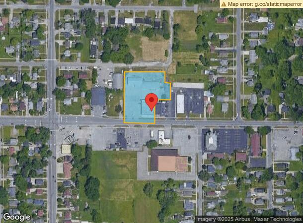
548 Shattuck Rd
11124123003000
PART OF E1/2 OF E1/2 OF SW1/4 OF SEC 12 BEG AT A POINT ON S LINE OF SEC 12 656.34 FT W FROM S1/4 POST TH N 295 FT TH ELY PARA TO S SEC LINE 232.23 FT TO W LINE OF FORMER LILY ST TH S ALONG FORMER ST 64 FT TH E PARA TO S SEC LINE 33 FT TH S PARA TO N&
Commercialnec
Saginaw
X
Michigan
26145C0179E
1.47 AC
2025
Midland/Flint
2025
Other Market Areas
010700
Saginaw, MI
19,840 SF
DEMOGRAPHICS near 548 Shattuck Rd
1 Mile
3 Mile
5 Mile
2024 Total Population
6,202
51,191
103,657
2029 Population
6,110
50,966
103,168
Pop Growth 2024-2029
(1.48%)
(0.44%)
(0.47%)
Average Age
39
40
40
2024 Total Households
2,565
21,882
43,914
HH Growth 2024-2029
(1.75%)
(0.59%)
(0.58%)
Median Household Inc
$38,804
$37,756
$40,820
Avg Household Size
2.40
2.20
2.20
2024 Avg HH Vehicles
2.00
2.00
2.00
Median Home Value
$64,022
$72,517
$87,770
Median Year Built
1956
1956
1962
Nearby Places
Map Layers
Map Styles
 Street
 Aerial
- Restaurants
- Banks
- Shops
- Fitness
- Groceries
PUBLIC TRANSPORTATION
AIRPORT
MBS International
DRIVE
WALK
Distance
MBS International
31 min
14.4 mi
Freight Ports
Port of Toledo
DRIVE
WALK
Distance
Port of Toledo
172 min
148.1 mi
Nearby Properties
Address
Land Use
TOTAL SIZE
Lot Size
Zoning
Address
Land Use
TOTAL SIZE
Lot Size
Zoning
551,744 SF
33.92 AC
B-3
Address
Land Use
TOTAL SIZE
Lot Size
Zoning
293,258 SF
40.97 AC
B-3
Address
Land Use
TOTAL SIZE
Lot Size
Zoning
221,862 SF
14.95 AC
R-3
Address
Land Use
TOTAL SIZE
Lot Size
Zoning
96,487 SF
8.47 AC
B-3
Address
Land Use
TOTAL SIZE
Lot Size
Zoning
177,778 SF
13.16 AC
Address
Land Use
TOTAL SIZE
Lot Size
Zoning
191,272 SF
19.80 AC
R-3
Address
Land Use
TOTAL SIZE
Lot Size
Zoning
164,040 SF
11.80 AC
R-3
Address
Land Use
TOTAL SIZE
Lot Size
Zoning
172,573 SF
19.07 AC
R-3
Address
Land Use
TOTAL SIZE
Lot Size
Zoning
70,050 SF
2.25 AC
B-4
Address
Land Use
TOTAL SIZE
Lot Size
Zoning
203,768 SF
30.79 AC
B-2
Address
Land Use
TOTAL SIZE
Lot Size
Zoning
162,161 SF
12.61 AC
R-3
Address
Land Use
TOTAL SIZE
Lot Size
Zoning
134,571 SF
12.23 AC
B-3
Address
Land Use
TOTAL SIZE
Lot Size
Zoning
208,498 SF
23.81 AC
B-3
Address
Land Use
TOTAL SIZE
Lot Size
Zoning
62,124 SF
3.15 AC
B-2
Address
Land Use
TOTAL SIZE
Lot Size
Zoning
88,901 SF
5.21 AC
RMU
Address
Land Use
TOTAL SIZE
Lot Size
Zoning
199,696 SF
27.42 AC
B-2
Address
Land Use
TOTAL SIZE
Lot Size
Zoning
189,360 SF
15.62 AC
B-3
Address
Land Use
TOTAL SIZE
Lot Size
Zoning
26,792 SF
7.89 AC
B-3
Address
Land Use
TOTAL SIZE
Lot Size
Zoning
153,001 SF
5.88 AC
RMU
Address
Land Use
TOTAL SIZE
Lot Size
Zoning
141,231 SF
16.35 AC
B-4
Address
Land Use
TOTAL SIZE
Lot Size
Zoning
54,851 SF
2.30 AC
B-2
Address
Land Use
TOTAL SIZE
Lot Size
Zoning
49,452 SF
2.48 AC
B-2
Address
Land Use
TOTAL SIZE
Lot Size
Zoning
83,156 SF
15.19 AC
Address
Land Use
TOTAL SIZE
Lot Size
Zoning
105,623 SF
10.09 AC
B-1
Address
Land Use
TOTAL SIZE
Lot Size
Zoning
115,761 SF
14.66 AC
B-3
Address
Land Use
TOTAL SIZE
Lot Size
Zoning
155,460 SF
18.35 AC
B-3
Address
Land Use
TOTAL SIZE
Lot Size
Zoning
57.28 AC
M-2
Address
Land Use
TOTAL SIZE
Lot Size
Zoning
105,424 SF
7.49 AC
B-2
Address
Land Use
TOTAL SIZE
Lot Size
Zoning
46,573 SF
1.46 AC
B-2
Address
Land Use
TOTAL SIZE
Lot Size
Zoning
99,834 SF
3.49 AC
R-3
The World's #1 Commercial Real Estate Marketplace
Connect with us
© 2025 CoStar Group
The information above has been obtained from sources believed reliable. While we do not doubt its accuracy we have not verified it and make no guarantee, warranty or representation about it. It is your responsibility to independently confirm its accuracy and completeness. Any projections, opinions, assumptions, or estimates used are for example only and do not represent the current or future performance of the property. The value of this transaction to you depends on tax and other factors which should be evaluated by your tax, financial, and legal advisors. You and your advisors should conduct a careful, independent investigation of the property to determine to your satisfaction the suitability of the property for your needs.