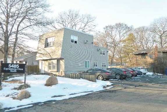
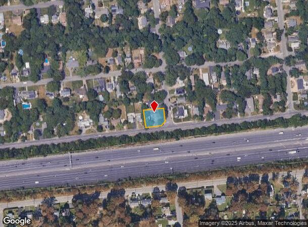
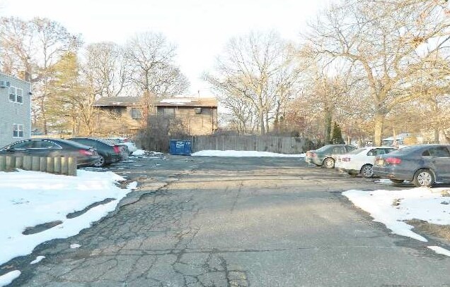
Property Record
5485 Expressway Dr N, Holtsville, NY 11742
NEARBY LISTINGS FOR SALE OR LEASE
Property Detail
5485 Expressway Dr N
Nassau County-Suffolk County, NY
Woodedge Park
0200-696-00-03-00-039-000
WOODEDGE PARK 1446 SHEET 2 255 & 25
Officebuilding
Suffolk
X
New York
36103C0685H
39
2024
0.27 AC
2024
Central Suffolk
158606
Long Island (New York)
DEMOGRAPHICS near 5485 Expressway Dr N
1 Mile
3 Mile
5 Mile
2024 Total Population
10,086
82,708
226,665
2029 Population
10,088
81,602
223,232
Pop Growth 2024-2029
+ 0.02%
(1.34%)
(1.51%)
Average Age
41
41
41
2024 Total Households
3,290
27,889
78,215
HH Growth 2024-2029
(0.12%)
(1.55%)
(1.70%)
Median Household Inc
$122,773
$113,281
$105,430
Avg Household Size
2.90
2.80
2.80
2024 Avg HH Vehicles
2.00
2.00
2.00
Median Home Value
$428,416
$419,698
$422,819
Median Year Built
1973
1973
1973
Nearby Places
- Restaurants
- Banks
- Shops
- Fitness
- Groceries
PUBLIC TRANSPORTATION
COMMUTER RAIL
Medford Station (Greenport Branch - Long Island Rail Road)
DRIVE
WALK
Distance
Medford Station (Greenport Branch - Long Island Rail Road)
6 min
3.1 mi
Ronkonkoma Station (Greenport Branch - Long Island Rail Road, Ronkonkoma Branch - Long Island Rail Road)
DRIVE
WALK
Distance
Ronkonkoma Station (Greenport Branch - Long Island Rail Road, Ronkonkoma Branch - Long Island Rail Road)
10 min
5.0 mi
AIRPORT
Long Island MacArthur
DRIVE
WALK
Distance
Long Island MacArthur
15 min
8.6 mi
Freight Ports
Port of New Haven
DRIVE
WALK
Distance
Port of New Haven
128 min
48.6 mi
Nearby Properties
Address
Land Use
TOTAL SIZE
Lot Size
Zoning
Address
Land Use
TOTAL SIZE
Lot Size
Zoning
95.19 AC
Address
Land Use
TOTAL SIZE
Lot Size
Zoning
23.50 AC
AA
Address
Land Use
TOTAL SIZE
Lot Size
Zoning
25.90 AC
Address
Land Use
TOTAL SIZE
Lot Size
Zoning
42.37 AC
Address
Land Use
TOTAL SIZE
Lot Size
Zoning
140.10 AC
Address
Land Use
TOTAL SIZE
Lot Size
Zoning
19.70 AC
AA
Address
Land Use
TOTAL SIZE
Lot Size
Zoning
8.10 AC
GSC
Address
Land Use
TOTAL SIZE
Lot Size
Zoning
6,486 SF
0.55 AC
VILLA
Address
Land Use
TOTAL SIZE
Lot Size
Zoning
8.60 AC
IND1
Address
Land Use
TOTAL SIZE
Lot Size
Zoning
32.41 AC
AA
Address
Land Use
TOTAL SIZE
Lot Size
Zoning
0.49 AC
VILLA
Address
Land Use
TOTAL SIZE
Lot Size
Zoning
17.76 AC
Address
Land Use
TOTAL SIZE
Lot Size
Zoning
2.10 AC
CAA
Address
Land Use
TOTAL SIZE
Lot Size
Zoning
32.41 AC
AA
Address
Land Use
TOTAL SIZE
Lot Size
Zoning
4.75 AC
BUS3
Address
Land Use
TOTAL SIZE
Lot Size
Zoning
4.48 AC
IND1
Address
Land Use
TOTAL SIZE
Lot Size
Zoning
28.20 AC
AA278
Address
Land Use
TOTAL SIZE
Lot Size
Zoning
1.46 AC
IND1
Address
Land Use
TOTAL SIZE
Lot Size
Zoning
36 AC
AA
Address
Land Use
TOTAL SIZE
Lot Size
Zoning
Address
Land Use
TOTAL SIZE
Lot Size
Zoning
24.50 AC
AA
Address
Land Use
TOTAL SIZE
Lot Size
Zoning
4.16 AC
BD
Address
Land Use
TOTAL SIZE
Lot Size
Zoning
0.57 AC
CR200
Address
Land Use
TOTAL SIZE
Lot Size
Zoning
Address
Land Use
TOTAL SIZE
Lot Size
Zoning
3.40 AC
B
Address
Land Use
TOTAL SIZE
Lot Size
Zoning
20.30 AC
B278
Address
Land Use
TOTAL SIZE
Lot Size
Zoning
19.20 AC
AA278
Address
Land Use
TOTAL SIZE
Lot Size
Zoning
2 AC
BUS1
Address
Land Use
TOTAL SIZE
Lot Size
Zoning
12.47 AC
Address
Land Use
TOTAL SIZE
Lot Size
Zoning
3 AC
BUS1
The World's #1 Commercial Real Estate Marketplace
Connect with us
© 2025 CoStar Group
The information above has been obtained from sources believed reliable. While we do not doubt its accuracy we have not verified it and make no guarantee, warranty or representation about it. It is your responsibility to independently confirm its accuracy and completeness. Any projections, opinions, assumptions, or estimates used are for example only and do not represent the current or future performance of the property. The value of this transaction to you depends on tax and other factors which should be evaluated by your tax, financial, and legal advisors. You and your advisors should conduct a careful, independent investigation of the property to determine to your satisfaction the suitability of the property for your needs.