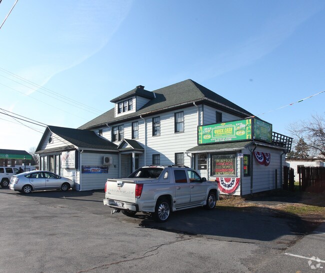
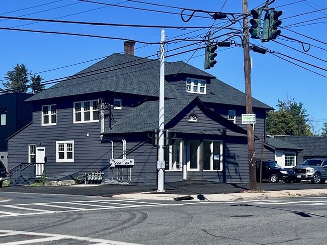
Property Record
549 Albany Ave, Kingston, NY 12401
Current Lease Availabilities
NEARBY LISTINGS FOR SALE OR LEASE
Property Detail
549 Albany Ave
0800-048.074-0001-003.000-0000
Foxhall Manor
Commercialofficeresidentialmixeduse
Ulster
X
New York
36111C0480E
3.000
2025
0.31 AC
2024
Newburgh/Kingston
952400
Other Market Areas
4,012 SF
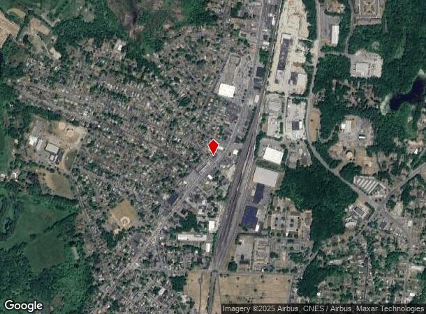
Kingston, NY
DEMOGRAPHICS near 549 Albany Ave
1 Mile
3 Mile
5 Mile
2024 Total Population
9,089
34,579
49,155
2029 Population
9,050
34,395
48,911
Pop Growth 2024-2029
(0.43%)
(0.53%)
(0.50%)
Average Age
42
43
44
2024 Total Households
3,868
14,897
21,032
HH Growth 2024-2029
(0.34%)
(0.54%)
(0.49%)
Median Household Inc
$57,260
$68,121
$73,276
Avg Household Size
2.20
2.10
2.20
2024 Avg HH Vehicles
2.00
2.00
2.00
Median Home Value
$220,198
$241,985
$268,711
Median Year Built
1950
1954
1957
Nearby Places
Map Layers
Map Styles
 Street
 Aerial
- Restaurants
- Banks
- Shops
- Fitness
- Groceries
PUBLIC TRANSPORTATION
AIRPORT
New York Stewart International
DRIVE
WALK
Distance
New York Stewart International
54 min
40.1 mi
Nearby Properties
Address
Land Use
TOTAL SIZE
Lot Size
Zoning
Address
Land Use
TOTAL SIZE
Lot Size
Zoning
21.40 AC
R-1
Address
Land Use
TOTAL SIZE
Lot Size
Zoning
1.58 AC
T5F
Address
Land Use
TOTAL SIZE
Lot Size
Zoning
80,640 SF
6.10 AC
37
Address
Land Use
TOTAL SIZE
Lot Size
Zoning
240,924 SF
17 AC
SD
Address
Land Use
TOTAL SIZE
Lot Size
Zoning
198,029 SF
14.10 AC
37
Address
Land Use
TOTAL SIZE
Lot Size
Zoning
181,151 SF
4.90 AC
SD
Address
Land Use
TOTAL SIZE
Lot Size
Zoning
425,087 SF
16.10 AC
36
Address
Land Use
TOTAL SIZE
Lot Size
Zoning
250,613 SF
11.70 AC
SD
Address
Land Use
TOTAL SIZE
Lot Size
Zoning
135,158 SF
31.80 AC
R-1
Address
Land Use
TOTAL SIZE
Lot Size
Zoning
142,823 SF
47.67 AC
33
Address
Land Use
TOTAL SIZE
Lot Size
Zoning
24,321 SF
46.40 AC
T2C
Address
Land Use
TOTAL SIZE
Lot Size
Zoning
109,860 SF
8.60 AC
35
Address
Land Use
TOTAL SIZE
Lot Size
Zoning
76,788 SF
0.77 AC
T5N
Address
Land Use
TOTAL SIZE
Lot Size
Zoning
16,933 SF
14.90 AC
SD
Address
Land Use
TOTAL SIZE
Lot Size
Zoning
172.24 AC
HP20
Address
Land Use
TOTAL SIZE
Lot Size
Zoning
67,180 SF
2.60 AC
T5MS
Address
Land Use
TOTAL SIZE
Lot Size
Zoning
205,740 SF
15 AC
36
Address
Land Use
TOTAL SIZE
Lot Size
Zoning
152,723 SF
9.60 AC
SD
Address
Land Use
TOTAL SIZE
Lot Size
Zoning
97,636 SF
2.60 AC
T5MS
Address
Land Use
TOTAL SIZE
Lot Size
Zoning
53,605 SF
10.83 AC
T5N
Address
Land Use
TOTAL SIZE
Lot Size
Zoning
23.30 AC
37
Address
Land Use
TOTAL SIZE
Lot Size
Zoning
8,674 SF
10.90 AC
SD
Address
Land Use
TOTAL SIZE
Lot Size
Zoning
67,566 SF
2.90 AC
T5N
Address
Land Use
TOTAL SIZE
Lot Size
Zoning
76,577 SF
1.30 AC
T5F
Address
Land Use
TOTAL SIZE
Lot Size
Zoning
4,104 SF
14.38 AC
SD
Address
Land Use
TOTAL SIZE
Lot Size
Zoning
10,124 SF
7.50 AC
SD
Address
Land Use
TOTAL SIZE
Lot Size
Zoning
12.70 AC
36
Address
Land Use
TOTAL SIZE
Lot Size
Zoning
2,670 SF
20.90 AC
SD
Address
Land Use
TOTAL SIZE
Lot Size
Zoning
11,488 SF
10.80 AC
SD
Address
Land Use
TOTAL SIZE
Lot Size
Zoning
129,612 SF
11.30 AC
36
The World's #1 Commercial Real Estate Marketplace
Connect with us
© 2026 CoStar Group
The information above has been obtained from sources believed reliable. While we do not doubt its accuracy we have not verified it and make no guarantee, warranty or representation about it. It is your responsibility to independently confirm its accuracy and completeness. Any projections, opinions, assumptions, or estimates used are for example only and do not represent the current or future performance of the property. The value of this transaction to you depends on tax and other factors which should be evaluated by your tax, financial, and legal advisors. You and your advisors should conduct a careful, independent investigation of the property to determine to your satisfaction the suitability of the property for your needs.