Property Record
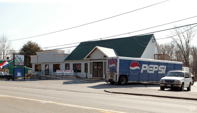
549 American Legion Hwy, Westport, MA 02790


NEARBY LISTINGS FOR SALE OR LEASE
-
-
View all Westport listings for sale on LoopNet.com
Property Detail
549 American Legion Hwy
WPOR-000066-000000-000015-000014A
Doris V Palmer
Commercialnec
Bristol
X
Massachusetts
25005C0364G
15-14a
2025
2.80 AC
2025
Attleboro/New Bedford
646103
Boston
4,458 SF
Providence-Warwick, RI-MA
DEMOGRAPHICS near 549 American Legion Hwy
1 Mile
3 Mile
5 Mile
2024 Total Population
830
13,895
46,619
2029 Population
821
13,721
46,117
Pop Growth 2024-2029
(1.08%)
(1.25%)
(1.08%)
Average Age
45
45
43
2024 Total Households
330
5,687
19,004
HH Growth 2024-2029
(1.21%)
(1.35%)
(1.13%)
Median Household Inc
$70,178
$87,029
$72,889
Avg Household Size
2.50
2.40
2.30
2024 Avg HH Vehicles
2.00
2.00
2.00
Median Home Value
$447,058
$430,350
$398,007
Median Year Built
1970
1973
1969
Nearby Places
Map Layers
Map Styles
 Street
 Aerial
- Restaurants
- Banks
- Shops
- Fitness
- Groceries
PUBLIC TRANSPORTATION
AIRPORT
Rhode Island Tf Green International
DRIVE
WALK
Distance
Rhode Island Tf Green International
47 min
31.7 mi
Freight Ports
Port of New Bedford Harbor
DRIVE
WALK
Distance
Port of New Bedford Harbor
18 min
11.6 mi
SALE & LEASE HISTORY
LISTING DATE
SALE/LEASE

Sep 23, 2016
For Sale
Feb 27, 2017
For Sale
Aug 07, 2017
For Sale
Nearby Properties
Address
Land Use
TOTAL SIZE
Lot Size
Zoning
Address
Land Use
TOTAL SIZE
Lot Size
Zoning
36.70 AC
E1
Address
Land Use
TOTAL SIZE
Lot Size
Zoning
174,416 SF
29.20 AC
CEMETA
Address
Land Use
TOTAL SIZE
Lot Size
Zoning
51,709 SF
2.32 AC
GB
Address
Land Use
TOTAL SIZE
Lot Size
Zoning
22,847 SF
6.06 AC
GC
Address
Land Use
TOTAL SIZE
Lot Size
Zoning
Address
Land Use
TOTAL SIZE
Lot Size
Zoning
31,444 SF
13 AC
E1
Address
Land Use
TOTAL SIZE
Lot Size
Zoning
53,708 SF
2.19 AC
GB
Address
Land Use
TOTAL SIZE
Lot Size
Zoning
11,976 SF
2.34 AC
R1
Address
Land Use
TOTAL SIZE
Lot Size
Zoning
45.52 AC
Address
Land Use
TOTAL SIZE
Lot Size
Zoning
14,033 SF
1.86 AC
HISTOR
Address
Land Use
TOTAL SIZE
Lot Size
Zoning
20.20 AC
R1
Address
Land Use
TOTAL SIZE
Lot Size
Zoning
31.61 AC
R1
Address
Land Use
TOTAL SIZE
Lot Size
Zoning
7 AC
E1
Address
Land Use
TOTAL SIZE
Lot Size
Zoning
20,240 SF
6.89 AC
R60
Address
Land Use
TOTAL SIZE
Lot Size
Zoning
5.81 AC
R1
Address
Land Use
TOTAL SIZE
Lot Size
Zoning
2,664 SF
1.39 AC
R1
Address
Land Use
TOTAL SIZE
Lot Size
Zoning
27,604 SF
1.69 AC
GB
Address
Land Use
TOTAL SIZE
Lot Size
Zoning
5.50 AC
HISTOR
Address
Land Use
TOTAL SIZE
Lot Size
Zoning
882 SF
10 AC
R1
Address
Land Use
TOTAL SIZE
Lot Size
Zoning
20.10 AC
R1
Address
Land Use
TOTAL SIZE
Lot Size
Zoning
3.30 AC
R1
Address
Land Use
TOTAL SIZE
Lot Size
Zoning
12,211 SF
1.35 AC
GC
Address
Land Use
TOTAL SIZE
Lot Size
Zoning
140.38 AC
R1
Address
Land Use
TOTAL SIZE
Lot Size
Zoning
1,044 SF
36 AC
R1
Address
Land Use
TOTAL SIZE
Lot Size
Zoning
1,410 SF
65.80 AC
HISTOR
Address
Land Use
TOTAL SIZE
Lot Size
Zoning
29.89 AC
HISTOR
Address
Land Use
TOTAL SIZE
Lot Size
Zoning
16,080 SF
1.99 AC
R1
Address
Land Use
TOTAL SIZE
Lot Size
Zoning
10,168 SF
1.79 AC
GC
Address
Land Use
TOTAL SIZE
Lot Size
Zoning
15,000 SF
18.65 AC
The World's #1 Commercial Real Estate Marketplace
Connect with us
© 2025 CoStar Group
The information above has been obtained from sources believed reliable. While we do not doubt its accuracy we have not verified it and make no guarantee, warranty or representation about it. It is your responsibility to independently confirm its accuracy and completeness. Any projections, opinions, assumptions, or estimates used are for example only and do not represent the current or future performance of the property. The value of this transaction to you depends on tax and other factors which should be evaluated by your tax, financial, and legal advisors. You and your advisors should conduct a careful, independent investigation of the property to determine to your satisfaction the suitability of the property for your needs.