Property Record
5495 La Jolla Blvd, La Jolla, CA 92037
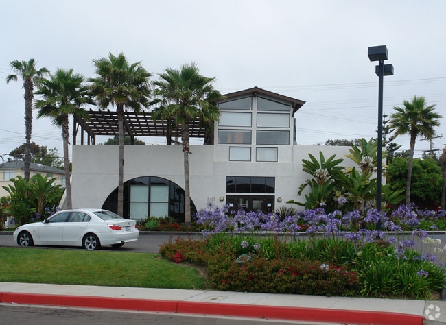

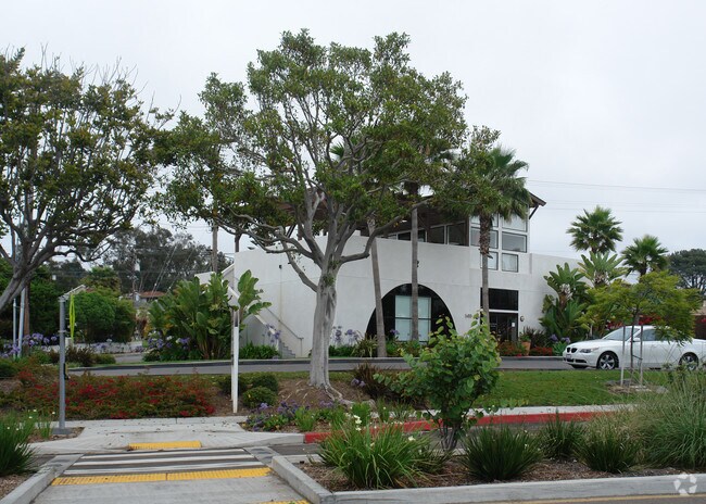
Property Detail
5495 La Jolla Blvd
357-611-01
BLK 22 (EX ALLEY)LOTS 1&2 IN TR 001083
Storebuilding
San Diego
LJPD-4
California
B and X Area of moderate flood hazard, usually the area between the limits of the 100-year and 500-year floods.
1,2
2024
0.16 AC
2025
La Jolla
008102
San Diego
11,820 SF
San Diego-Chula Vista-Carlsbad, CA
NEARBY LISTINGS FOR SALE OR LEASE
DEMOGRAPHICS near 5495 La Jolla Blvd
1 mile
3 mile
5 mile
2025 Total Population
12,735
81,716
205,778
2030 Population
12,945
83,894
208,867
Pop Growth 2025-2030
+ 1.65%
+ 2.67%
+ 1.50%
Average Age
43
42
40
2025 Total Households
5,743
38,399
88,186
HH Growth 2025-2030
+ 1.57%
+ 2.85%
+ 1.67%
Median Household Inc
$167,807
$131,478
$115,670
Avg Household Size
2.20
2.00
2.10
2025 Avg HH Vehicles
2.00
2.00
2.00
Median Home Value
$1,129,226
$1,109,182
$1,063,908
Median Year Built
1970
1972
1972
Nearby Places
Map Layers
Map Styles
 Street
 Aerial
Layers
 Traffic
 Biking
Places
Listings with unknown addresses are not visible on the map
- Restaurants
- Banks
- Shops
- Fitness
- Groceries
PUBLIC TRANSPORTATION
COMMUTER RAIL
Old Town Transit Center (Coaster - San Diego North County Transit District (Coaster/Sprinter/Breeze))
Drive
Walk
Distance
Old Town Transit Center (Coaster - San Diego North County Transit District (Coaster/Sprinter/Breeze))
13 min
7.9 mi
Sorrento Valley (Coaster - San Diego North County Transit District (Coaster/Sprinter/Breeze))
Drive
Walk
Distance
Sorrento Valley (Coaster - San Diego North County Transit District (Coaster/Sprinter/Breeze))
17 min
9.7 mi
AIRPORT
San Diego International
Drive
Walk
Distance
San Diego International
16 min
8.1 mi
Freight Ports
Port of San Diego
Drive
Walk
Distance
Port of San Diego
21 min
14.0 mi
Nearby Properties
Address
Land Use
TOTAL SIZE
Lot Size
Zoning
Address
Land Use
TOTAL SIZE
Lot Size
Zoning
11.60 AC
RM-3-7
Address
Land Use
TOTAL SIZE
Lot Size
Zoning
35.76 AC
RS-1-4
Address
Land Use
TOTAL SIZE
Lot Size
Zoning
49,209 SF
0.73 AC
LJPD-3
Address
Land Use
TOTAL SIZE
Lot Size
Zoning
2.38 AC
R-3
Address
Land Use
TOTAL SIZE
Lot Size
Zoning
7.04 AC
MBPD-VC-N
Address
Land Use
TOTAL SIZE
Lot Size
Zoning
25.46 AC
IL-3-1
Address
Land Use
TOTAL SIZE
Lot Size
Zoning
5.23 AC
LJPD-5
Address
Land Use
TOTAL SIZE
Lot Size
Zoning
3.82 AC
LJPD-5
Address
Land Use
TOTAL SIZE
Lot Size
Zoning
14.02 AC
IP-2-1
Address
Land Use
TOTAL SIZE
Lot Size
Zoning
11.31 AC
LJPD-6
Address
Land Use
TOTAL SIZE
Lot Size
Zoning
7.09 AC
IP-2-1
Address
Land Use
TOTAL SIZE
Lot Size
Zoning
15.50 AC
RM-4-10
Address
Land Use
TOTAL SIZE
Lot Size
Zoning
63,420 SF
0.65 AC
LJPD-5A
Address
Land Use
TOTAL SIZE
Lot Size
Zoning
65,663 SF
1.58 AC
LJSPD-V
Address
Land Use
TOTAL SIZE
Lot Size
Zoning
98,561 SF
2.42 AC
RM-2-5
Address
Land Use
TOTAL SIZE
Lot Size
Zoning
74,984 SF
2.75 AC
RM-1-1
Address
Land Use
TOTAL SIZE
Lot Size
Zoning
5.49 AC
CC-4-2
Address
Land Use
TOTAL SIZE
Lot Size
Zoning
0.48 AC
LJPD-3
Address
Land Use
TOTAL SIZE
Lot Size
Zoning
41,476 SF
1.40 AC
RM-2-5
Address
Land Use
TOTAL SIZE
Lot Size
Zoning
66,366 SF
0.48 AC
LJPD-3
Address
Land Use
TOTAL SIZE
Lot Size
Zoning
1.11 AC
LJPD-5
Address
Land Use
TOTAL SIZE
Lot Size
Zoning
60,921 SF
0.74 AC
LJPD-1A
Address
Land Use
TOTAL SIZE
Lot Size
Zoning
57,686 SF
0.14 AC
CC-4-2
Address
Land Use
TOTAL SIZE
Lot Size
Zoning
72,900 SF
0.63 AC
LJPD-1A
Address
Land Use
TOTAL SIZE
Lot Size
Zoning
68,000 SF
18.18 AC
LJSPD-PRF
Address
Land Use
TOTAL SIZE
Lot Size
Zoning
56,214 SF
1.78 AC
CV-1-2
Address
Land Use
TOTAL SIZE
Lot Size
Zoning
4.84 AC
RM-3-7
Address
Land Use
TOTAL SIZE
Lot Size
Zoning
4.41 AC
RM-3-7
Address
Land Use
TOTAL SIZE
Lot Size
Zoning
40,896 SF
0.56 AC
LJPD-1A
Address
Land Use
TOTAL SIZE
Lot Size
Zoning
46,480 SF
0.55 AC
LJPD-1A
The World's #1 Commercial Real Estate Marketplace
Connect with us
© 2026 CoStar Group
The information above has been obtained from sources believed reliable. While we do not doubt its accuracy we have not verified it and make no guarantee, warranty or representation about it. It is your responsibility to independently confirm its accuracy and completeness. Any projections, opinions, assumptions, or estimates used are for example only and do not represent the current or future performance of the property. The value of this transaction to you depends on tax and other factors which should be evaluated by your tax, financial, and legal advisors. You and your advisors should conduct a careful, independent investigation of the property to determine to your satisfaction the suitability of the property for your needs.