Property Record
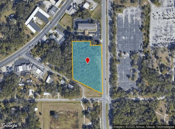
5495 Ne 25Th St, Ocala, FL 34470


NEARBY LISTINGS FOR SALE OR LEASE
Property Detail
5495 Ne 25Th St
Ocala, FL
Wilsons Sub
24141-000-00
SEC 01 TWP 15 RGE 22 PLAT BOOK B PAGE 241 WILSONS SUB REVISED COM AT THE NE COR OF LOT 43 TH S 00-57-43 E 160.57 FT TO THE POB TH CONT S 00-57-43 E 751.92 FT TH N 63-43-36 W 472.86 FT TH N 00-57-43 W 534.98 FT TH N 88-57-50 E 420.43 FT TO THE POB & E
Commercialacreage
Marion
X
Florida
12083C0535E
43
2024
4.22 AC
2024
Greater Ocala
002002
Ocala
DEMOGRAPHICS near 5495 Ne 25Th St
1 Mile
3 Mile
5 Mile
2024 Total Population
4,165
25,985
70,531
2029 Population
4,806
29,254
79,301
Pop Growth 2024-2029
+ 15.39%
+ 12.58%
+ 12.43%
Average Age
41
43
41
2024 Total Households
1,915
11,353
28,969
HH Growth 2024-2029
+ 15.61%
+ 12.61%
+ 12.44%
Median Household Inc
$45,292
$56,694
$58,664
Avg Household Size
2.20
2.30
2.40
2024 Avg HH Vehicles
1.00
2.00
2.00
Median Home Value
$139,317
$165,882
$184,919
Median Year Built
1990
1983
1983
Nearby Places
Map Layers
Map Styles
 Street
 Aerial
- Restaurants
- Banks
- Shops
- Fitness
- Groceries
SALE & LEASE HISTORY
LISTING DATE
SALE/LEASE

May 13, 2021
For Sale
Aug 14, 2017
For Sale
Nearby Properties
Address
Land Use
TOTAL SIZE
Lot Size
Zoning
Address
Land Use
TOTAL SIZE
Lot Size
Zoning
205,664 SF
22.56 AC
B5
Address
Land Use
TOTAL SIZE
Lot Size
Zoning
116,035 SF
38.20 AC
GU
Address
Land Use
TOTAL SIZE
Lot Size
Zoning
30,334 SF
29.72 AC
GU
Address
Land Use
TOTAL SIZE
Lot Size
Zoning
78,280 SF
12.54 AC
R3
Address
Land Use
TOTAL SIZE
Lot Size
Zoning
196,416 SF
29.65 AC
SC
Address
Land Use
TOTAL SIZE
Lot Size
Zoning
134,827 SF
14.83 AC
SC
Address
Land Use
TOTAL SIZE
Lot Size
Zoning
192,553 SF
21.18 AC
SC
Address
Land Use
TOTAL SIZE
Lot Size
Zoning
134,890 SF
18.90 AC
B4
Address
Land Use
TOTAL SIZE
Lot Size
Zoning
10,552 SF
51.60 AC
PRV
Address
Land Use
TOTAL SIZE
Lot Size
Zoning
35,356 SF
6.14 AC
R3
Address
Land Use
TOTAL SIZE
Lot Size
Zoning
81,689 SF
11.05 AC
B2
Address
Land Use
TOTAL SIZE
Lot Size
Zoning
61,045 SF
22.64 AC
A1
Address
Land Use
TOTAL SIZE
Lot Size
Zoning
39,552 SF
5.97 AC
R3
Address
Land Use
TOTAL SIZE
Lot Size
Zoning
14,344 SF
3.12 AC
B2
Address
Land Use
TOTAL SIZE
Lot Size
Zoning
81,174 SF
18.50 AC
B2
Address
Land Use
TOTAL SIZE
Lot Size
Zoning
21,173 SF
216.46 AC
B2
Address
Land Use
TOTAL SIZE
Lot Size
Zoning
27,949 SF
6.03 AC
R3
Address
Land Use
TOTAL SIZE
Lot Size
Zoning
36,064 SF
5.31 AC
R3
Address
Land Use
TOTAL SIZE
Lot Size
Zoning
32,675 SF
478 AC
A1
Address
Land Use
TOTAL SIZE
Lot Size
Zoning
78,751 SF
20 AC
GU
Address
Land Use
TOTAL SIZE
Lot Size
Zoning
60,099 SF
52.96 AC
B2
Address
Land Use
TOTAL SIZE
Lot Size
Zoning
5,322 SF
403 AC
R1
Address
Land Use
TOTAL SIZE
Lot Size
Zoning
98,080 SF
6.69 AC
M1
Address
Land Use
TOTAL SIZE
Lot Size
Zoning
18,564 SF
3.25 AC
INST
Address
Land Use
TOTAL SIZE
Lot Size
Zoning
76,132 SF
9.40 AC
R3
Address
Land Use
TOTAL SIZE
Lot Size
Zoning
60,576 SF
20.47 AC
INST
Address
Land Use
TOTAL SIZE
Lot Size
Zoning
10,800 SF
2.82 AC
B2A
Address
Land Use
TOTAL SIZE
Lot Size
Zoning
139,437 SF
21.36 AC
M3
Address
Land Use
TOTAL SIZE
Lot Size
Zoning
55,708 SF
6.37 AC
B2A
Address
Land Use
TOTAL SIZE
Lot Size
Zoning
16,667 SF
3.28 AC
B2A
The World's #1 Commercial Real Estate Marketplace
Connect with us
© 2025 CoStar Group
The information above has been obtained from sources believed reliable. While we do not doubt its accuracy we have not verified it and make no guarantee, warranty or representation about it. It is your responsibility to independently confirm its accuracy and completeness. Any projections, opinions, assumptions, or estimates used are for example only and do not represent the current or future performance of the property. The value of this transaction to you depends on tax and other factors which should be evaluated by your tax, financial, and legal advisors. You and your advisors should conduct a careful, independent investigation of the property to determine to your satisfaction the suitability of the property for your needs.