Property Record
55 2Nd St, Maxwell, TX 78656


Property Detail
55 2Nd St
37174
O.T. MAXWELL, BLOCK 1,2,11,12, INCLUDES ABANDONED STREETS & ALLEYS, ACRES 9.55 INCLUDES ABANDONED STREETS & ALLEYS
Industrialgeneral
Caldwell
B and X Area of moderate flood hazard, usually the area between the limits of the 100-year and 500-year floods.
Texas
2025
9.55 AC
2025
Caldwell County
960502
Austin
396 SF
Austin-Round Rock-San Marcos, TX
NEARBY LISTINGS FOR SALE OR LEASE
-
-
View all Maxwell listings for sale on LoopNet.com
DEMOGRAPHICS near 55 2Nd St
1 mile
3 mile
5 mile
2024 Total Population
357
1,682
6,419
2029 Population
375
1,785
7,150
Pop Growth 2024-2029
+ 5.04%
+ 6.12%
+ 11.39%
Average Age
40
38
37
2024 Total Households
132
569
2,078
HH Growth 2024-2029
+ 6.06%
+ 6.15%
+ 11.45%
Median Household Inc
$76,667
$69,098
$68,749
Avg Household Size
2.60
2.80
2.90
2024 Avg HH Vehicles
3.00
3.00
3.00
Median Home Value
$183,333
$163,114
$158,875
Median Year Built
1987
1989
1993
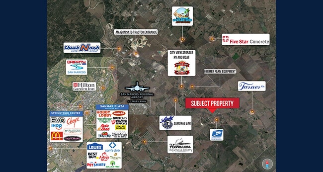
Nearby Places
Map Layers
Map Styles
 Street
 Aerial
Transit
 Traffic
 Biking
Places
Listings with unknown addresses are not visible on the map
- Restaurants
- Banks
- Shops
- Fitness
- Groceries
PUBLIC TRANSPORTATION
AIRPORT
Austin-Bergstrom International
Drive
Walk
Distance
Austin-Bergstrom International
38 min
29.9 mi
Freight Ports
Calhoun Port
Drive
Walk
Distance
Calhoun Port
159 min
132.5 mi
SALE & LEASE HISTORY
LISTING DATE
SALE/LEASE

Nov 15, 2022
For Sale
Nearby Properties
Address
Land Use
TOTAL SIZE
Lot Size
Zoning
Address
Land Use
TOTAL SIZE
Lot Size
Zoning
171,520 SF
31.01 AC
Address
Land Use
TOTAL SIZE
Lot Size
Zoning
1,600 SF
49.26 AC
Address
Land Use
TOTAL SIZE
Lot Size
Zoning
68,590 SF
34.95 AC
Address
Land Use
TOTAL SIZE
Lot Size
Zoning
13,956 SF
49.65 AC
Address
Land Use
TOTAL SIZE
Lot Size
Zoning
4.47 AC
Address
Land Use
TOTAL SIZE
Lot Size
Zoning
8,785 SF
9.78 AC
Address
Land Use
TOTAL SIZE
Lot Size
Zoning
3,284 SF
4 AC
Address
Land Use
TOTAL SIZE
Lot Size
Zoning
113.60 AC
Address
Land Use
TOTAL SIZE
Lot Size
Zoning
340.37 AC
Address
Land Use
TOTAL SIZE
Lot Size
Zoning
4,980 SF
19.46 AC
Address
Land Use
TOTAL SIZE
Lot Size
Zoning
3,133 SF
2.39 AC
Address
Land Use
TOTAL SIZE
Lot Size
Zoning
Address
Land Use
TOTAL SIZE
Lot Size
Zoning
12,432 SF
1 AC
Address
Land Use
TOTAL SIZE
Lot Size
Zoning
432 SF
40 AC
Address
Land Use
TOTAL SIZE
Lot Size
Zoning
5,474 SF
2 AC
Address
Land Use
TOTAL SIZE
Lot Size
Zoning
67.65 AC
Address
Land Use
TOTAL SIZE
Lot Size
Zoning
3,400 SF
2.40 AC
Address
Land Use
TOTAL SIZE
Lot Size
Zoning
Address
Land Use
TOTAL SIZE
Lot Size
Zoning
6,300 SF
2.54 AC
Address
Land Use
TOTAL SIZE
Lot Size
Zoning
22.73 AC
Address
Land Use
TOTAL SIZE
Lot Size
Zoning
8.41 AC
Address
Land Use
TOTAL SIZE
Lot Size
Zoning
3,000 SF
4 AC
Address
Land Use
TOTAL SIZE
Lot Size
Zoning
4,267 SF
8.35 AC
Address
Land Use
TOTAL SIZE
Lot Size
Zoning
8,323 SF
1.59 AC
Address
Land Use
TOTAL SIZE
Lot Size
Zoning
24.07 AC
Address
Land Use
TOTAL SIZE
Lot Size
Zoning
2,000 SF
13 AC
Address
Land Use
TOTAL SIZE
Lot Size
Zoning
Address
Land Use
TOTAL SIZE
Lot Size
Zoning
1,778 SF
5.03 AC
Address
Land Use
TOTAL SIZE
Lot Size
Zoning
The World's #1 Commercial Real Estate Marketplace
Connect with us
© 2026 CoStar Group
The information above has been obtained from sources believed reliable. While we do not doubt its accuracy we have not verified it and make no guarantee, warranty or representation about it. It is your responsibility to independently confirm its accuracy and completeness. Any projections, opinions, assumptions, or estimates used are for example only and do not represent the current or future performance of the property. The value of this transaction to you depends on tax and other factors which should be evaluated by your tax, financial, and legal advisors. You and your advisors should conduct a careful, independent investigation of the property to determine to your satisfaction the suitability of the property for your needs.