Property Record
55 Bloomfield Ave, Caldwell, NJ 07006

Save to a Folder
{{folder.Name}}
{{folder.ListingIds.length}} Properties
{{folder.ListingIds.length}} Property
Create a New Folder
Property Detail
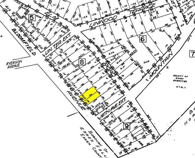
55 Bloomfield Ave
Newark, NJ
25 X 131
03-00008-0000-00018
Essex
Parkinglot
New Jersey
B
4
B and X Area of moderate flood hazard, usually the area between the limits of the 100-year and 500-year floods.
0.11 AC
2025
Suburban Essex/Rt 280
2026
Northern New Jersey
015900
NEARBY LISTINGS FOR SALE OR LEASE
DEMOGRAPHICS near 55 Bloomfield Ave
1 mile
3 mile
5 mile
2025 Total Population
17,037
97,719
313,528
2030 Population
17,959
103,324
328,839
Pop Growth 2025-2030
+ 5.41%
+ 5.74%
+ 4.88%
Average Age
41
43
41
2025 Total Households
6,303
37,128
116,346
HH Growth 2025-2030
+ 5.76%
+ 5.87%
+ 5.03%
Median Household Inc
$145,897
$164,555
$132,813
Avg Household Size
2.50
2.60
2.60
2025 Avg HH Vehicles
2.00
2.00
2.00
Median Home Value
$716,766
$678,369
$650,859
Median Year Built
1955
1958
1957
Nearby Places
Map Layers
Map Styles
 Street
 Aerial
Layers
 Traffic
 Biking
Places
Listings with unknown addresses are not visible on the map
- Restaurants
- Banks
- Shops
- Fitness
- Groceries
PUBLIC TRANSPORTATION
COMMUTER RAIL
Watchung Avenue (Montclair-Boonton Line - NJ Transit Commuter Rail (NJ Transit))
Drive
Walk
Distance
Watchung Avenue (Montclair-Boonton Line - NJ Transit Commuter Rail (NJ Transit))
7 min
4.0 mi
Upper Montclair (Montclair-Boonton Line - NJ Transit Commuter Rail (NJ Transit))
Drive
Walk
Distance
Upper Montclair (Montclair-Boonton Line - NJ Transit Commuter Rail (NJ Transit))
8 min
4.2 mi
AIRPORT
Newark Liberty International
Drive
Walk
Distance
Newark Liberty International
24 min
14.6 mi
LaGuardia
Drive
Walk
Distance
LaGuardia
47 min
33.0 mi
John F Kennedy International
Drive
Walk
Distance
John F Kennedy International
58 min
35.9 mi
Freight Ports
Port Newark Container Terminal
Drive
Walk
Distance
Port Newark Container Terminal
27 min
14.5 mi
Nearby Properties
Address
Land Use
TOTAL SIZE
Lot Size
Zoning
Address
Land Use
TOTAL SIZE
Lot Size
Zoning
33.60 AC
P-C
Address
Land Use
TOTAL SIZE
Lot Size
Zoning
74.58 AC
S
Address
Land Use
TOTAL SIZE
Lot Size
Zoning
48.85 AC
R-3B
Address
Land Use
TOTAL SIZE
Lot Size
Zoning
1,589 SF
0.22 AC
R4
Address
Land Use
TOTAL SIZE
Lot Size
Zoning
298,272 SF
31.36 AC
P-6
Address
Land Use
TOTAL SIZE
Lot Size
Zoning
101.44 AC
OB-1
Address
Land Use
TOTAL SIZE
Lot Size
Zoning
32.34 AC
RA
Address
Land Use
TOTAL SIZE
Lot Size
Zoning
25.88 AC
Address
Land Use
TOTAL SIZE
Lot Size
Zoning
14.54 AC
R-MF
Address
Land Use
TOTAL SIZE
Lot Size
Zoning
55.77 AC
OB-1
Address
Land Use
TOTAL SIZE
Lot Size
Zoning
4.60 AC
Address
Land Use
TOTAL SIZE
Lot Size
Zoning
51.24 AC
OB-2
Address
Land Use
TOTAL SIZE
Lot Size
Zoning
84.70 AC
Address
Land Use
TOTAL SIZE
Lot Size
Zoning
17.90 AC
B-2
Address
Land Use
TOTAL SIZE
Lot Size
Zoning
119,746 SF
8.79 AC
R-1
Address
Land Use
TOTAL SIZE
Lot Size
Zoning
364.34 AC
R-1
Address
Land Use
TOTAL SIZE
Lot Size
Zoning
13.82 AC
O
Address
Land Use
TOTAL SIZE
Lot Size
Zoning
4.08 AC
Address
Land Use
TOTAL SIZE
Lot Size
Zoning
67.49 AC
Address
Land Use
TOTAL SIZE
Lot Size
Zoning
103.46 AC
R-40
Address
Land Use
TOTAL SIZE
Lot Size
Zoning
61.69 AC
Address
Land Use
TOTAL SIZE
Lot Size
Zoning
73,436 SF
189.03 AC
R-2
Address
Land Use
TOTAL SIZE
Lot Size
Zoning
1,063 SF
14.08 AC
C-1
Address
Land Use
TOTAL SIZE
Lot Size
Zoning
Address
Land Use
TOTAL SIZE
Lot Size
Zoning
27.50 AC
M-2
Address
Land Use
TOTAL SIZE
Lot Size
Zoning
5.06 AC
Address
Land Use
TOTAL SIZE
Lot Size
Zoning
10.72 AC
Address
Land Use
TOTAL SIZE
Lot Size
Zoning
5.74 AC
B-2
Address
Land Use
TOTAL SIZE
Lot Size
Zoning
Address
Land Use
TOTAL SIZE
Lot Size
Zoning
31.56 AC
R-3
The World's #1 Commercial Real Estate Marketplace
Connect with us
© 2026 CoStar Group
The information above has been obtained from sources believed reliable. While we do not doubt its accuracy we have not verified it and make no guarantee, warranty or representation about it. It is your responsibility to independently confirm its accuracy and completeness. Any projections, opinions, assumptions, or estimates used are for example only and do not represent the current or future performance of the property. The value of this transaction to you depends on tax and other factors which should be evaluated by your tax, financial, and legal advisors. You and your advisors should conduct a careful, independent investigation of the property to determine to your satisfaction the suitability of the property for your needs.