Property Record
55 Lehigh Rd, Pulaski, NY 13142
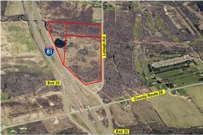
Property Detail
55 Lehigh Rd
Syracuse, NY
OSWEGO
355089-101-000-0005-002-000-0000
New York
Privateutilityelectricwatergasnuclearsolarwindetc
49.53 AC
02 - SINGL
Oswego County
A Areas with a 1% annual chance of flooding and a 26% chance of flooding over the life of a 30-year mortgage.
Syracuse
NEARBY LISTINGS FOR SALE OR LEASE
-
-
View all Pulaski listings for sale on LoopNet.com
DEMOGRAPHICS near 55 Lehigh Rd
1 mile
3 mile
5 mile
2025 Total Population
258
1,995
6,510
2030 Population
259
2,036
6,563
Pop Growth 2025-2030
+ 0.39%
+ 2.06%
+ 0.81%
Average Age
41
42
42
2025 Total Households
95
759
2,655
HH Growth 2025-2030
+ 1.05%
+ 2.24%
+ 0.75%
Median Household Inc
$96,428
$95,208
$79,460
Avg Household Size
2.60
2.60
2.40
2025 Avg HH Vehicles
3.00
2.00
2.00
Median Home Value
$154,054
$169,243
$169,671
Median Year Built
1961
1975
1973
Nearby Places
Map Layers
Map Styles
 Street
 Aerial
Layers
 Traffic
 Biking
Places
Listings with unknown addresses are not visible on the map
- Restaurants
- Banks
- Shops
- Fitness
- Groceries
PUBLIC TRANSPORTATION
AIRPORT
Syracuse Hancock International
Drive
Walk
Distance
Syracuse Hancock International
39 min
30.2 mi
Freight Ports
Albany, NY Port
Drive
Walk
Distance
Albany, NY Port
199 min
154.2 mi
Nearby Properties
Address
Land Use
TOTAL SIZE
Lot Size
Zoning
Address
Land Use
TOTAL SIZE
Lot Size
Zoning
166,960 SF
152.14 AC
06 - INDUS
Address
Land Use
TOTAL SIZE
Lot Size
Zoning
27,944 SF
34.51 AC
01 - NOT Z
Address
Land Use
TOTAL SIZE
Lot Size
Zoning
91,883 SF
16.10 AC
02 - SINGL
Address
Land Use
TOTAL SIZE
Lot Size
Zoning
73,362 SF
22.66 AC
03 - MULTI
Address
Land Use
TOTAL SIZE
Lot Size
Zoning
30.95 AC
Address
Land Use
TOTAL SIZE
Lot Size
Zoning
1,440 SF
28.01 AC
06 - INDUS
Address
Land Use
TOTAL SIZE
Lot Size
Zoning
18,868 SF
17.42 AC
02 - SINGL
Address
Land Use
TOTAL SIZE
Lot Size
Zoning
4,488 SF
3.91 AC
01 - NOT Z
Address
Land Use
TOTAL SIZE
Lot Size
Zoning
14,700 SF
2.81 AC
01 - NOT Z
Address
Land Use
TOTAL SIZE
Lot Size
Zoning
4.41 AC
02 - SINGL
Address
Land Use
TOTAL SIZE
Lot Size
Zoning
11,275 SF
7.21 AC
02 - SINGL
Address
Land Use
TOTAL SIZE
Lot Size
Zoning
6.50 AC
Address
Land Use
TOTAL SIZE
Lot Size
Zoning
3,867 SF
0.96 AC
03 - MULTI
Address
Land Use
TOTAL SIZE
Lot Size
Zoning
660 SF
19.68 AC
02 - SINGL
Address
Land Use
TOTAL SIZE
Lot Size
Zoning
3,008 SF
155 AC
02 - SINGL
Address
Land Use
TOTAL SIZE
Lot Size
Zoning
4,000 SF
62.98 AC
03 - MULTI
Address
Land Use
TOTAL SIZE
Lot Size
Zoning
2,648 SF
3.40 AC
01 - NOT Z
Address
Land Use
TOTAL SIZE
Lot Size
Zoning
1,960 SF
1.50 AC
01 - NOT Z
Address
Land Use
TOTAL SIZE
Lot Size
Zoning
3,562 SF
1.58 AC
Address
Land Use
TOTAL SIZE
Lot Size
Zoning
5,322 SF
2.02 AC
05 - COMME
Address
Land Use
TOTAL SIZE
Lot Size
Zoning
2,744 SF
60 AC
02 - SINGL
Address
Land Use
TOTAL SIZE
Lot Size
Zoning
5,040 SF
1.50 AC
01 - NOT Z
Address
Land Use
TOTAL SIZE
Lot Size
Zoning
4,892 SF
1.38 AC
02 - SINGL
Address
Land Use
TOTAL SIZE
Lot Size
Zoning
247.32 AC
01 - NOT Z
Address
Land Use
TOTAL SIZE
Lot Size
Zoning
4,845 SF
1.03 AC
05 - COMME
Address
Land Use
TOTAL SIZE
Lot Size
Zoning
9,633 SF
1.54 AC
01 - NOT Z
Address
Land Use
TOTAL SIZE
Lot Size
Zoning
1,924 SF
11.50 AC
Address
Land Use
TOTAL SIZE
Lot Size
Zoning
2,062 SF
40 AC
Address
Land Use
TOTAL SIZE
Lot Size
Zoning
5,108 SF
80 AC
02 - SINGL
The World's #1 Commercial Real Estate Marketplace
Connect with us
© 2026 CoStar Group
The information above has been obtained from sources believed reliable. While we do not doubt its accuracy we have not verified it and make no guarantee, warranty or representation about it. It is your responsibility to independently confirm its accuracy and completeness. Any projections, opinions, assumptions, or estimates used are for example only and do not represent the current or future performance of the property. The value of this transaction to you depends on tax and other factors which should be evaluated by your tax, financial, and legal advisors. You and your advisors should conduct a careful, independent investigation of the property to determine to your satisfaction the suitability of the property for your needs.