Property Record
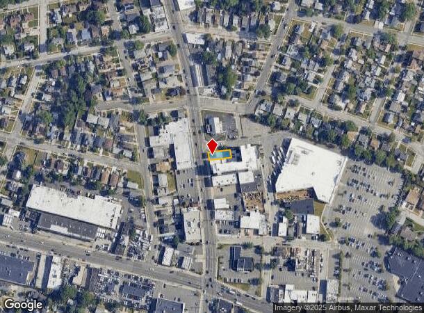
55 N Central Ave, Valley Stream, NY 11580
NEARBY LISTINGS FOR SALE OR LEASE
Property Detail
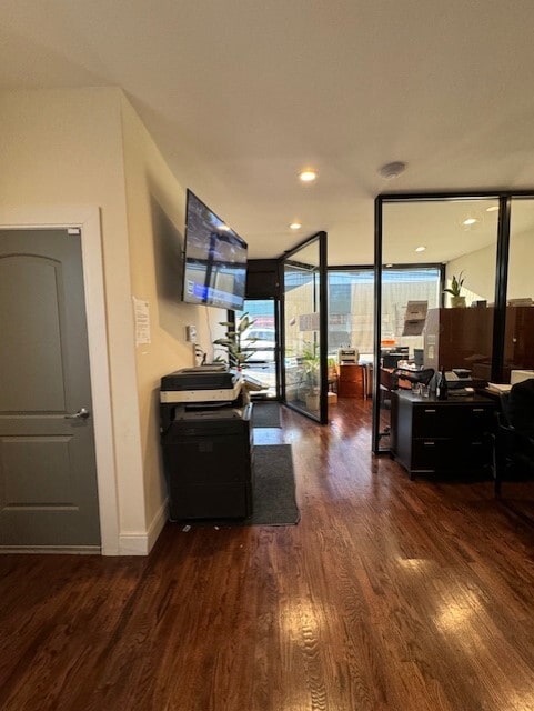
55 N Central Ave
2035-37-S-00-0155-0
TOWN #1 SCH DIST 030
Commercialnec
Nassau
X
New York
36059C0212G
155
2025
0.07 AC
2025
Southern Nassau
410500
Long Island (New York)
2,856 SF
Nassau County-Suffolk County, NY
DEMOGRAPHICS near 55 N Central Ave
1 Mile
3 Mile
5 Mile
2024 Total Population
31,204
281,320
719,977
2029 Population
30,299
268,130
683,416
Pop Growth 2024-2029
(2.90%)
(4.69%)
(5.08%)
Average Age
41
41
41
2024 Total Households
9,560
86,780
225,483
HH Growth 2024-2029
(2.99%)
(4.96%)
(5.28%)
Median Household Inc
$112,805
$115,537
$100,981
Avg Household Size
3.10
3.10
3.10
2024 Avg HH Vehicles
2.00
2.00
2.00
Median Home Value
$552,767
$632,875
$657,982
Median Year Built
1951
1952
1951
Nearby Places
- Restaurants
- Banks
- Shops
- Fitness
- Groceries
SALE & LEASE HISTORY
LISTING DATE
SALE/LEASE

Sep 24, 2016
For Sale
May 21, 2018
For Lease
Jan 03, 2024
For Lease
Nearby Properties
Address
Land Use
TOTAL SIZE
Lot Size
Zoning
Address
Land Use
TOTAL SIZE
Lot Size
Zoning
294.47 AC
PARK
Address
Land Use
TOTAL SIZE
Lot Size
Zoning
285,170 SF
12.63 AC
R3-1
Address
Land Use
TOTAL SIZE
Lot Size
Zoning
27.23 AC
PARK
Address
Land Use
TOTAL SIZE
Lot Size
Zoning
129,378 SF
4.86 AC
R2A
Address
Land Use
TOTAL SIZE
Lot Size
Zoning
160,000 SF
4.02 AC
R3-2
Address
Land Use
TOTAL SIZE
Lot Size
Zoning
64,618 SF
8.04 AC
Address
Land Use
TOTAL SIZE
Lot Size
Zoning
93.35 AC
PARK
Address
Land Use
TOTAL SIZE
Lot Size
Zoning
178,870 SF
7.60 AC
M1-1
Address
Land Use
TOTAL SIZE
Lot Size
Zoning
122,080 SF
2.81 AC
R2
Address
Land Use
TOTAL SIZE
Lot Size
Zoning
5,296 SF
37.42 AC
PARK
Address
Land Use
TOTAL SIZE
Lot Size
Zoning
213,338 SF
2.91 AC
R3X
Address
Land Use
TOTAL SIZE
Lot Size
Zoning
252,665 SF
7.50 AC
R3-2
Address
Land Use
TOTAL SIZE
Lot Size
Zoning
97,190 SF
1.75 AC
R3X
Address
Land Use
TOTAL SIZE
Lot Size
Zoning
170,000 SF
4.02 AC
R3-2
Address
Land Use
TOTAL SIZE
Lot Size
Zoning
78,380 SF
0.85 AC
R3-2
Address
Land Use
TOTAL SIZE
Lot Size
Zoning
806 SF
84.15 AC
R2A
Address
Land Use
TOTAL SIZE
Lot Size
Zoning
260,000 SF
4.14 AC
R2
Address
Land Use
TOTAL SIZE
Lot Size
Zoning
96,071 SF
5.58 AC
M1-1
Address
Land Use
TOTAL SIZE
Lot Size
Zoning
149,804 SF
9.07 AC
M1-1
Address
Land Use
TOTAL SIZE
Lot Size
Zoning
141,782 SF
7.39 AC
M1-1
Address
Land Use
TOTAL SIZE
Lot Size
Zoning
85,330 SF
2.91 AC
R3-2
Address
Land Use
TOTAL SIZE
Lot Size
Zoning
4,000 SF
23.88 AC
PARK
Address
Land Use
TOTAL SIZE
Lot Size
Zoning
131,000 SF
2.43 AC
M1-1
Address
Land Use
TOTAL SIZE
Lot Size
Zoning
107,762 SF
5.23 AC
M1-1
Address
Land Use
TOTAL SIZE
Lot Size
Zoning
59,963 SF
1.55 AC
M1-1
Address
Land Use
TOTAL SIZE
Lot Size
Zoning
305,980 SF
10.73 AC
M1-1
Address
Land Use
TOTAL SIZE
Lot Size
Zoning
97,721 SF
5.18 AC
M1-1
Address
Land Use
TOTAL SIZE
Lot Size
Zoning
78,944 SF
11.31 AC
M1-1
Address
Land Use
TOTAL SIZE
Lot Size
Zoning
100 SF
15.61 AC
PARK
Address
Land Use
TOTAL SIZE
Lot Size
Zoning
49,410 SF
3.19 AC
R3A
The World's #1 Commercial Real Estate Marketplace
Connect with us
© 2025 CoStar Group
The information above has been obtained from sources believed reliable. While we do not doubt its accuracy we have not verified it and make no guarantee, warranty or representation about it. It is your responsibility to independently confirm its accuracy and completeness. Any projections, opinions, assumptions, or estimates used are for example only and do not represent the current or future performance of the property. The value of this transaction to you depends on tax and other factors which should be evaluated by your tax, financial, and legal advisors. You and your advisors should conduct a careful, independent investigation of the property to determine to your satisfaction the suitability of the property for your needs.