Property Record
55 Sicker Rd, Latham, NY 12110
NEARBY LISTINGS FOR SALE OR LEASE
Property Detail
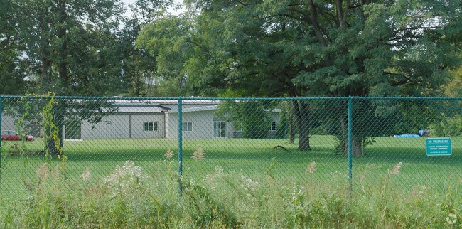
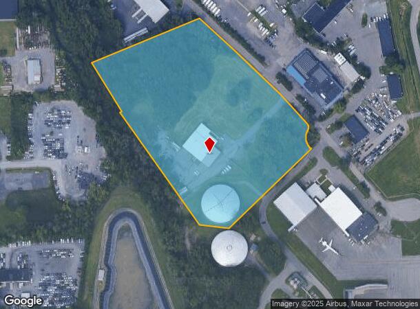
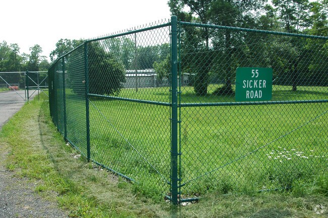
55 Sicker Rd
012689-018-000-0002-050-001-0000
N-SICKER RD E-81 C-36-92.1
Warehouse
Albany
AE
New York
36001C0068D
50.001
2025
10.50 AC
2024
E Outer Albany County
013703
Albany/Schenectady/Troy
11,900 SF
Albany-Schenectady-Troy, NY
DEMOGRAPHICS near 55 Sicker Rd
1 Mile
3 Mile
5 Mile
2024 Total Population
861
34,845
114,756
2029 Population
880
34,852
115,241
Pop Growth 2024-2029
+ 2.21%
+ 0.02%
+ 0.42%
Average Age
45
43
42
2024 Total Households
271
13,896
43,913
HH Growth 2024-2029
+ 2.58%
(0.06%)
+ 0.44%
Median Household Inc
$93,485
$95,345
$92,757
Avg Household Size
2.50
2.40
2.30
2024 Avg HH Vehicles
2.00
2.00
2.00
Median Home Value
$285,869
$290,024
$276,490
Median Year Built
1974
1974
1974
Nearby Places
- Restaurants
- Banks
- Shops
- Fitness
- Groceries
PUBLIC TRANSPORTATION
COMMUTER RAIL
Schenectady (Adirondack - VIA Rail, Empire Service - VIA Rail, Ethan Allen Express - VIA Rail, Lake Shore Limited - VIA Rail, Maple Leaf - VIA Rail, Toronto - New York - VIA Rail)
DRIVE
WALK
Distance
Schenectady (Adirondack - VIA Rail, Empire Service - VIA Rail, Ethan Allen Express - VIA Rail, Lake Shore Limited - VIA Rail, Maple Leaf - VIA Rail, Toronto - New York - VIA Rail)
18 min
8.5 mi
AIRPORT
Albany International
DRIVE
WALK
Distance
Albany International
7 min
3.0 mi
Freight Ports
Albany, NY Port
DRIVE
WALK
Distance
Albany, NY Port
26 min
12.8 mi
Nearby Properties
Address
Land Use
TOTAL SIZE
Lot Size
Zoning
Address
Land Use
TOTAL SIZE
Lot Size
Zoning
821,670 SF
803.50 AC
17
Address
Land Use
TOTAL SIZE
Lot Size
Zoning
154,580 SF
89.34 AC
16
Address
Land Use
TOTAL SIZE
Lot Size
Zoning
373,296 SF
11.70 AC
46
Address
Land Use
TOTAL SIZE
Lot Size
Zoning
90,316 SF
57.10 AC
04 - FARM
Address
Land Use
TOTAL SIZE
Lot Size
Zoning
226,171 SF
26.39 AC
12
Address
Land Use
TOTAL SIZE
Lot Size
Zoning
301,834 SF
9 AC
26
Address
Land Use
TOTAL SIZE
Lot Size
Zoning
266,600 SF
22.60 AC
47
Address
Land Use
TOTAL SIZE
Lot Size
Zoning
242,630 SF
18.50 AC
16
Address
Land Use
TOTAL SIZE
Lot Size
Zoning
84,242 SF
43.60 AC
12
Address
Land Use
TOTAL SIZE
Lot Size
Zoning
25,786 SF
8 AC
17
Address
Land Use
TOTAL SIZE
Lot Size
Zoning
167,222 SF
15.65 AC
14
Address
Land Use
TOTAL SIZE
Lot Size
Zoning
77.50 AC
M1
Address
Land Use
TOTAL SIZE
Lot Size
Zoning
162,500 SF
19.90 AC
17
Address
Land Use
TOTAL SIZE
Lot Size
Zoning
256,101 SF
9 AC
12
Address
Land Use
TOTAL SIZE
Lot Size
Zoning
141,570 SF
4.43 AC
12
Address
Land Use
TOTAL SIZE
Lot Size
Zoning
264,473 SF
26.40 AC
25
Address
Land Use
TOTAL SIZE
Lot Size
Zoning
83,120 SF
126.75 AC
25
Address
Land Use
TOTAL SIZE
Lot Size
Zoning
151,287 SF
11.20 AC
12
Address
Land Use
TOTAL SIZE
Lot Size
Zoning
73,736 SF
7.58 AC
14
Address
Land Use
TOTAL SIZE
Lot Size
Zoning
214,716 SF
28.40 AC
19
Address
Land Use
TOTAL SIZE
Lot Size
Zoning
9,774 SF
49.20 AC
43
Address
Land Use
TOTAL SIZE
Lot Size
Zoning
53,852 SF
43.35 AC
25
Address
Land Use
TOTAL SIZE
Lot Size
Zoning
25,112 SF
13.16 AC
04 - FARM
Address
Land Use
TOTAL SIZE
Lot Size
Zoning
Address
Land Use
TOTAL SIZE
Lot Size
Zoning
108,656 SF
6.44 AC
12
Address
Land Use
TOTAL SIZE
Lot Size
Zoning
10,088 SF
30.04 AC
08 - GOVER
Address
Land Use
TOTAL SIZE
Lot Size
Zoning
186,095 SF
14.94 AC
12
Address
Land Use
TOTAL SIZE
Lot Size
Zoning
269,318 SF
7.60 AC
17
Address
Land Use
TOTAL SIZE
Lot Size
Zoning
117,723 SF
9.07 AC
12
Address
Land Use
TOTAL SIZE
Lot Size
Zoning
99,620 SF
15 AC
45
The World's #1 Commercial Real Estate Marketplace
Connect with us
© 2025 CoStar Group
The information above has been obtained from sources believed reliable. While we do not doubt its accuracy we have not verified it and make no guarantee, warranty or representation about it. It is your responsibility to independently confirm its accuracy and completeness. Any projections, opinions, assumptions, or estimates used are for example only and do not represent the current or future performance of the property. The value of this transaction to you depends on tax and other factors which should be evaluated by your tax, financial, and legal advisors. You and your advisors should conduct a careful, independent investigation of the property to determine to your satisfaction the suitability of the property for your needs.