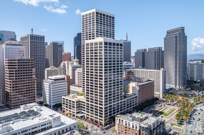
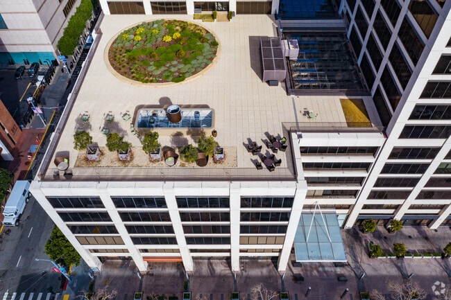
Property Record
55 Spear St, San Francisco, CA 94105


NEARBY LISTINGS FOR SALE OR LEASE
Property Detail
55 Spear St
San Francisco-San Mateo-Redwood City, CA
San Francisco
3713-007
California
Officebuilding
7
2024
2.60 AC
2025
South Financial District
061507
San Francisco
1,534,312 SF
DEMOGRAPHICS near 55 Spear St
1 mile
3 mile
5 mile
2024 Total Population
52,881
344,208
575,482
2029 Population
49,255
321,304
534,586
Pop Growth 2024-2029
(6.86%)
(6.65%)
(7.11%)
Average Age
44
42
42
2024 Total Households
28,958
171,598
263,432
HH Growth 2024-2029
(7.22%)
(7.20%)
(7.54%)
Median Household Inc
$118,083
$122,793
$130,896
Avg Household Size
1.80
1.90
2.00
2024 Avg HH Vehicles
1.00
1.00
1.00
Median Home Value
$1,106,876
$1,094,214
$1,100,603
Median Year Built
1983
1955
1949
Nearby Places
Map Layers
Map Styles
 Street
 Aerial
Transit
 Traffic
 Biking
Places
Listings with unknown addresses are not visible on the map
- Restaurants
- Banks
- Shops
- Fitness
- Groceries
PUBLIC TRANSPORTATION
TRANSIT/SUBWAY
Ferry Terminal (F Market - San Francisco Municipal Railway (MUNI Metro))
Drive
Walk
Distance
Ferry Terminal (F Market - San Francisco Municipal Railway (MUNI Metro))
1 min
3 min
0.1 mi
Market and Drumm (F Market - San Francisco Municipal Railway (MUNI Metro))
Drive
Walk
Distance
Market and Drumm (F Market - San Francisco Municipal Railway (MUNI Metro))
1 min
3 min
0.1 mi
California and Drumm (California Street Cable Car - San Francisco Municipal Railway (MUNI Metro))
Drive
Walk
Distance
California and Drumm (California Street Cable Car - San Francisco Municipal Railway (MUNI Metro))
2 min
3 min
0.2 mi
Embarcadero Station (Dublin/Pleasanton - Millbrae - Bay Area Rapid Transit (BART), Fremont - Daly City - Bay Area Rapid Transit (BART), Pittsburg/Bay Point - San Francisco International - Bay Area Rapid Transit (BART), Richmond - Millbrae - Bay Area Rapid Transit (BART))
Drive
Walk
Distance
Embarcadero Station (Dublin/Pleasanton - Millbrae - Bay Area Rapid Transit (BART), Fremont - Daly City - Bay Area Rapid Transit (BART), Pittsburg/Bay Point - San Francisco International - Bay Area Rapid Transit (BART), Richmond - Millbrae - Bay Area Rapid Transit (BART))
1 min
4 min
0.2 mi
Embarcadero Station (J Church - San Francisco Municipal Railway (MUNI Metro), K Ingleside - San Francisco Municipal Railway (MUNI Metro), L Taraval - San Francisco Municipal Railway (MUNI Metro), M Ocean View - San Francisco Municipal Railway (MUNI Metro), N Judah - San Francisco Municipal Railway (MUNI Metro), S Castro Shuttle - San Francisco Municipal Railway (MUNI Metro), T Third Street - San Francisco Municipal Railway (MUNI Metro))
Drive
Walk
Distance
Embarcadero Station (J Church - San Francisco Municipal Railway (MUNI Metro), K Ingleside - San Francisco Municipal Railway (MUNI Metro), L Taraval - San Francisco Municipal Railway (MUNI Metro), M Ocean View - San Francisco Municipal Railway (MUNI Metro), N Judah - San Francisco Municipal Railway (MUNI Metro), S Castro Shuttle - San Francisco Municipal Railway (MUNI Metro), T Third Street - San Francisco Municipal Railway (MUNI Metro))
1 min
4 min
0.2 mi
COMMUTER RAIL
Drive
Walk
Distance
4 min
1.5 mi
San Francisco 4th & King (Caltrain - Caltrain (Caltrain))
Drive
Walk
Distance
San Francisco 4th & King (Caltrain - Caltrain (Caltrain))
4 min
1.6 mi
AIRPORT
San Francisco International
Drive
Walk
Distance
San Francisco International
23 min
14.5 mi
Metro Oakland International
Drive
Walk
Distance
Metro Oakland International
29 min
19.0 mi
Norman Y Mineta San Jose International
Drive
Walk
Distance
Norman Y Mineta San Jose International
59 min
46.1 mi
Freight Ports
Port of San Francisco
Drive
Walk
Distance
Port of San Francisco
3 min
1.1 mi
SALE & LEASE HISTORY
LISTING DATE
SALE/LEASE

Nov 27, 2019
For Lease
May 14, 2019
For Lease
Jun 16, 2020
For Lease
Jun 13, 2023
For Lease
Jun 08, 2021
For Lease
Jan 14, 2022
For Lease
Jan 07, 2020
For Lease
Feb 15, 2018
For Lease
Feb 06, 2023
For Lease
Dec 21, 2023
For Lease
Nearby Properties
Address
Land Use
TOTAL SIZE
Lot Size
Zoning
Address
Land Use
TOTAL SIZE
Lot Size
Zoning
1,015,000 SF
2.43 AC
RC4
Address
Land Use
TOTAL SIZE
Lot Size
Zoning
764,661 SF
0.67 AC
C3OSD
Address
Land Use
TOTAL SIZE
Lot Size
Zoning
750,370 SF
3.25 AC
MBR3
Address
Land Use
TOTAL SIZE
Lot Size
Zoning
1,471,929 SF
1.93 AC
C3O
Address
Land Use
TOTAL SIZE
Lot Size
Zoning
1,300,000 SF
1.74 AC
C3O
Address
Land Use
TOTAL SIZE
Lot Size
Zoning
1,420,430 SF
1.16 AC
C3OSD
Address
Land Use
TOTAL SIZE
Lot Size
Zoning
914,037 SF
1.36 AC
C3O
Address
Land Use
TOTAL SIZE
Lot Size
Zoning
717,234 SF
3.47 AC
UMU
Address
Land Use
TOTAL SIZE
Lot Size
Zoning
605,459 SF
0.63 AC
C3O
Address
Land Use
TOTAL SIZE
Lot Size
Zoning
475,791 SF
0.55 AC
C3OSD
Address
Land Use
TOTAL SIZE
Lot Size
Zoning
690,442 SF
0.79 AC
C3O
Address
Land Use
TOTAL SIZE
Lot Size
Zoning
10.92 AC
Address
Land Use
TOTAL SIZE
Lot Size
Zoning
750,491 SF
0.51 AC
C3O
Address
Land Use
TOTAL SIZE
Lot Size
Zoning
432,000 SF
0.35 AC
C3OSD
Address
Land Use
TOTAL SIZE
Lot Size
Zoning
266,143 SF
4 AC
C-3-R
Address
Land Use
TOTAL SIZE
Lot Size
Zoning
885,581 SF
5.20 AC
M2
Address
Land Use
TOTAL SIZE
Lot Size
Zoning
512,395 SF
1.24 AC
C3O
Address
Land Use
TOTAL SIZE
Lot Size
Zoning
508,714 SF
1.29 AC
C3R
Address
Land Use
TOTAL SIZE
Lot Size
Zoning
1,084,662 SF
1.67 AC
C3O
Address
Land Use
TOTAL SIZE
Lot Size
Zoning
505,120 SF
0.41 AC
C3O
Address
Land Use
TOTAL SIZE
Lot Size
Zoning
694,334 SF
1.01 AC
C3O
Address
Land Use
TOTAL SIZE
Lot Size
Zoning
696,431 SF
0.97 AC
C3G
Address
Land Use
TOTAL SIZE
Lot Size
Zoning
139,070 SF
0.64 AC
C3O
Address
Land Use
TOTAL SIZE
Lot Size
Zoning
1.52 AC
C3G
Address
Land Use
TOTAL SIZE
Lot Size
Zoning
1,424,230 SF
2.60 AC
C3G
Address
Land Use
TOTAL SIZE
Lot Size
Zoning
614,740 SF
1.74 AC
C3OSD
Address
Land Use
TOTAL SIZE
Lot Size
Zoning
615,957 SF
0.63 AC
C3O
Address
Land Use
TOTAL SIZE
Lot Size
Zoning
492,980 SF
0.43 AC
C3O
Address
Land Use
TOTAL SIZE
Lot Size
Zoning
385,000 SF
0.81 AC
C3O
The World's #1 Commercial Real Estate Marketplace
Connect with us
© 2026 CoStar Group
The information above has been obtained from sources believed reliable. While we do not doubt its accuracy we have not verified it and make no guarantee, warranty or representation about it. It is your responsibility to independently confirm its accuracy and completeness. Any projections, opinions, assumptions, or estimates used are for example only and do not represent the current or future performance of the property. The value of this transaction to you depends on tax and other factors which should be evaluated by your tax, financial, and legal advisors. You and your advisors should conduct a careful, independent investigation of the property to determine to your satisfaction the suitability of the property for your needs.