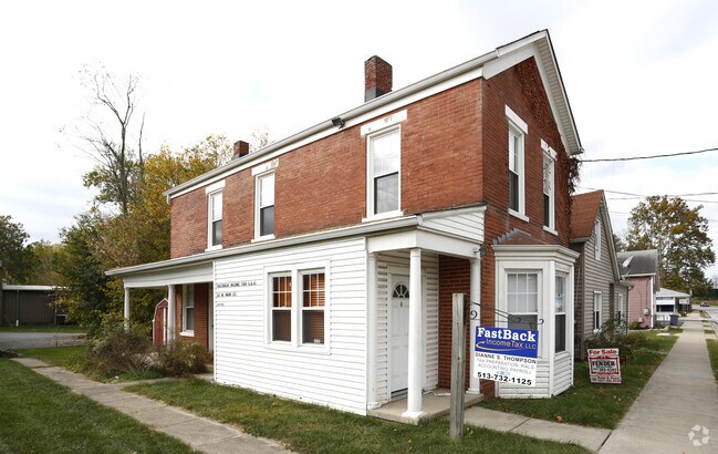
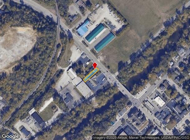
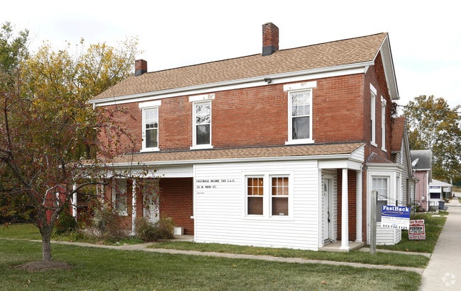
Property Record
55 W Main St, Batavia, OH 45103
NEARBY LISTINGS FOR SALE OR LEASE
-
-
View all Batavia listings for sale on LoopNet.com
Property Detail
55 W Main St
Cincinnati, OH-KY-IN
Batavia Vill
06-02-18A-001
BATAVIA VILL; LOT 1 HOERNER SUB
Officebuilding
Clermont
X
Ohio
39025C0233G
1
2024
0.14 AC
2024
Eastgate/Anderson Twp
041101
Cincinnati/Dayton
1,514 SF
DEMOGRAPHICS near 55 W Main St
1 Mile
3 Mile
5 Mile
2024 Total Population
2,021
15,819
62,735
2029 Population
2,071
16,363
64,627
Pop Growth 2024-2029
+ 2.47%
+ 3.44%
+ 3.02%
Average Age
39
40
40
2024 Total Households
770
5,894
24,576
HH Growth 2024-2029
+ 2.60%
+ 3.56%
+ 3.11%
Median Household Inc
$62,206
$70,612
$67,746
Avg Household Size
2.50
2.60
2.50
2024 Avg HH Vehicles
2.00
2.00
2.00
Median Home Value
$190,045
$256,464
$215,250
Median Year Built
1970
1995
1990
Nearby Places
Map Layers
Map Styles
 Street
 Aerial
- Restaurants
- Banks
- Shops
- Fitness
- Groceries
PUBLIC TRANSPORTATION
AIRPORT
Cincinnati/Northern Kentucky International
DRIVE
WALK
Distance
Cincinnati/Northern Kentucky International
34 min
31.0 mi
Freight Ports
Virginia Port Authority - Richmond
DRIVE
WALK
Distance
Virginia Port Authority - Richmond
1 min
383.3 mi
SALE & LEASE HISTORY
LISTING DATE
SALE/LEASE

Oct 18, 2016
For Sale
Nearby Properties
Address
Land Use
TOTAL SIZE
Lot Size
Zoning
Address
Land Use
TOTAL SIZE
Lot Size
Zoning
58.36 AC
Address
Land Use
TOTAL SIZE
Lot Size
Zoning
11,636 SF
49.40 AC
Address
Land Use
TOTAL SIZE
Lot Size
Zoning
11,215 SF
20.57 AC
Address
Land Use
TOTAL SIZE
Lot Size
Zoning
20,468 SF
143.20 AC
Address
Land Use
TOTAL SIZE
Lot Size
Zoning
49.15 AC
Address
Land Use
TOTAL SIZE
Lot Size
Zoning
Address
Land Use
TOTAL SIZE
Lot Size
Zoning
11,566 SF
28.70 AC
Address
Land Use
TOTAL SIZE
Lot Size
Zoning
26,263 SF
49.43 AC
Address
Land Use
TOTAL SIZE
Lot Size
Zoning
115,094 SF
18.53 AC
Address
Land Use
TOTAL SIZE
Lot Size
Zoning
17,253 SF
10.59 AC
Address
Land Use
TOTAL SIZE
Lot Size
Zoning
9,504 SF
24.04 AC
Address
Land Use
TOTAL SIZE
Lot Size
Zoning
6,900 SF
37.76 AC
Address
Land Use
TOTAL SIZE
Lot Size
Zoning
30,540 SF
20.57 AC
Address
Land Use
TOTAL SIZE
Lot Size
Zoning
35,046 SF
0.76 AC
Address
Land Use
TOTAL SIZE
Lot Size
Zoning
2,688 SF
16.09 AC
Address
Land Use
TOTAL SIZE
Lot Size
Zoning
20,482 SF
39.58 AC
Address
Land Use
TOTAL SIZE
Lot Size
Zoning
8,144 SF
41.50 AC
Address
Land Use
TOTAL SIZE
Lot Size
Zoning
5,712 SF
10.76 AC
Address
Land Use
TOTAL SIZE
Lot Size
Zoning
4,812 SF
14.08 AC
Address
Land Use
TOTAL SIZE
Lot Size
Zoning
5,712 SF
10.76 AC
Address
Land Use
TOTAL SIZE
Lot Size
Zoning
80,311 SF
7.38 AC
Address
Land Use
TOTAL SIZE
Lot Size
Zoning
6,362 SF
12.60 AC
Address
Land Use
TOTAL SIZE
Lot Size
Zoning
11.05 AC
Address
Land Use
TOTAL SIZE
Lot Size
Zoning
23,636 SF
4.46 AC
Address
Land Use
TOTAL SIZE
Lot Size
Zoning
81,672 SF
10.57 AC
Address
Land Use
TOTAL SIZE
Lot Size
Zoning
13,272 SF
1.06 AC
Address
Land Use
TOTAL SIZE
Lot Size
Zoning
4,446 SF
4.29 AC
Address
Land Use
TOTAL SIZE
Lot Size
Zoning
61,050 SF
5.09 AC
Address
Land Use
TOTAL SIZE
Lot Size
Zoning
15,800 SF
16.75 AC
Address
Land Use
TOTAL SIZE
Lot Size
Zoning
14,700 SF
68.88 AC
The World's #1 Commercial Real Estate Marketplace
Connect with us
© 2025 CoStar Group
The information above has been obtained from sources believed reliable. While we do not doubt its accuracy we have not verified it and make no guarantee, warranty or representation about it. It is your responsibility to independently confirm its accuracy and completeness. Any projections, opinions, assumptions, or estimates used are for example only and do not represent the current or future performance of the property. The value of this transaction to you depends on tax and other factors which should be evaluated by your tax, financial, and legal advisors. You and your advisors should conduct a careful, independent investigation of the property to determine to your satisfaction the suitability of the property for your needs.