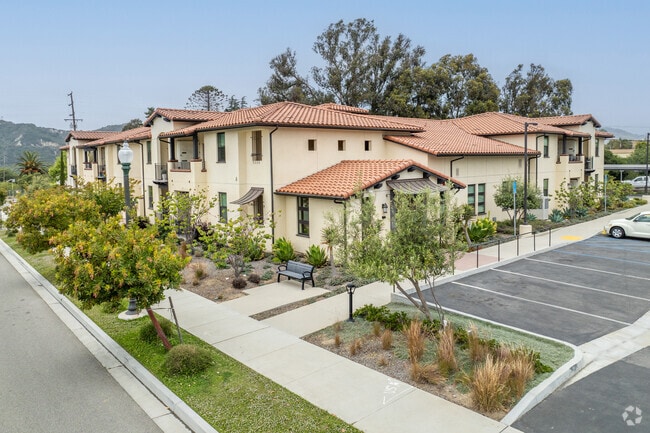
Property Record
55 Willett St, Ventura, CA 93001


NEARBY LISTINGS FOR SALE OR LEASE
Property Detail
55 Willett St
Oxnard-Thousand Oaks-Ventura, CA
Tract No 5489
069-0-290-015
TRACT: 548900 LOT: 117 REF: 165MR 1
Apartment
Ventura
X
California
06111C0741F
117
2024
1.01 AC
2025
Ventura
002200
Los Angeles
DEMOGRAPHICS near 55 Willett St
1 Mile
3 Mile
5 Mile
2024 Total Population
6,180
29,832
63,214
2029 Population
6,158
29,643
63,246
Pop Growth 2024-2029
(0.36%)
(0.63%)
+ 0.05%
Average Age
39
40
42
2024 Total Households
2,041
11,440
24,929
HH Growth 2024-2029
(0.49%)
(0.58%)
+ 0.10%
Median Household Inc
$87,122
$73,951
$86,206
Avg Household Size
2.80
2.50
2.40
2024 Avg HH Vehicles
2.00
2.00
2.00
Median Home Value
$628,318
$733,262
$759,461
Median Year Built
1981
1962
1965
Nearby Places
Map Layers
Map Styles
 Street
 Aerial
- Restaurants
- Banks
- Shops
- Fitness
- Groceries
PUBLIC TRANSPORTATION
COMMUTER RAIL
Ventura Amtrak (Metrolink Ventura County Line - Amtrak, Pacific Surfliner - Amtrak)
DRIVE
WALK
Distance
Ventura Amtrak (Metrolink Ventura County Line - Amtrak, Pacific Surfliner - Amtrak)
7 min
3.1 mi
East Ventura Metrolink Station (Metrolink Ventura County Line - Metrolink Trains)
DRIVE
WALK
Distance
East Ventura Metrolink Station (Metrolink Ventura County Line - Metrolink Trains)
14 min
9.6 mi
Freight Ports
The Port of Hueneme
DRIVE
WALK
Distance
The Port of Hueneme
26 min
15.9 mi
Nearby Properties
Address
Land Use
TOTAL SIZE
Lot Size
Zoning
Address
Land Use
TOTAL SIZE
Lot Size
Zoning
4.19 AC
H
Address
Land Use
TOTAL SIZE
Lot Size
Zoning
Address
Land Use
TOTAL SIZE
Lot Size
Zoning
7,280 SF
5.38 AC
C-T-O
Address
Land Use
TOTAL SIZE
Lot Size
Zoning
6.81 AC
C-T-O
Address
Land Use
TOTAL SIZE
Lot Size
Zoning
2.89 AC
C-T-O
Address
Land Use
TOTAL SIZE
Lot Size
Zoning
639.79 AC
Address
Land Use
TOTAL SIZE
Lot Size
Zoning
11,444 SF
6.57 AC
Address
Land Use
TOTAL SIZE
Lot Size
Zoning
732 SF
0.51 AC
DR
Address
Land Use
TOTAL SIZE
Lot Size
Zoning
0.84 AC
Address
Land Use
TOTAL SIZE
Lot Size
Zoning
57,554 SF
0.58 AC
Address
Land Use
TOTAL SIZE
Lot Size
Zoning
43,498 SF
1.67 AC
R33
Address
Land Use
TOTAL SIZE
Lot Size
Zoning
19,709 SF
0.14 AC
DC
Address
Land Use
TOTAL SIZE
Lot Size
Zoning
168 SF
7.87 AC
M3
Address
Land Use
TOTAL SIZE
Lot Size
Zoning
19,431 SF
0.59 AC
DR
Address
Land Use
TOTAL SIZE
Lot Size
Zoning
38,456 SF
1.49 AC
R33
Address
Land Use
TOTAL SIZE
Lot Size
Zoning
1.33 AC
DC
Address
Land Use
TOTAL SIZE
Lot Size
Zoning
29,058 SF
1.18 AC
C2
Address
Land Use
TOTAL SIZE
Lot Size
Zoning
3,596 SF
1.19 AC
Address
Land Use
TOTAL SIZE
Lot Size
Zoning
29,798 SF
0.57 AC
C1
Address
Land Use
TOTAL SIZE
Lot Size
Zoning
3.60 AC
8
Address
Land Use
TOTAL SIZE
Lot Size
Zoning
1.40 AC
7
Address
Land Use
TOTAL SIZE
Lot Size
Zoning
5.10 AC
Address
Land Use
TOTAL SIZE
Lot Size
Zoning
1.54 AC
Address
Land Use
TOTAL SIZE
Lot Size
Zoning
0.77 AC
7
Address
Land Use
TOTAL SIZE
Lot Size
Zoning
11,970 SF
5.18 AC
M1
Address
Land Use
TOTAL SIZE
Lot Size
Zoning
0.88 AC
Address
Land Use
TOTAL SIZE
Lot Size
Zoning
21,700 SF
1.89 AC
MXD
Address
Land Use
TOTAL SIZE
Lot Size
Zoning
462 SF
0.77 AC
C-2
Address
Land Use
TOTAL SIZE
Lot Size
Zoning
20,600 SF
5.92 AC
M2
The World's #1 Commercial Real Estate Marketplace
Connect with us
© 2025 CoStar Group
The information above has been obtained from sources believed reliable. While we do not doubt its accuracy we have not verified it and make no guarantee, warranty or representation about it. It is your responsibility to independently confirm its accuracy and completeness. Any projections, opinions, assumptions, or estimates used are for example only and do not represent the current or future performance of the property. The value of this transaction to you depends on tax and other factors which should be evaluated by your tax, financial, and legal advisors. You and your advisors should conduct a careful, independent investigation of the property to determine to your satisfaction the suitability of the property for your needs.