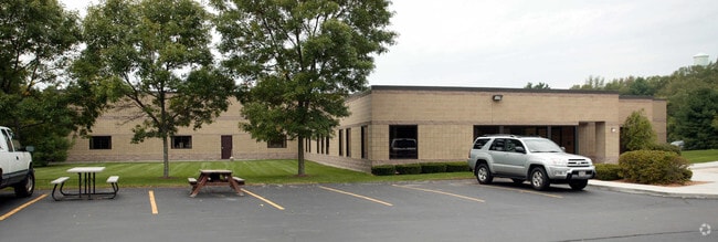
Property Record
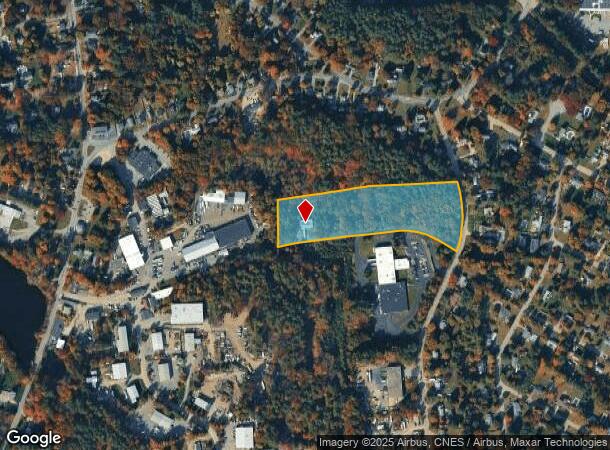
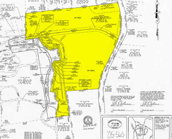
55 Winter St, Hanover, MA 02339
NEARBY LISTINGS FOR SALE OR LEASE
Property Detail
55 Winter St
HANO-000060-000000-000068
Plymouth
Warehouse
Massachusetts
AE
68
25023C0201K
7.15 AC
2025
Route 3 South
2025
Boston
503102
Boston-Cambridge-Newton, MA-NH
4,050 SF
DEMOGRAPHICS near 55 Winter St
1 Mile
3 Mile
5 Mile
2024 Total Population
2,562
32,058
84,413
2029 Population
2,551
32,106
84,353
Pop Growth 2024-2029
(0.43%)
+ 0.15%
(0.07%)
Average Age
40
41
41
2024 Total Households
841
11,415
31,010
HH Growth 2024-2029
(0.48%)
+ 0.07%
(0.16%)
Median Household Inc
$186,110
$130,714
$120,658
Avg Household Size
3.00
2.80
2.70
2024 Avg HH Vehicles
3.00
2.00
2.00
Median Home Value
$710,740
$525,602
$488,653
Median Year Built
1967
1969
1967
Nearby Places
Map Layers
Map Styles
 Street
 Aerial
- Restaurants
- Banks
- Shops
- Fitness
- Groceries
PUBLIC TRANSPORTATION
COMMUTER RAIL
Abington (Kingston/Plymouth Line - Massachusetts Bay Transportation Authority Commuter Rail (Purple Line))
DRIVE
WALK
Distance
Abington (Kingston/Plymouth Line - Massachusetts Bay Transportation Authority Commuter Rail (Purple Line))
11 min
4.7 mi
Whitman (Kingston/Plymouth Line - Massachusetts Bay Transportation Authority Commuter Rail (Purple Line))
DRIVE
WALK
Distance
Whitman (Kingston/Plymouth Line - Massachusetts Bay Transportation Authority Commuter Rail (Purple Line))
11 min
5.0 mi
AIRPORT
General Edward Lawrence Logan International
DRIVE
WALK
Distance
General Edward Lawrence Logan International
44 min
26.3 mi
Freight Ports
Port of Boston
DRIVE
WALK
Distance
Port of Boston
42 min
24.1 mi
Nearby Properties
Address
Land Use
TOTAL SIZE
Lot Size
Zoning
Address
Land Use
TOTAL SIZE
Lot Size
Zoning
69.93 AC
100
Address
Land Use
TOTAL SIZE
Lot Size
Zoning
23.41 AC
R
Address
Land Use
TOTAL SIZE
Lot Size
Zoning
78.50 AC
R
Address
Land Use
TOTAL SIZE
Lot Size
Zoning
141,514 SF
46.60 AC
R
Address
Land Use
TOTAL SIZE
Lot Size
Zoning
99,138 SF
83.32 AC
100
Address
Land Use
TOTAL SIZE
Lot Size
Zoning
3.72 AC
INDUST
Address
Land Use
TOTAL SIZE
Lot Size
Zoning
16.12 AC
RESIDE
Address
Land Use
TOTAL SIZE
Lot Size
Zoning
91,586 SF
13.70 AC
R
Address
Land Use
TOTAL SIZE
Lot Size
Zoning
121,800 SF
0.97 AC
C
Address
Land Use
TOTAL SIZE
Lot Size
Zoning
108,958 SF
7.37 AC
LI
Address
Land Use
TOTAL SIZE
Lot Size
Zoning
13.10 AC
Address
Land Use
TOTAL SIZE
Lot Size
Zoning
137,617 SF
24.54 AC
C
Address
Land Use
TOTAL SIZE
Lot Size
Zoning
12.04 AC
C
Address
Land Use
TOTAL SIZE
Lot Size
Zoning
25,262 SF
244 AC
Address
Land Use
TOTAL SIZE
Lot Size
Zoning
9.30 AC
BUSINE
Address
Land Use
TOTAL SIZE
Lot Size
Zoning
3.63 AC
RESIDE
Address
Land Use
TOTAL SIZE
Lot Size
Zoning
24.07 AC
BD
Address
Land Use
TOTAL SIZE
Lot Size
Zoning
3.88 AC
BD
Address
Land Use
TOTAL SIZE
Lot Size
Zoning
11.48 AC
C
Address
Land Use
TOTAL SIZE
Lot Size
Zoning
60,274 SF
15.10 AC
B
Address
Land Use
TOTAL SIZE
Lot Size
Zoning
127,644 SF
15.76 AC
Address
Land Use
TOTAL SIZE
Lot Size
Zoning
47,909 SF
12.59 AC
C
Address
Land Use
TOTAL SIZE
Lot Size
Zoning
14.20 AC
C
Address
Land Use
TOTAL SIZE
Lot Size
Zoning
23.31 AC
B
Address
Land Use
TOTAL SIZE
Lot Size
Zoning
184,542 SF
13.58 AC
I
Address
Land Use
TOTAL SIZE
Lot Size
Zoning
16.12 AC
100
Address
Land Use
TOTAL SIZE
Lot Size
Zoning
2.25 AC
Address
Land Use
TOTAL SIZE
Lot Size
Zoning
13.56 AC
Address
Land Use
TOTAL SIZE
Lot Size
Zoning
40,466 SF
19 AC
RESIDE
Address
Land Use
TOTAL SIZE
Lot Size
Zoning
92,516 SF
12.68 AC
GR
The World's #1 Commercial Real Estate Marketplace
Connect with us
© 2025 CoStar Group
The information above has been obtained from sources believed reliable. While we do not doubt its accuracy we have not verified it and make no guarantee, warranty or representation about it. It is your responsibility to independently confirm its accuracy and completeness. Any projections, opinions, assumptions, or estimates used are for example only and do not represent the current or future performance of the property. The value of this transaction to you depends on tax and other factors which should be evaluated by your tax, financial, and legal advisors. You and your advisors should conduct a careful, independent investigation of the property to determine to your satisfaction the suitability of the property for your needs.