Property Record
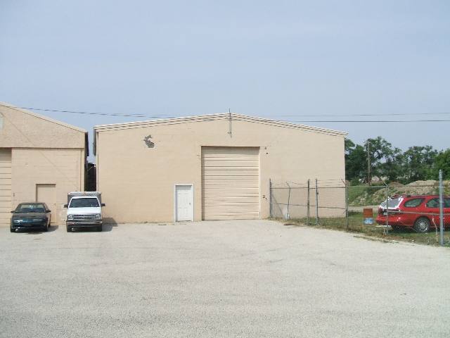
550 42Nd St S, Bettendorf, IA 52722
NEARBY LISTINGS FOR SALE OR LEASE
-
-
View all Bettendorf listings for sale on LoopNet.com
Property Detail
550 42Nd St S
8427390051
Metes & Bounds
Warehouse
SEC:27 TWP:78 RNG:04PT NE SE & PT SE SEPROPOSED TRACTSKORNA LAND
X
Scott
19163C0388H
Iowa
2025
3.76 AC
2025
Outlying Scott County
013400
Davenport/Moline/Rock Island
2,196 SF
Davenport-Moline-Rock Island, IA-IL
DEMOGRAPHICS near 550 42Nd St S
1 Mile
3 Mile
5 Mile
2024 Total Population
3,203
62,715
158,584
2029 Population
3,201
61,781
156,311
Pop Growth 2024-2029
(0.06%)
(1.49%)
(1.43%)
Average Age
41
41
40
2024 Total Households
1,327
26,553
65,888
HH Growth 2024-2029
(0.08%)
(1.56%)
(1.50%)
Median Household Inc
$56,232
$63,644
$65,225
Avg Household Size
2.40
2.30
2.30
2024 Avg HH Vehicles
2.00
2.00
2.00
Median Home Value
$220,412
$165,726
$171,069
Median Year Built
1977
1962
1965
Nearby Places
Map Layers
Map Styles
 Street
 Aerial
- Restaurants
- Banks
- Shops
- Fitness
- Groceries
PUBLIC TRANSPORTATION
AIRPORT
Quad Cities International
DRIVE
WALK
Distance
Quad Cities International
29 min
15.7 mi
Freight Ports
Port Milwaukee
DRIVE
WALK
Distance
Port Milwaukee
235 min
206.8 mi
Nearby Properties
Address
Land Use
TOTAL SIZE
Lot Size
Zoning
Address
Land Use
TOTAL SIZE
Lot Size
Zoning
157,798 SF
25.37 AC
Address
Land Use
TOTAL SIZE
Lot Size
Zoning
9,000 SF
408.98 AC
Address
Land Use
TOTAL SIZE
Lot Size
Zoning
5,296 SF
67.13 AC
Address
Land Use
TOTAL SIZE
Lot Size
Zoning
1,800 SF
60.86 AC
Address
Land Use
TOTAL SIZE
Lot Size
Zoning
76,808 SF
1.94 AC
Address
Land Use
TOTAL SIZE
Lot Size
Zoning
111,979 SF
6.86 AC
Address
Land Use
TOTAL SIZE
Lot Size
Zoning
64,661 SF
147.01 AC
Address
Land Use
TOTAL SIZE
Lot Size
Zoning
3,543 SF
14.79 AC
Address
Land Use
TOTAL SIZE
Lot Size
Zoning
65,958 SF
15.04 AC
Address
Land Use
TOTAL SIZE
Lot Size
Zoning
67,813 SF
2.56 AC
Address
Land Use
TOTAL SIZE
Lot Size
Zoning
15,353 SF
3.73 AC
Address
Land Use
TOTAL SIZE
Lot Size
Zoning
61,794 SF
8.83 AC
Address
Land Use
TOTAL SIZE
Lot Size
Zoning
71,108 SF
8.99 AC
Address
Land Use
TOTAL SIZE
Lot Size
Zoning
172,320 SF
32.46 AC
Address
Land Use
TOTAL SIZE
Lot Size
Zoning
40,307 SF
1.25 AC
Address
Land Use
TOTAL SIZE
Lot Size
Zoning
67,439 SF
2.02 AC
Address
Land Use
TOTAL SIZE
Lot Size
Zoning
114,160 SF
2.97 AC
Address
Land Use
TOTAL SIZE
Lot Size
Zoning
8,870 SF
8.01 AC
Address
Land Use
TOTAL SIZE
Lot Size
Zoning
73,353 SF
3.45 AC
Address
Land Use
TOTAL SIZE
Lot Size
Zoning
250,504 SF
25.67 AC
Address
Land Use
TOTAL SIZE
Lot Size
Zoning
79,949 SF
2.63 AC
Address
Land Use
TOTAL SIZE
Lot Size
Zoning
1,200 SF
7.02 AC
Address
Land Use
TOTAL SIZE
Lot Size
Zoning
2,400 SF
228.12 AC
Address
Land Use
TOTAL SIZE
Lot Size
Zoning
59,668 SF
7.80 AC
Address
Land Use
TOTAL SIZE
Lot Size
Zoning
96,335 SF
8.83 AC
Address
Land Use
TOTAL SIZE
Lot Size
Zoning
3,384,969 SF
128 AC
EM
Address
Land Use
TOTAL SIZE
Lot Size
Zoning
61,637 SF
2.66 AC
Address
Land Use
TOTAL SIZE
Lot Size
Zoning
53,959 SF
5.58 AC
Address
Land Use
TOTAL SIZE
Lot Size
Zoning
65,156 SF
7.44 AC
The World's #1 Commercial Real Estate Marketplace
Connect with us
© 2025 CoStar Group
The information above has been obtained from sources believed reliable. While we do not doubt its accuracy we have not verified it and make no guarantee, warranty or representation about it. It is your responsibility to independently confirm its accuracy and completeness. Any projections, opinions, assumptions, or estimates used are for example only and do not represent the current or future performance of the property. The value of this transaction to you depends on tax and other factors which should be evaluated by your tax, financial, and legal advisors. You and your advisors should conduct a careful, independent investigation of the property to determine to your satisfaction the suitability of the property for your needs.