Property Record
550 E Industrial Park Rd, Murphysboro, IL 62966
Save to a Folder
{{folder.Name}}
{{folder.ListingIds.length}} Properties
{{folder.ListingIds.length}} Property
Create a New Folder
Property Detail
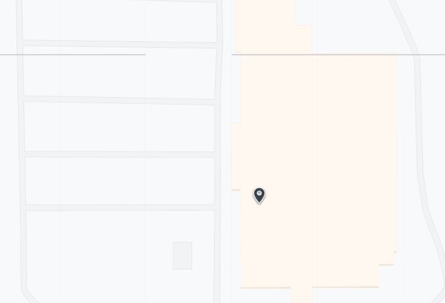
550 E Industrial Park Rd
Carbondale, IL
PT NE1/2 33-8-2 1.61 AC SURV BK 9 PG 42 FROM 09-33-227-026 DEC 2018R005284 2019R003948
09-33-227-021
Jackson
Commercialnec
Illinois
B and X Area of moderate flood hazard, usually the area between the limits of the 100-year and 500-year floods.
0.47 AC
2024
Marion/I-64 & South
2024
Other Market Areas
010400
NEARBY LISTINGS FOR SALE OR LEASE
DEMOGRAPHICS near 550 E Industrial Park Rd
1 mile
3 mile
5 mile
2025 Total Population
1,536
10,392
13,647
2030 Population
1,545
10,453
13,705
Pop Growth 2025-2030
+ 0.59%
+ 0.59%
+ 0.43%
Average Age
44
42
43
2025 Total Households
695
4,521
5,974
HH Growth 2025-2030
+ 0.58%
+ 0.49%
+ 0.40%
Median Household Inc
$67,957
$51,583
$54,565
Avg Household Size
2.10
2.20
2.20
2025 Avg HH Vehicles
2.00
2.00
2.00
Median Home Value
$179,333
$111,317
$130,607
Median Year Built
1981
1967
1971
Nearby Places
Map Layers
Map Styles
 Street
 Aerial
Layers
 Traffic
 Biking
Places
Listings with unknown addresses are not visible on the map
- Restaurants
- Banks
- Shops
- Fitness
- Groceries
PUBLIC TRANSPORTATION
COMMUTER RAIL
Carbondale (City of New Orleans - Amtrak, Illini - Amtrak, Saluki - Amtrak)
Drive
Walk
Distance
Carbondale (City of New Orleans - Amtrak, Illini - Amtrak, Saluki - Amtrak)
15 min
9.3 mi
Freight Ports
Tulsa Port of Inola
Drive
Walk
Distance
Tulsa Port of Inola
545 min
465.6 mi
Nearby Properties
Address
Land Use
TOTAL SIZE
Lot Size
Zoning
Address
Land Use
TOTAL SIZE
Lot Size
Zoning
Address
Land Use
TOTAL SIZE
Lot Size
Zoning
Address
Land Use
TOTAL SIZE
Lot Size
Zoning
37.20 AC
Address
Land Use
TOTAL SIZE
Lot Size
Zoning
2.32 AC
Address
Land Use
TOTAL SIZE
Lot Size
Zoning
12,468 SF
1.14 AC
Address
Land Use
TOTAL SIZE
Lot Size
Zoning
0.28 AC
Address
Land Use
TOTAL SIZE
Lot Size
Zoning
Address
Land Use
TOTAL SIZE
Lot Size
Zoning
5,000 SF
2.60 AC
Address
Land Use
TOTAL SIZE
Lot Size
Zoning
Address
Land Use
TOTAL SIZE
Lot Size
Zoning
2.23 AC
Address
Land Use
TOTAL SIZE
Lot Size
Zoning
0.84 AC
Address
Land Use
TOTAL SIZE
Lot Size
Zoning
13,325 SF
2.31 AC
Address
Land Use
TOTAL SIZE
Lot Size
Zoning
9,000 SF
1.61 AC
Address
Land Use
TOTAL SIZE
Lot Size
Zoning
3.37 AC
Address
Land Use
TOTAL SIZE
Lot Size
Zoning
4,150 SF
0.80 AC
Address
Land Use
TOTAL SIZE
Lot Size
Zoning
1.01 AC
Address
Land Use
TOTAL SIZE
Lot Size
Zoning
0.50 AC
Address
Land Use
TOTAL SIZE
Lot Size
Zoning
Address
Land Use
TOTAL SIZE
Lot Size
Zoning
4,008 SF
2.35 AC
Address
Land Use
TOTAL SIZE
Lot Size
Zoning
1.16 AC
Address
Land Use
TOTAL SIZE
Lot Size
Zoning
4,597 SF
1.19 AC
Address
Land Use
TOTAL SIZE
Lot Size
Zoning
3,070 SF
0.53 AC
Address
Land Use
TOTAL SIZE
Lot Size
Zoning
Address
Land Use
TOTAL SIZE
Lot Size
Zoning
7,563 SF
0.29 AC
Address
Land Use
TOTAL SIZE
Lot Size
Zoning
Address
Land Use
TOTAL SIZE
Lot Size
Zoning
9,230 SF
1.42 AC
Address
Land Use
TOTAL SIZE
Lot Size
Zoning
Address
Land Use
TOTAL SIZE
Lot Size
Zoning
22,500 SF
2.05 AC
Address
Land Use
TOTAL SIZE
Lot Size
Zoning
The World's #1 Commercial Real Estate Marketplace
Connect with us
© 2026 CoStar Group
The information above has been obtained from sources believed reliable. While we do not doubt its accuracy we have not verified it and make no guarantee, warranty or representation about it. It is your responsibility to independently confirm its accuracy and completeness. Any projections, opinions, assumptions, or estimates used are for example only and do not represent the current or future performance of the property. The value of this transaction to you depends on tax and other factors which should be evaluated by your tax, financial, and legal advisors. You and your advisors should conduct a careful, independent investigation of the property to determine to your satisfaction the suitability of the property for your needs.