Property Record
550 Eagle Rock Ave, Roseland, NJ 07068


Property Detail
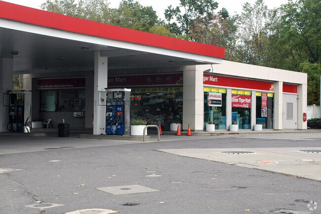
550 Eagle Rock Ave
Newark, NJ
200X145 1.00 AC
18-00002-0000-00007
Essex
Commercialnec
New Jersey
B-2
7
C and X Area of minimal flood hazard, usually depicted on FIRMs as above the 500-year flood level.
1 AC
2024
Suburban Essex/Rt 280
2025
Northern New Jersey
020902
NEARBY LISTINGS FOR SALE OR LEASE
DEMOGRAPHICS near 550 Eagle Rock Ave
1 mile
3 mile
5 mile
2025 Total Population
4,916
66,705
176,799
2030 Population
5,160
70,302
186,121
Pop Growth 2025-2030
+ 4.96%
+ 5.39%
+ 5.27%
Average Age
46
43
43
2025 Total Households
1,975
24,182
64,034
HH Growth 2025-2030
+ 4.86%
+ 5.42%
+ 5.32%
Median Household Inc
$157,042
$162,411
$165,616
Avg Household Size
2.50
2.70
2.70
2025 Avg HH Vehicles
2.00
2.00
2.00
Median Home Value
$691,075
$735,351
$712,112
Median Year Built
1977
1966
1966
Nearby Places
Map Layers
Map Styles
 Street
 Aerial
Layers
 Traffic
 Biking
Places
Listings with unknown addresses are not visible on the map
- Restaurants
- Banks
- Shops
- Fitness
- Groceries
PUBLIC TRANSPORTATION
COMMUTER RAIL
Orange (Morris & Essex Gladstone Branch - NJ Transit Commuter Rail (NJ Transit), Morris & Essex Morristown Line - NJ Transit Commuter Rail (NJ Transit))
Drive
Walk
Distance
Orange (Morris & Essex Gladstone Branch - NJ Transit Commuter Rail (NJ Transit), Morris & Essex Morristown Line - NJ Transit Commuter Rail (NJ Transit))
11 min
7.4 mi
Highland Avenue (Morris & Essex Gladstone Branch - NJ Transit Commuter Rail (NJ Transit), Morris & Essex Morristown Line - NJ Transit Commuter Rail (NJ Transit))
Drive
Walk
Distance
Highland Avenue (Morris & Essex Gladstone Branch - NJ Transit Commuter Rail (NJ Transit), Morris & Essex Morristown Line - NJ Transit Commuter Rail (NJ Transit))
12 min
7.9 mi
AIRPORT
Newark Liberty International
Drive
Walk
Distance
Newark Liberty International
25 min
17.1 mi
LaGuardia
Drive
Walk
Distance
LaGuardia
52 min
36.7 mi
John F Kennedy International
Drive
Walk
Distance
John F Kennedy International
63 min
40.0 mi
Freight Ports
Maher Terminal
Drive
Walk
Distance
Maher Terminal
30 min
17.4 mi
Nearby Properties
Address
Land Use
TOTAL SIZE
Lot Size
Zoning
Address
Land Use
TOTAL SIZE
Lot Size
Zoning
37.70 AC
R-6
Address
Land Use
TOTAL SIZE
Lot Size
Zoning
48.85 AC
R-3B
Address
Land Use
TOTAL SIZE
Lot Size
Zoning
98.27 AC
AH1
Address
Land Use
TOTAL SIZE
Lot Size
Zoning
19.70 AC
R-4
Address
Land Use
TOTAL SIZE
Lot Size
Zoning
13 AC
RM
Address
Land Use
TOTAL SIZE
Lot Size
Zoning
101.44 AC
OB-1
Address
Land Use
TOTAL SIZE
Lot Size
Zoning
32.34 AC
RA
Address
Land Use
TOTAL SIZE
Lot Size
Zoning
147,871 SF
26.50 AC
PB-3
Address
Land Use
TOTAL SIZE
Lot Size
Zoning
317,431 SF
20.97 AC
R-2
Address
Land Use
TOTAL SIZE
Lot Size
Zoning
55.77 AC
OB-1
Address
Land Use
TOTAL SIZE
Lot Size
Zoning
51.24 AC
OB-2
Address
Land Use
TOTAL SIZE
Lot Size
Zoning
119,552 SF
129 AC
I1A
Address
Land Use
TOTAL SIZE
Lot Size
Zoning
17.90 AC
B-2
Address
Land Use
TOTAL SIZE
Lot Size
Zoning
119,746 SF
8.79 AC
R-1
Address
Land Use
TOTAL SIZE
Lot Size
Zoning
55.22 AC
R-2
Address
Land Use
TOTAL SIZE
Lot Size
Zoning
336,832 SF
46.12 AC
R-L
Address
Land Use
TOTAL SIZE
Lot Size
Zoning
561,510 SF
35.55 AC
P-B2
Address
Land Use
TOTAL SIZE
Lot Size
Zoning
41.84 AC
OB-1
Address
Land Use
TOTAL SIZE
Lot Size
Zoning
216,359 SF
13.87 AC
R-5B
Address
Land Use
TOTAL SIZE
Lot Size
Zoning
61.69 AC
Address
Land Use
TOTAL SIZE
Lot Size
Zoning
19.70 AC
R-3
Address
Land Use
TOTAL SIZE
Lot Size
Zoning
27.50 AC
M-2
Address
Land Use
TOTAL SIZE
Lot Size
Zoning
278,784 SF
6.01 AC
OB-2
Address
Land Use
TOTAL SIZE
Lot Size
Zoning
49.53 AC
P
Address
Land Use
TOTAL SIZE
Lot Size
Zoning
25.40 AC
I-3
Address
Land Use
TOTAL SIZE
Lot Size
Zoning
38.40 AC
Address
Land Use
TOTAL SIZE
Lot Size
Zoning
28.06 AC
OB-3
Address
Land Use
TOTAL SIZE
Lot Size
Zoning
25.71 AC
Address
Land Use
TOTAL SIZE
Lot Size
Zoning
259,325 SF
13.62 AC
I1A
Address
Land Use
TOTAL SIZE
Lot Size
Zoning
1,443 SF
165.75 AC
I-R2
The World's #1 Commercial Real Estate Marketplace
Connect with us
© 2026 CoStar Group
The information above has been obtained from sources believed reliable. While we do not doubt its accuracy we have not verified it and make no guarantee, warranty or representation about it. It is your responsibility to independently confirm its accuracy and completeness. Any projections, opinions, assumptions, or estimates used are for example only and do not represent the current or future performance of the property. The value of this transaction to you depends on tax and other factors which should be evaluated by your tax, financial, and legal advisors. You and your advisors should conduct a careful, independent investigation of the property to determine to your satisfaction the suitability of the property for your needs.