Property Record
550 Highway 19 41, Hampton, GA 30228

NEARBY LISTINGS FOR SALE OR LEASE
Property Detail
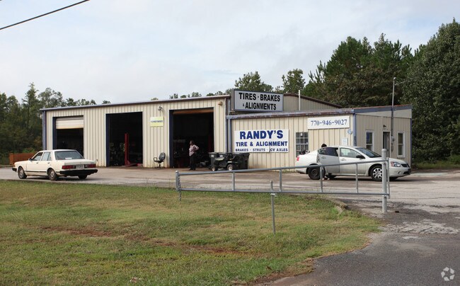
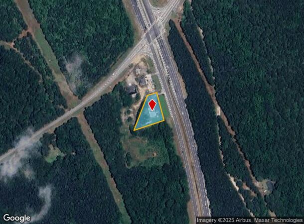
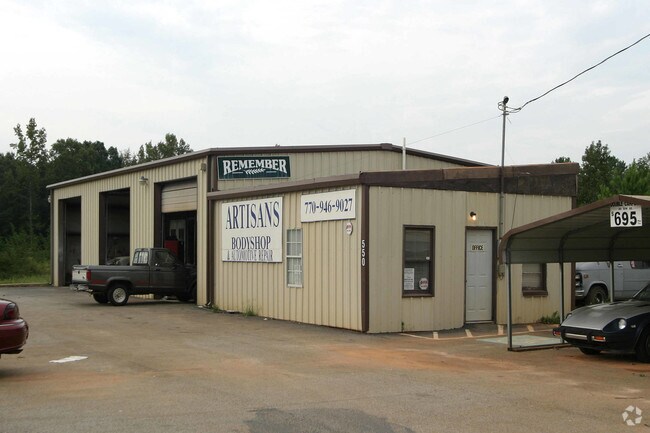
550 Highway 19 41
0007-01-027-000
LAND LOT: 196 /LAND DISTRICT: 6; Total Multi Sales 3.30 AC
Autorepair
Henry
X
Georgia
13063C0165F
196
2025
0.85 AC
2025
W Henry/Spalding
070503
Atlanta
5,892 SF
Atlanta-Sandy Springs-Roswell, GA
DEMOGRAPHICS near 550 Highway 19 41
1 mile
3 mile
5 mile
2024 Total Population
1,716
27,363
66,387
2029 Population
1,869
28,868
69,086
Pop Growth 2024-2029
+ 8.92%
+ 5.50%
+ 4.07%
Average Age
38
36
37
2024 Total Households
570
8,963
21,996
HH Growth 2024-2029
+ 8.95%
+ 5.61%
+ 4.06%
Median Household Inc
$64,342
$61,289
$70,419
Avg Household Size
3.00
2.90
2.90
2024 Avg HH Vehicles
2.00
2.00
2.00
Median Home Value
$195,896
$198,975
$216,373
Median Year Built
1999
2003
2001
Nearby Places
Map Layers
Map Styles
 Street
 Aerial
Transit
 Traffic
 Biking
Places
Listings with unknown addresses are not visible on the map
- Restaurants
- Banks
- Shops
- Fitness
- Groceries
PUBLIC TRANSPORTATION
AIRPORT
Hartsfield - Jackson Atlanta International
Drive
Walk
Distance
Hartsfield - Jackson Atlanta International
32 min
19.8 mi
Nearby Properties
Address
Land Use
TOTAL SIZE
Lot Size
Zoning
Address
Land Use
TOTAL SIZE
Lot Size
Zoning
269,130 SF
15.78 AC
C
Address
Land Use
TOTAL SIZE
Lot Size
Zoning
1,424,654 SF
172.86 AC
Address
Land Use
TOTAL SIZE
Lot Size
Zoning
39,373 SF
587.19 AC
M1
Address
Land Use
TOTAL SIZE
Lot Size
Zoning
344,076 SF
69.14 AC
AG
Address
Land Use
TOTAL SIZE
Lot Size
Zoning
640,693 SF
691.83 AC
PD
Address
Land Use
TOTAL SIZE
Lot Size
Zoning
250 SF
23.09 AC
C
Address
Land Use
TOTAL SIZE
Lot Size
Zoning
224 SF
20 AC
C
Address
Land Use
TOTAL SIZE
Lot Size
Zoning
194,270 SF
24.27 AC
C
Address
Land Use
TOTAL SIZE
Lot Size
Zoning
5,529 SF
26.29 AC
OI
Address
Land Use
TOTAL SIZE
Lot Size
Zoning
54,499 SF
10.18 AC
GB
Address
Land Use
TOTAL SIZE
Lot Size
Zoning
42,762 SF
6 AC
C
Address
Land Use
TOTAL SIZE
Lot Size
Zoning
289 SF
50.20 AC
C
Address
Land Use
TOTAL SIZE
Lot Size
Zoning
34,563 SF
4.88 AC
C
Address
Land Use
TOTAL SIZE
Lot Size
Zoning
26,297 SF
77 AC
AG
Address
Land Use
TOTAL SIZE
Lot Size
Zoning
2,314 SF
300.26 AC
RA
Address
Land Use
TOTAL SIZE
Lot Size
Zoning
47,057 SF
6.83 AC
C
Address
Land Use
TOTAL SIZE
Lot Size
Zoning
9.19 AC
C
Address
Land Use
TOTAL SIZE
Lot Size
Zoning
147,861 SF
36.79 AC
M1
Address
Land Use
TOTAL SIZE
Lot Size
Zoning
96.63 AC
PD
Address
Land Use
TOTAL SIZE
Lot Size
Zoning
1,826 SF
169.71 AC
C
Address
Land Use
TOTAL SIZE
Lot Size
Zoning
8.44 AC
C
Address
Land Use
TOTAL SIZE
Lot Size
Zoning
402.93 AC
Address
Land Use
TOTAL SIZE
Lot Size
Zoning
41,568 SF
29.31 AC
M2
Address
Land Use
TOTAL SIZE
Lot Size
Zoning
1,750 SF
5.13 AC
GB
Address
Land Use
TOTAL SIZE
Lot Size
Zoning
1,404 SF
62.12 AC
RMH
Address
Land Use
TOTAL SIZE
Lot Size
Zoning
1,064 SF
44.35 AC
RA
Address
Land Use
TOTAL SIZE
Lot Size
Zoning
80,166 SF
95.23 AC
HI
Address
Land Use
TOTAL SIZE
Lot Size
Zoning
24,540 SF
26 AC
C1
Address
Land Use
TOTAL SIZE
Lot Size
Zoning
26.60 AC
C
The World's #1 Commercial Real Estate Marketplace
Connect with us
© 2026 CoStar Group
The information above has been obtained from sources believed reliable. While we do not doubt its accuracy we have not verified it and make no guarantee, warranty or representation about it. It is your responsibility to independently confirm its accuracy and completeness. Any projections, opinions, assumptions, or estimates used are for example only and do not represent the current or future performance of the property. The value of this transaction to you depends on tax and other factors which should be evaluated by your tax, financial, and legal advisors. You and your advisors should conduct a careful, independent investigation of the property to determine to your satisfaction the suitability of the property for your needs.