Property Record
550 Kane Ct, Oviedo, FL 32765
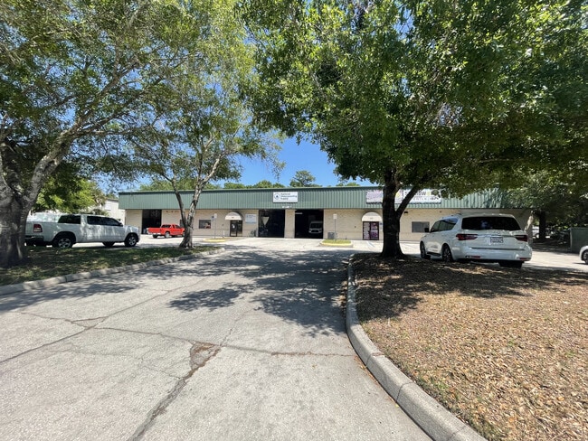


Property Detail
550 Kane Ct
16-21-31-518-0000-0030
LOT 3 (LESS N 62.5 FT) & ALL LOT 4 OVIEDO BUSINESS PARK PB 45 PGS 27 & 28
Warehouse
SEMINOLE
I1
Florida
B and X Area of moderate flood hazard, usually the area between the limits of the 100-year and 500-year floods.
3,4
2025
1.28 AC
2025
Seminole County
021314
Orlando
16,800 SF
Orlando-Kissimmee-Sanford, FL
NEARBY LISTINGS FOR SALE OR LEASE
DEMOGRAPHICS near 550 Kane Ct
1 mile
3 mile
5 mile
2025 Total Population
5,284
62,151
152,956
2030 Population
5,639
65,700
162,374
Pop Growth 2025-2030
+ 6.72%
+ 5.71%
+ 6.16%
Average Age
40
41
39
2025 Total Households
1,920
22,464
54,189
HH Growth 2025-2030
+ 6.82%
+ 5.81%
+ 6.47%
Median Household Inc
$86,421
$103,194
$94,411
Avg Household Size
2.70
2.70
2.60
2025 Avg HH Vehicles
2.00
2.00
2.00
Median Home Value
$483,387
$477,893
$454,520
Median Year Built
1993
1993
1993
Nearby Places
Map Layers
Map Styles
 Street
 Aerial
Layers
 Traffic
 Biking
Places
Listings with unknown addresses are not visible on the map
- Restaurants
- Banks
- Shops
- Fitness
- Groceries
PUBLIC TRANSPORTATION
COMMUTER RAIL
Altamonte Springs (SunRail - Florida Department of Transportation)
Drive
Walk
Distance
Altamonte Springs (SunRail - Florida Department of Transportation)
18 min
9.8 mi
AIRPORT
Orlando Sanford International
Drive
Walk
Distance
Orlando Sanford International
19 min
12.1 mi
Orlando International
Drive
Walk
Distance
Orlando International
32 min
24.1 mi
Freight Ports
Port Canaveral
Drive
Walk
Distance
Port Canaveral
69 min
57.0 mi
SALE & LEASE HISTORY
LISTING DATE
SALE/LEASE

Apr 18, 2025
For Lease
Nearby Properties
Address
Land Use
TOTAL SIZE
Lot Size
Zoning
Address
Land Use
TOTAL SIZE
Lot Size
Zoning
581 SF
29.77 AC
Address
Land Use
TOTAL SIZE
Lot Size
Zoning
276,300 SF
3.34 AC
A1
Address
Land Use
TOTAL SIZE
Lot Size
Zoning
5,938 SF
9.14 AC
Address
Land Use
TOTAL SIZE
Lot Size
Zoning
183,886 SF
47.67 AC
A1
Address
Land Use
TOTAL SIZE
Lot Size
Zoning
432 SF
16.07 AC
PUD
Address
Land Use
TOTAL SIZE
Lot Size
Zoning
792 SF
15.23 AC
PUD
Address
Land Use
TOTAL SIZE
Lot Size
Zoning
9.23 AC
Address
Land Use
TOTAL SIZE
Lot Size
Zoning
98,868 SF
3.02 AC
Address
Land Use
TOTAL SIZE
Lot Size
Zoning
4,380 SF
20.01 AC
A1
Address
Land Use
TOTAL SIZE
Lot Size
Zoning
906 SF
15.85 AC
C1
Address
Land Use
TOTAL SIZE
Lot Size
Zoning
25,480 SF
23.86 AC
PUD
Address
Land Use
TOTAL SIZE
Lot Size
Zoning
412,265 SF
52.13 AC
PLI
Address
Land Use
TOTAL SIZE
Lot Size
Zoning
10,500 SF
21.76 AC
PUD
Address
Land Use
TOTAL SIZE
Lot Size
Zoning
203,683 SF
8.82 AC
R4
Address
Land Use
TOTAL SIZE
Lot Size
Zoning
193,990 SF
27.51 AC
C2
Address
Land Use
TOTAL SIZE
Lot Size
Zoning
114,222 SF
260 AC
A1
Address
Land Use
TOTAL SIZE
Lot Size
Zoning
158,927 SF
5.41 AC
MUDSF
Address
Land Use
TOTAL SIZE
Lot Size
Zoning
193,241 SF
25.77 AC
R3A
Address
Land Use
TOTAL SIZE
Lot Size
Zoning
165,650 SF
11.12 AC
M1A
Address
Land Use
TOTAL SIZE
Lot Size
Zoning
144,594 SF
19.94 AC
R3A
Address
Land Use
TOTAL SIZE
Lot Size
Zoning
10,640 SF
9.46 AC
C1
Address
Land Use
TOTAL SIZE
Lot Size
Zoning
280,330 SF
14.77 AC
MUDNDD
Address
Land Use
TOTAL SIZE
Lot Size
Zoning
586,237 SF
43.13 AC
Address
Land Use
TOTAL SIZE
Lot Size
Zoning
121,389 SF
30.79 AC
A1
Address
Land Use
TOTAL SIZE
Lot Size
Zoning
4.07 AC
Address
Land Use
TOTAL SIZE
Lot Size
Zoning
77,228 SF
3.52 AC
PUD
Address
Land Use
TOTAL SIZE
Lot Size
Zoning
85,813 SF
11.62 AC
PUD
Address
Land Use
TOTAL SIZE
Lot Size
Zoning
100,483 SF
4.99 AC
M1A
Address
Land Use
TOTAL SIZE
Lot Size
Zoning
54,582 SF
11.30 AC
Address
Land Use
TOTAL SIZE
Lot Size
Zoning
123,117 SF
21.68 AC
A1
The World's #1 Commercial Real Estate Marketplace
Connect with us
© 2026 CoStar Group
The information above has been obtained from sources believed reliable. While we do not doubt its accuracy we have not verified it and make no guarantee, warranty or representation about it. It is your responsibility to independently confirm its accuracy and completeness. Any projections, opinions, assumptions, or estimates used are for example only and do not represent the current or future performance of the property. The value of this transaction to you depends on tax and other factors which should be evaluated by your tax, financial, and legal advisors. You and your advisors should conduct a careful, independent investigation of the property to determine to your satisfaction the suitability of the property for your needs.