Property Record
550 Madison Ave, Reading, PA 19605


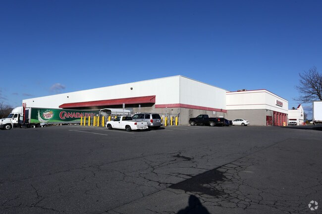
Property Detail
550 Madison Ave
66-5308-15-64-8186
Berks
Storemultistory
Pennsylvania
B and X Area of moderate flood hazard, usually the area between the limits of the 100-year and 500-year floods.
2
2026
9.39 AC
2026
Berks County
012600
Philadelphia
116,236 SF
Reading, PA
NEARBY LISTINGS FOR SALE OR LEASE
DEMOGRAPHICS near 550 Madison Ave
1 mile
3 mile
5 mile
2025 Total Population
6,820
107,653
185,328
2030 Population
6,914
109,519
189,098
Pop Growth 2025-2030
+ 1.38%
+ 1.73%
+ 2.03%
Average Age
39
37
39
2025 Total Households
2,436
38,515
67,699
HH Growth 2025-2030
+ 1.35%
+ 1.78%
+ 2.09%
Median Household Inc
$75,680
$54,473
$61,030
Avg Household Size
2.70
2.60
2.60
2025 Avg HH Vehicles
2.00
1.00
2.00
Median Home Value
$181,987
$171,285
$195,985
Median Year Built
1952
1950
1954
Nearby Places
Map Layers
Map Styles
 Street
 Aerial
Layers
 Traffic
 Biking
Places
Listings with unknown addresses are not visible on the map
- Restaurants
- Banks
- Shops
- Fitness
- Groceries
Nearby Properties
Address
Land Use
TOTAL SIZE
Lot Size
Zoning
Address
Land Use
TOTAL SIZE
Lot Size
Zoning
446,569 SF
81.02 AC
Address
Land Use
TOTAL SIZE
Lot Size
Zoning
33,761 SF
4.38 AC
Address
Land Use
TOTAL SIZE
Lot Size
Zoning
609,600 SF
37.91 AC
Address
Land Use
TOTAL SIZE
Lot Size
Zoning
99,065 SF
81.29 AC
Address
Land Use
TOTAL SIZE
Lot Size
Zoning
342,332 SF
3.30 AC
Address
Land Use
TOTAL SIZE
Lot Size
Zoning
144,696 SF
7.43 AC
Address
Land Use
TOTAL SIZE
Lot Size
Zoning
141,767 SF
124.26 AC
Address
Land Use
TOTAL SIZE
Lot Size
Zoning
250,600 SF
37.61 AC
Address
Land Use
TOTAL SIZE
Lot Size
Zoning
88,576 SF
1.80 AC
Address
Land Use
TOTAL SIZE
Lot Size
Zoning
69,422 SF
40.02 AC
Address
Land Use
TOTAL SIZE
Lot Size
Zoning
386,194 SF
29.21 AC
Address
Land Use
TOTAL SIZE
Lot Size
Zoning
209,584 SF
24.33 AC
Address
Land Use
TOTAL SIZE
Lot Size
Zoning
292,673 SF
488.56 AC
Address
Land Use
TOTAL SIZE
Lot Size
Zoning
139,946 SF
16.02 AC
Address
Land Use
TOTAL SIZE
Lot Size
Zoning
234,880 SF
21.12 AC
Address
Land Use
TOTAL SIZE
Lot Size
Zoning
130,410 SF
23.02 AC
Address
Land Use
TOTAL SIZE
Lot Size
Zoning
45,138 SF
20.34 AC
Address
Land Use
TOTAL SIZE
Lot Size
Zoning
241,410 SF
44.78 AC
Address
Land Use
TOTAL SIZE
Lot Size
Zoning
112,474 SF
10.38 AC
Address
Land Use
TOTAL SIZE
Lot Size
Zoning
104,559 SF
14.14 AC
Address
Land Use
TOTAL SIZE
Lot Size
Zoning
174,046 SF
6.92 AC
Address
Land Use
TOTAL SIZE
Lot Size
Zoning
116,788 SF
13.11 AC
Address
Land Use
TOTAL SIZE
Lot Size
Zoning
402,006 SF
32.46 AC
Address
Land Use
TOTAL SIZE
Lot Size
Zoning
167,802 SF
17.62 AC
Address
Land Use
TOTAL SIZE
Lot Size
Zoning
27,055 SF
1.77 AC
Address
Land Use
TOTAL SIZE
Lot Size
Zoning
347,124 SF
19.93 AC
Address
Land Use
TOTAL SIZE
Lot Size
Zoning
158,736 SF
12.71 AC
Address
Land Use
TOTAL SIZE
Lot Size
Zoning
66,369 SF
3 AC
Address
Land Use
TOTAL SIZE
Lot Size
Zoning
42,496 SF
10.43 AC
Address
Land Use
TOTAL SIZE
Lot Size
Zoning
105,272 SF
2.19 AC
The World's #1 Commercial Real Estate Marketplace
Connect with us
© 2026 CoStar Group
The information above has been obtained from sources believed reliable. While we do not doubt its accuracy we have not verified it and make no guarantee, warranty or representation about it. It is your responsibility to independently confirm its accuracy and completeness. Any projections, opinions, assumptions, or estimates used are for example only and do not represent the current or future performance of the property. The value of this transaction to you depends on tax and other factors which should be evaluated by your tax, financial, and legal advisors. You and your advisors should conduct a careful, independent investigation of the property to determine to your satisfaction the suitability of the property for your needs.