Property Record
550 N Harrison Rd, Tucson, AZ 85748

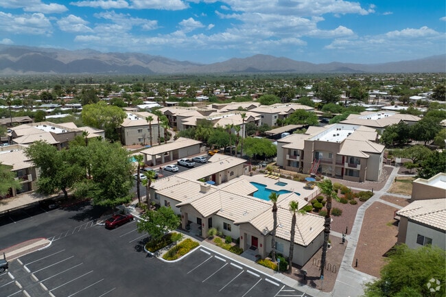

Property Detail
550 N Harrison Rd
133-36-9540
FRONTIER MISSION ESTATES LOT 1
Apartment
Pima
R3
Arizona
B and X Area of moderate flood hazard, usually the area between the limits of the 100-year and 500-year floods.
1
2025
5.71 AC
2026
Eastside
004042
Tucson
84,768 SF
Tucson, AZ
NEARBY LISTINGS FOR SALE OR LEASE
DEMOGRAPHICS near 550 N Harrison Rd
1 mile
3 mile
5 mile
2025 Total Population
13,402
79,234
172,405
2030 Population
13,625
80,820
176,008
Pop Growth 2025-2030
+ 1.66%
+ 2.00%
+ 2.09%
Average Age
43
43
43
2025 Total Households
5,898
36,588
76,673
HH Growth 2025-2030
+ 1.71%
+ 2.19%
+ 2.23%
Median Household Inc
$83,776
$69,732
$70,804
Avg Household Size
2.20
2.10
2.20
2025 Avg HH Vehicles
2.00
2.00
2.00
Median Home Value
$346,863
$331,328
$335,349
Median Year Built
1982
1981
1978
Nearby Places
Map Layers
Map Styles
 Street
 Aerial
Layers
 Traffic
 Biking
Places
Listings with unknown addresses are not visible on the map
- Restaurants
- Banks
- Shops
- Fitness
- Groceries
PUBLIC TRANSPORTATION
AIRPORT
Tucson International
Drive
Walk
Distance
Tucson International
29 min
16.4 mi
Freight Ports
Port of San Diego
Drive
Walk
Distance
Port of San Diego
456 min
419.2 mi
Nearby Properties
Address
Land Use
TOTAL SIZE
Lot Size
Zoning
Address
Land Use
TOTAL SIZE
Lot Size
Zoning
222,434 SF
19.43 AC
Address
Land Use
TOTAL SIZE
Lot Size
Zoning
96,125 SF
15.38 AC
SR
Address
Land Use
TOTAL SIZE
Lot Size
Zoning
504,584 SF
18.17 AC
O3
Address
Land Use
TOTAL SIZE
Lot Size
Zoning
26,554 SF
5.08 AC
I1
Address
Land Use
TOTAL SIZE
Lot Size
Zoning
322,009 SF
17.96 AC
Address
Land Use
TOTAL SIZE
Lot Size
Zoning
1,804 SF
8.29 AC
R3
Address
Land Use
TOTAL SIZE
Lot Size
Zoning
276,903 SF
37.62 AC
RX1
Address
Land Use
TOTAL SIZE
Lot Size
Zoning
240,585 SF
18.16 AC
R2
Address
Land Use
TOTAL SIZE
Lot Size
Zoning
264,788 SF
12.63 AC
R3
Address
Land Use
TOTAL SIZE
Lot Size
Zoning
188,350 SF
10.81 AC
Address
Land Use
TOTAL SIZE
Lot Size
Zoning
88,579 SF
9.59 AC
Address
Land Use
TOTAL SIZE
Lot Size
Zoning
180,149 SF
17.48 AC
PAD3
Address
Land Use
TOTAL SIZE
Lot Size
Zoning
128,894 SF
10.06 AC
C1
Address
Land Use
TOTAL SIZE
Lot Size
Zoning
268,026 SF
16 AC
R3
Address
Land Use
TOTAL SIZE
Lot Size
Zoning
171,301 SF
6.36 AC
C3
Address
Land Use
TOTAL SIZE
Lot Size
Zoning
83,067 SF
37.84 AC
RX1
Address
Land Use
TOTAL SIZE
Lot Size
Zoning
144,316 SF
14.71 AC
C2
Address
Land Use
TOTAL SIZE
Lot Size
Zoning
98,730 SF
26.54 AC
SR
Address
Land Use
TOTAL SIZE
Lot Size
Zoning
218,742 SF
9.88 AC
C1
Address
Land Use
TOTAL SIZE
Lot Size
Zoning
253,982 SF
12.14 AC
SR
Address
Land Use
TOTAL SIZE
Lot Size
Zoning
15,893 SF
2.86 AC
I1
Address
Land Use
TOTAL SIZE
Lot Size
Zoning
6,120 SF
5.50 AC
C2
Address
Land Use
TOTAL SIZE
Lot Size
Zoning
115,098 SF
14.68 AC
C1
Address
Land Use
TOTAL SIZE
Lot Size
Zoning
219,640 SF
13.18 AC
O3
Address
Land Use
TOTAL SIZE
Lot Size
Zoning
223,763 SF
9.18 AC
C1
Address
Land Use
TOTAL SIZE
Lot Size
Zoning
174,516 SF
8.86 AC
O3
Address
Land Use
TOTAL SIZE
Lot Size
Zoning
76,253 SF
7.19 AC
C1
Address
Land Use
TOTAL SIZE
Lot Size
Zoning
21,928 SF
41.39 AC
SR
Address
Land Use
TOTAL SIZE
Lot Size
Zoning
104,232 SF
16.87 AC
SR
Address
Land Use
TOTAL SIZE
Lot Size
Zoning
180,114 SF
8.43 AC
R3
The World's #1 Commercial Real Estate Marketplace
Connect with us
© 2026 CoStar Group
The information above has been obtained from sources believed reliable. While we do not doubt its accuracy we have not verified it and make no guarantee, warranty or representation about it. It is your responsibility to independently confirm its accuracy and completeness. Any projections, opinions, assumptions, or estimates used are for example only and do not represent the current or future performance of the property. The value of this transaction to you depends on tax and other factors which should be evaluated by your tax, financial, and legal advisors. You and your advisors should conduct a careful, independent investigation of the property to determine to your satisfaction the suitability of the property for your needs.