Property Record
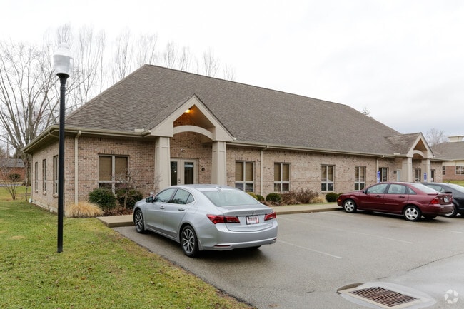
550 N Main St, Springboro, OH 45066


NEARBY LISTINGS FOR SALE OR LEASE
Property Detail
550 N Main St
04-08-100-047
Main
Officebuilding
MAIN
A
Warren
39165C0028F
Ohio
2024
1.53 AC
2024
Outlying Warren County
030504
Cincinnati/Dayton
4,400 SF
Cincinnati, OH-KY-IN
DEMOGRAPHICS near 550 N Main St
1 Mile
3 Mile
5 Mile
2024 Total Population
6,222
40,619
98,273
2029 Population
6,744
42,902
102,092
Pop Growth 2024-2029
+ 8.39%
+ 5.62%
+ 3.89%
Average Age
42
40
41
2024 Total Households
2,368
15,090
39,295
HH Growth 2024-2029
+ 8.36%
+ 5.51%
+ 3.44%
Median Household Inc
$110,494
$108,510
$90,900
Avg Household Size
2.60
2.60
2.50
2024 Avg HH Vehicles
2.00
2.00
2.00
Median Home Value
$265,097
$279,100
$258,314
Median Year Built
1986
1994
1989
Nearby Places
Map Layers
Map Styles
 Street
 Aerial
- Restaurants
- Banks
- Shops
- Fitness
- Groceries
PUBLIC TRANSPORTATION
AIRPORT
James M Cox Dayton International
DRIVE
WALK
Distance
James M Cox Dayton International
39 min
27.0 mi
Freight Ports
Port of Toledo
DRIVE
WALK
Distance
Port of Toledo
195 min
167.2 mi
SALE & LEASE HISTORY
LISTING DATE
SALE/LEASE

Dec 04, 2024
For Lease
Nearby Properties
Address
Land Use
TOTAL SIZE
Lot Size
Zoning
Address
Land Use
TOTAL SIZE
Lot Size
Zoning
11,684 SF
16.01 AC
Address
Land Use
TOTAL SIZE
Lot Size
Zoning
446,592 SF
4.33 AC
Address
Land Use
TOTAL SIZE
Lot Size
Zoning
142,758 SF
11.15 AC
Address
Land Use
TOTAL SIZE
Lot Size
Zoning
6,048 SF
51.16 AC
Address
Land Use
TOTAL SIZE
Lot Size
Zoning
266,231 SF
17.07 AC
Address
Land Use
TOTAL SIZE
Lot Size
Zoning
507,846 SF
23.90 AC
Address
Land Use
TOTAL SIZE
Lot Size
Zoning
39,404 SF
55.59 AC
Address
Land Use
TOTAL SIZE
Lot Size
Zoning
36,570 SF
20.29 AC
Address
Land Use
TOTAL SIZE
Lot Size
Zoning
64,121 SF
21.21 AC
Address
Land Use
TOTAL SIZE
Lot Size
Zoning
13.24 AC
Address
Land Use
TOTAL SIZE
Lot Size
Zoning
203,556 SF
10.69 AC
Address
Land Use
TOTAL SIZE
Lot Size
Zoning
162,036 SF
9.81 AC
Address
Land Use
TOTAL SIZE
Lot Size
Zoning
56.81 AC
R1
Address
Land Use
TOTAL SIZE
Lot Size
Zoning
4,578 SF
10.81 AC
Address
Land Use
TOTAL SIZE
Lot Size
Zoning
20,093 SF
11.15 AC
Address
Land Use
TOTAL SIZE
Lot Size
Zoning
209,894 SF
5.41 AC
Address
Land Use
TOTAL SIZE
Lot Size
Zoning
15,559 SF
40.01 AC
Address
Land Use
TOTAL SIZE
Lot Size
Zoning
11,260 SF
6.32 AC
Address
Land Use
TOTAL SIZE
Lot Size
Zoning
122,344 SF
2.17 AC
Address
Land Use
TOTAL SIZE
Lot Size
Zoning
81,259 SF
63.28 AC
Address
Land Use
TOTAL SIZE
Lot Size
Zoning
41,424 SF
50.03 AC
Address
Land Use
TOTAL SIZE
Lot Size
Zoning
120,000 SF
11.52 AC
Address
Land Use
TOTAL SIZE
Lot Size
Zoning
55,611 SF
9.56 AC
Address
Land Use
TOTAL SIZE
Lot Size
Zoning
214,266 SF
47.41 AC
Address
Land Use
TOTAL SIZE
Lot Size
Zoning
122,344 SF
4.10 AC
Address
Land Use
TOTAL SIZE
Lot Size
Zoning
66,650 SF
14.98 AC
Address
Land Use
TOTAL SIZE
Lot Size
Zoning
11,847 SF
5.96 AC
Address
Land Use
TOTAL SIZE
Lot Size
Zoning
70,217 SF
12.25 AC
Address
Land Use
TOTAL SIZE
Lot Size
Zoning
1,848 SF
50.22 AC
Address
Land Use
TOTAL SIZE
Lot Size
Zoning
487,924 SF
22.33 AC
The World's #1 Commercial Real Estate Marketplace
Connect with us
© 2026 CoStar Group
The information above has been obtained from sources believed reliable. While we do not doubt its accuracy we have not verified it and make no guarantee, warranty or representation about it. It is your responsibility to independently confirm its accuracy and completeness. Any projections, opinions, assumptions, or estimates used are for example only and do not represent the current or future performance of the property. The value of this transaction to you depends on tax and other factors which should be evaluated by your tax, financial, and legal advisors. You and your advisors should conduct a careful, independent investigation of the property to determine to your satisfaction the suitability of the property for your needs.