Property Record
550 S Fm 1138, Nevada, TX 75173


Property Detail
550 S Fm 1138
Dallas-Fort Worth-Arlington, TX
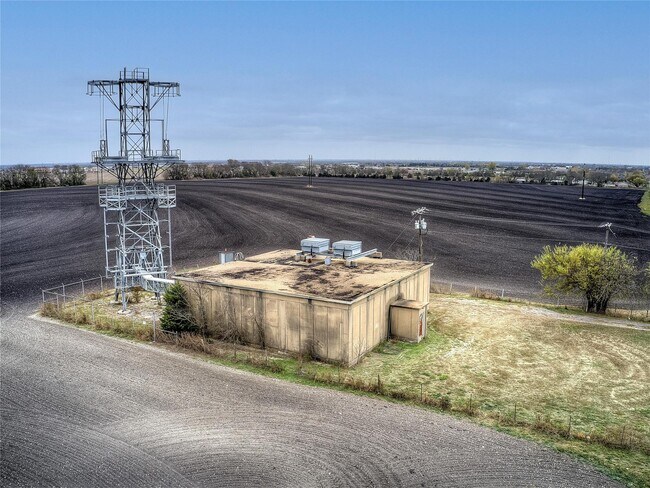
ABS A0312 J W FOOTE SURVEY, TRACT 1, 1.44 ACRES
R-6312-000-0010-1
COLLIN
Telephonefacility
Texas
B and X Area of moderate flood hazard, usually the area between the limits of the 100-year and 500-year floods.
1
2025
1.44 AC
2025
Plano
031201
Dallas/Ft Worth
3,136 SF
NEARBY LISTINGS FOR SALE OR LEASE
DEMOGRAPHICS near 550 S Fm 1138
1 mile
3 mile
5 mile
2025 Total Population
1,032
7,728
36,581
2030 Population
1,228
9,247
43,706
Pop Growth 2025-2030
+ 18.99%
+ 19.66%
+ 19.48%
Average Age
40
39
37
2025 Total Households
348
2,539
11,853
HH Growth 2025-2030
+ 19.25%
+ 19.73%
+ 19.56%
Median Household Inc
$122,844
$122,741
$116,077
Avg Household Size
3.00
3.00
3.10
2025 Avg HH Vehicles
3.00
3.00
2.00
Median Home Value
$449,456
$443,374
$401,307
Median Year Built
2010
2010
2010
Nearby Places
Map Layers
Map Styles
 Street
 Aerial
Transit
 Traffic
 Biking
Places
Listings with unknown addresses are not visible on the map
- Restaurants
- Banks
- Shops
- Fitness
- Groceries
PUBLIC TRANSPORTATION
AIRPORT
Dallas Love Field
Drive
Walk
Distance
Dallas Love Field
58 min
39.0 mi
SALE & LEASE HISTORY
LISTING DATE
SALE/LEASE

Oct 28, 2021
For Sale
May 02, 2023
For Sale
Aug 04, 2021
For Sale
Nearby Properties
Address
Land Use
TOTAL SIZE
Lot Size
Zoning
Address
Land Use
TOTAL SIZE
Lot Size
Zoning
425,621 SF
132.43 AC
Address
Land Use
TOTAL SIZE
Lot Size
Zoning
197,080 SF
29.65 AC
Address
Land Use
TOTAL SIZE
Lot Size
Zoning
62.13 AC
Address
Land Use
TOTAL SIZE
Lot Size
Zoning
55,110 SF
9.12 AC
Address
Land Use
TOTAL SIZE
Lot Size
Zoning
202.24 AC
Address
Land Use
TOTAL SIZE
Lot Size
Zoning
202.32 AC
Address
Land Use
TOTAL SIZE
Lot Size
Zoning
150.66 AC
Address
Land Use
TOTAL SIZE
Lot Size
Zoning
130.44 AC
RESI
Address
Land Use
TOTAL SIZE
Lot Size
Zoning
2,538 SF
150.45 AC
Address
Land Use
TOTAL SIZE
Lot Size
Zoning
30,000 SF
13.10 AC
Address
Land Use
TOTAL SIZE
Lot Size
Zoning
2,042 SF
70.54 AC
AG
Address
Land Use
TOTAL SIZE
Lot Size
Zoning
52.06 AC
PD
Address
Land Use
TOTAL SIZE
Lot Size
Zoning
9,311 SF
7.38 AC
Address
Land Use
TOTAL SIZE
Lot Size
Zoning
38.06 AC
Address
Land Use
TOTAL SIZE
Lot Size
Zoning
1,057 SF
1.50 AC
Address
Land Use
TOTAL SIZE
Lot Size
Zoning
9,790 SF
13.27 AC
Address
Land Use
TOTAL SIZE
Lot Size
Zoning
69.75 AC
RESI
Address
Land Use
TOTAL SIZE
Lot Size
Zoning
11,711 SF
10.18 AC
Address
Land Use
TOTAL SIZE
Lot Size
Zoning
7,959 SF
10.91 AC
Address
Land Use
TOTAL SIZE
Lot Size
Zoning
62.38 AC
Address
Land Use
TOTAL SIZE
Lot Size
Zoning
39.97 AC
Address
Land Use
TOTAL SIZE
Lot Size
Zoning
6,453 SF
4.06 AC
Address
Land Use
TOTAL SIZE
Lot Size
Zoning
9,198 SF
1.44 AC
Address
Land Use
TOTAL SIZE
Lot Size
Zoning
2,604 SF
37.18 AC
Address
Land Use
TOTAL SIZE
Lot Size
Zoning
53.16 AC
Address
Land Use
TOTAL SIZE
Lot Size
Zoning
43.56 AC
Address
Land Use
TOTAL SIZE
Lot Size
Zoning
3,369 SF
9.98 AC
Address
Land Use
TOTAL SIZE
Lot Size
Zoning
42 SF
5 AC
Address
Land Use
TOTAL SIZE
Lot Size
Zoning
43.36 AC
Address
Land Use
TOTAL SIZE
Lot Size
Zoning
7,920 SF
3.99 AC
The World's #1 Commercial Real Estate Marketplace
Connect with us
© 2026 CoStar Group
The information above has been obtained from sources believed reliable. While we do not doubt its accuracy we have not verified it and make no guarantee, warranty or representation about it. It is your responsibility to independently confirm its accuracy and completeness. Any projections, opinions, assumptions, or estimates used are for example only and do not represent the current or future performance of the property. The value of this transaction to you depends on tax and other factors which should be evaluated by your tax, financial, and legal advisors. You and your advisors should conduct a careful, independent investigation of the property to determine to your satisfaction the suitability of the property for your needs.