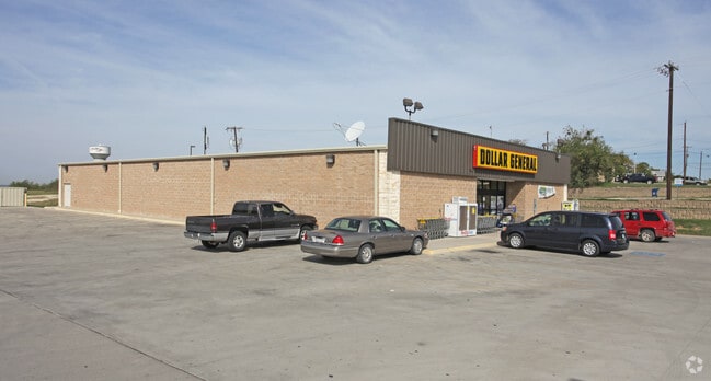
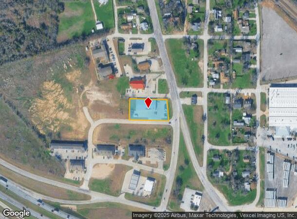
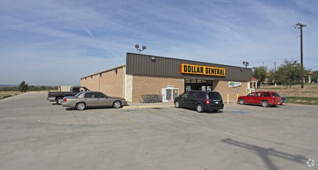
Property Record
550 S Main St, Rhome, TX 76078
NEARBY LISTINGS FOR SALE OR LEASE
Property Detail
550 S Main St
S2590009804
Bc Rhome Addition
Commercialnec
BC RHOME ADDITION
X
Wise
48497C0500D
Texas
2024
0.85 AC
2025
Northwest Fort Worth
150405
Dallas/Ft Worth
9,394 SF
Dallas-Fort Worth-Arlington, TX
DEMOGRAPHICS near 550 S Main St
1 Mile
3 Mile
5 Mile
2024 Total Population
1,537
5,755
14,621
2029 Population
1,861
6,963
17,492
Pop Growth 2024-2029
+ 21.08%
+ 20.99%
+ 19.64%
Average Age
37
38
38
2024 Total Households
526
1,951
4,935
HH Growth 2024-2029
+ 20.72%
+ 20.66%
+ 19.33%
Median Household Inc
$87,303
$91,357
$83,431
Avg Household Size
2.90
2.90
2.90
2024 Avg HH Vehicles
2.00
2.00
2.00
Median Home Value
$235,416
$291,162
$271,829
Median Year Built
2002
2000
2000
Nearby Places
Map Layers
Map Styles
 Street
 Aerial
- Restaurants
- Banks
- Shops
- Fitness
- Groceries
PUBLIC TRANSPORTATION
AIRPORT
Dallas-Fort Worth International
DRIVE
WALK
Distance
Dallas-Fort Worth International
40 min
31.4 mi
SALE & LEASE HISTORY
LISTING DATE
SALE/LEASE

Oct 10, 2018
For Sale
Nearby Properties
Address
Land Use
TOTAL SIZE
Lot Size
Zoning
Address
Land Use
TOTAL SIZE
Lot Size
Zoning
136,400 SF
13.83 AC
Address
Land Use
TOTAL SIZE
Lot Size
Zoning
136,400 SF
27.50 AC
Address
Land Use
TOTAL SIZE
Lot Size
Zoning
81,438 SF
6.82 AC
Address
Land Use
TOTAL SIZE
Lot Size
Zoning
64,400 SF
10.08 AC
Address
Land Use
TOTAL SIZE
Lot Size
Zoning
62,600 SF
5.33 AC
Address
Land Use
TOTAL SIZE
Lot Size
Zoning
75,740 SF
11.78 AC
Address
Land Use
TOTAL SIZE
Lot Size
Zoning
75,500 SF
11.78 AC
Address
Land Use
TOTAL SIZE
Lot Size
Zoning
63,628 SF
8.18 AC
Address
Land Use
TOTAL SIZE
Lot Size
Zoning
68,527 SF
6.91 AC
Address
Land Use
TOTAL SIZE
Lot Size
Zoning
109,740 SF
13.46 AC
Address
Land Use
TOTAL SIZE
Lot Size
Zoning
60,000 SF
5 AC
Address
Land Use
TOTAL SIZE
Lot Size
Zoning
31,752 SF
5.63 AC
Address
Land Use
TOTAL SIZE
Lot Size
Zoning
5,000 SF
29.28 AC
Address
Land Use
TOTAL SIZE
Lot Size
Zoning
14,940 SF
10 AC
Address
Land Use
TOTAL SIZE
Lot Size
Zoning
31,752 SF
5.11 AC
Address
Land Use
TOTAL SIZE
Lot Size
Zoning
14,384 SF
28.80 AC
Address
Land Use
TOTAL SIZE
Lot Size
Zoning
49,300 SF
4.16 AC
Address
Land Use
TOTAL SIZE
Lot Size
Zoning
21,113 SF
9.59 AC
Address
Land Use
TOTAL SIZE
Lot Size
Zoning
50,600 SF
10.06 AC
Address
Land Use
TOTAL SIZE
Lot Size
Zoning
58,270 SF
6.64 AC
Address
Land Use
TOTAL SIZE
Lot Size
Zoning
46,960 SF
9.30 AC
Address
Land Use
TOTAL SIZE
Lot Size
Zoning
43,512 SF
14.31 AC
Address
Land Use
TOTAL SIZE
Lot Size
Zoning
25,100 SF
6.93 AC
Address
Land Use
TOTAL SIZE
Lot Size
Zoning
53,200 SF
5 AC
Address
Land Use
TOTAL SIZE
Lot Size
Zoning
24,958 SF
1.78 AC
Address
Land Use
TOTAL SIZE
Lot Size
Zoning
8,850 SF
5.25 AC
Address
Land Use
TOTAL SIZE
Lot Size
Zoning
47,469 SF
4 AC
Address
Land Use
TOTAL SIZE
Lot Size
Zoning
24,762 SF
5 AC
The World's #1 Commercial Real Estate Marketplace
Connect with us
© 2026 CoStar Group
The information above has been obtained from sources believed reliable. While we do not doubt its accuracy we have not verified it and make no guarantee, warranty or representation about it. It is your responsibility to independently confirm its accuracy and completeness. Any projections, opinions, assumptions, or estimates used are for example only and do not represent the current or future performance of the property. The value of this transaction to you depends on tax and other factors which should be evaluated by your tax, financial, and legal advisors. You and your advisors should conduct a careful, independent investigation of the property to determine to your satisfaction the suitability of the property for your needs.