Property Record
550 S Mesa Hills Dr, El Paso, TX 79912

NEARBY LISTINGS FOR SALE OR LEASE
Property Detail
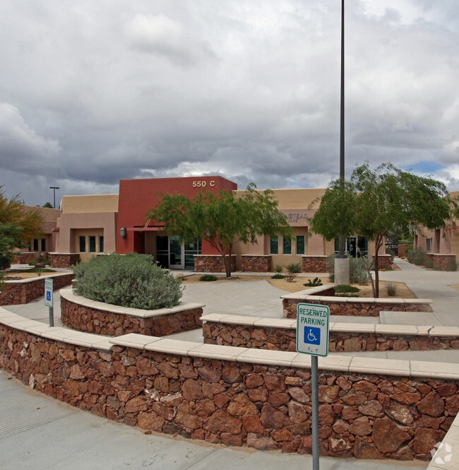
550 S Mesa Hills Dr
El Paso, TX
Desert Office Garden Suites
D459-999-000C-0100
DESERT OFFICE GARDEN SUITES #C-1 (1550.00 SQ FT) & 4.1667% UND INT IN COMMON AREA (2.4894 AC)
Commercialnec
El Paso
2024
Texas
2025
2.53 AC
001114
West
1,550 SF
El Paso
DEMOGRAPHICS near 550 S Mesa Hills Dr
1 Mile
3 Mile
5 Mile
2024 Total Population
11,991
68,307
163,195
2029 Population
12,199
69,550
166,053
Pop Growth 2024-2029
+ 1.73%
+ 1.82%
+ 1.75%
Average Age
36
39
39
2024 Total Households
5,152
28,307
63,594
HH Growth 2024-2029
+ 1.22%
+ 1.75%
+ 1.81%
Median Household Inc
$43,918
$57,947
$54,620
Avg Household Size
2.30
2.30
2.50
2024 Avg HH Vehicles
2.00
2.00
2.00
Median Home Value
$164,806
$214,171
$196,957
Median Year Built
1985
1982
1980
Nearby Places
Map Layers
Map Styles
 Street
 Aerial
- Restaurants
- Banks
- Shops
- Fitness
- Groceries
PUBLIC TRANSPORTATION
AIRPORT
El Paso International
DRIVE
WALK
Distance
El Paso International
34 min
19.0 mi
SALE & LEASE HISTORY
LISTING DATE
SALE/LEASE

Jan 30, 2025
For Lease
Nearby Properties
Address
Land Use
TOTAL SIZE
Lot Size
Zoning
Address
Land Use
TOTAL SIZE
Lot Size
Zoning
439,669 SF
33.95 AC
A2
Address
Land Use
TOTAL SIZE
Lot Size
Zoning
248,997 SF
14.85 AC
C3S
Address
Land Use
TOTAL SIZE
Lot Size
Zoning
588,864 SF
27.37 AC
AO
Address
Land Use
TOTAL SIZE
Lot Size
Zoning
243,741 SF
22.80 AC
R3
Address
Land Use
TOTAL SIZE
Lot Size
Zoning
235,843 SF
11.55 AC
C1
Address
Land Use
TOTAL SIZE
Lot Size
Zoning
246,802 SF
11.08 AC
C3
Address
Land Use
TOTAL SIZE
Lot Size
Zoning
210,420 SF
16.11 AC
PR2
Address
Land Use
TOTAL SIZE
Lot Size
Zoning
191,148 SF
20.29 AC
C3
Address
Land Use
TOTAL SIZE
Lot Size
Zoning
164,712 SF
4.68 AC
GM
Address
Land Use
TOTAL SIZE
Lot Size
Zoning
226,548 SF
18.50 AC
PR2
Address
Land Use
TOTAL SIZE
Lot Size
Zoning
185,273 SF
11.78 AC
C3S
Address
Land Use
TOTAL SIZE
Lot Size
Zoning
270,268 SF
11.83 AC
A2
Address
Land Use
TOTAL SIZE
Lot Size
Zoning
60,057 SF
7.22 AC
SCZ
Address
Land Use
TOTAL SIZE
Lot Size
Zoning
160,509 SF
8.85 AC
A2
Address
Land Use
TOTAL SIZE
Lot Size
Zoning
201,291 SF
43.23 AC
R3
Address
Land Use
TOTAL SIZE
Lot Size
Zoning
231,480 SF
12.77 AC
C4S
Address
Land Use
TOTAL SIZE
Lot Size
Zoning
173,552 SF
10.65 AC
A2S
Address
Land Use
TOTAL SIZE
Lot Size
Zoning
227,940 SF
16.41 AC
COP
Address
Land Use
TOTAL SIZE
Lot Size
Zoning
119,020 SF
8.56 AC
C3S
Address
Land Use
TOTAL SIZE
Lot Size
Zoning
142,567 SF
5.74 AC
A2S
Address
Land Use
TOTAL SIZE
Lot Size
Zoning
212,938 SF
9.38 AC
C1
Address
Land Use
TOTAL SIZE
Lot Size
Zoning
289,013 SF
6.84 AC
C3
Address
Land Use
TOTAL SIZE
Lot Size
Zoning
141,711 SF
4.50 AC
C2
Address
Land Use
TOTAL SIZE
Lot Size
Zoning
103,164 SF
4.05 AC
GMU
Address
Land Use
TOTAL SIZE
Lot Size
Zoning
119,191 SF
9.05 AC
C3
Address
Land Use
TOTAL SIZE
Lot Size
Zoning
187,488 SF
9.54 AC
A2
Address
Land Use
TOTAL SIZE
Lot Size
Zoning
191,445 SF
9.95 AC
A3S
Address
Land Use
TOTAL SIZE
Lot Size
Zoning
640 AC
PMD
Address
Land Use
TOTAL SIZE
Lot Size
Zoning
212,174 SF
8.44 AC
A2S
Address
Land Use
TOTAL SIZE
Lot Size
Zoning
176,816 SF
11.49 AC
C1S
The World's #1 Commercial Real Estate Marketplace
Connect with us
© 2025 CoStar Group
The information above has been obtained from sources believed reliable. While we do not doubt its accuracy we have not verified it and make no guarantee, warranty or representation about it. It is your responsibility to independently confirm its accuracy and completeness. Any projections, opinions, assumptions, or estimates used are for example only and do not represent the current or future performance of the property. The value of this transaction to you depends on tax and other factors which should be evaluated by your tax, financial, and legal advisors. You and your advisors should conduct a careful, independent investigation of the property to determine to your satisfaction the suitability of the property for your needs.