Property Record
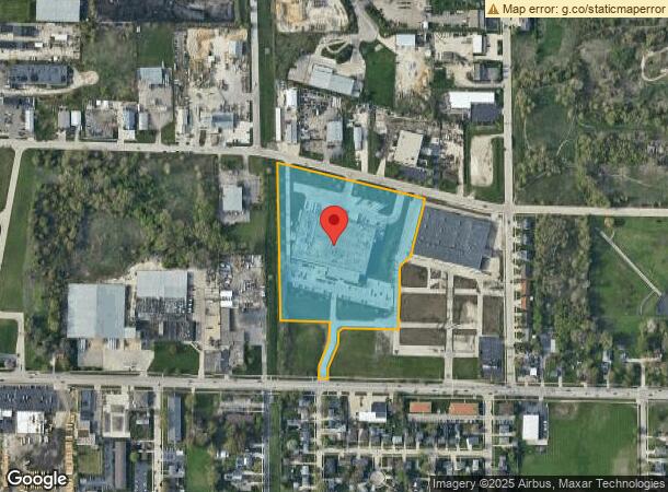
5500 52Nd St, Kenosha, WI 53144


NEARBY LISTINGS FOR SALE OR LEASE
Property Detail
5500 52Nd St
Chicago-Naperville-Elgin, IL-IN-WI
Csm# 2446
08-222-35-251-008
LOT 3 CSM #2446 DOC#1410587 PT OF SW 1/4 OF NW 1/4 SEC 35 T2 R22 12.38 AC (2005 PT 08-222-35-251-005) V1384 P73 DOC#1443165 D
Manufacturinglight
Kenosha
X
Wisconsin
55059C0203D
3
2024
12.38 AC
2024
Kenosha East
000700
Chicago
DEMOGRAPHICS near 5500 52Nd St
1 Mile
3 Mile
5 Mile
2024 Total Population
10,407
76,969
118,464
2029 Population
10,369
75,957
117,434
Pop Growth 2024-2029
(0.37%)
(1.31%)
(0.87%)
Average Age
38
39
39
2024 Total Households
3,862
29,972
47,169
HH Growth 2024-2029
(0.47%)
(1.28%)
(0.86%)
Median Household Inc
$65,782
$64,137
$67,276
Avg Household Size
2.60
2.40
2.40
2024 Avg HH Vehicles
2.00
2.00
2.00
Median Home Value
$177,261
$188,386
$215,871
Median Year Built
1973
1965
1973
Nearby Places
Map Layers
Map Styles
 Street
 Aerial
- Restaurants
- Banks
- Shops
- Fitness
- Groceries
PUBLIC TRANSPORTATION
AIRPORT
General Mitchell International
DRIVE
WALK
Distance
General Mitchell International
40 min
29.9 mi
Nearby Properties
Address
Land Use
TOTAL SIZE
Lot Size
Zoning
Address
Land Use
TOTAL SIZE
Lot Size
Zoning
731,186 SF
81.94 AC
M2
Address
Land Use
TOTAL SIZE
Lot Size
Zoning
3,886 SF
20.04 AC
Address
Land Use
TOTAL SIZE
Lot Size
Zoning
57.67 AC
Address
Land Use
TOTAL SIZE
Lot Size
Zoning
606,510 SF
36.02 AC
Address
Land Use
TOTAL SIZE
Lot Size
Zoning
606,510 SF
32.10 AC
Address
Land Use
TOTAL SIZE
Lot Size
Zoning
30.04 AC
Address
Land Use
TOTAL SIZE
Lot Size
Zoning
850,230 SF
39.46 AC
M2
Address
Land Use
TOTAL SIZE
Lot Size
Zoning
626,520 SF
35.19 AC
M2
Address
Land Use
TOTAL SIZE
Lot Size
Zoning
20.33 AC
M2
Address
Land Use
TOTAL SIZE
Lot Size
Zoning
35,092 SF
26.34 AC
B2
Address
Land Use
TOTAL SIZE
Lot Size
Zoning
4,643 SF
60 AC
Address
Land Use
TOTAL SIZE
Lot Size
Zoning
183,173 SF
9.73 AC
RM3
Address
Land Use
TOTAL SIZE
Lot Size
Zoning
16,466 SF
19.09 AC
RM2
Address
Land Use
TOTAL SIZE
Lot Size
Zoning
32,245 SF
22 AC
RM2
Address
Land Use
TOTAL SIZE
Lot Size
Zoning
26,016 SF
14.02 AC
FW
Address
Land Use
TOTAL SIZE
Lot Size
Zoning
2,963 SF
13.16 AC
Address
Land Use
TOTAL SIZE
Lot Size
Zoning
14.40 AC
Address
Land Use
TOTAL SIZE
Lot Size
Zoning
148,330 SF
17.55 AC
Address
Land Use
TOTAL SIZE
Lot Size
Zoning
194,281 SF
19.13 AC
B2
Address
Land Use
TOTAL SIZE
Lot Size
Zoning
25.40 AC
FW
Address
Land Use
TOTAL SIZE
Lot Size
Zoning
14.60 AC
Address
Land Use
TOTAL SIZE
Lot Size
Zoning
85,469 SF
11.30 AC
Address
Land Use
TOTAL SIZE
Lot Size
Zoning
176,978 SF
24.81 AC
Address
Land Use
TOTAL SIZE
Lot Size
Zoning
10.37 AC
IP
Address
Land Use
TOTAL SIZE
Lot Size
Zoning
5.03 AC
RM2
Address
Land Use
TOTAL SIZE
Lot Size
Zoning
172,962 SF
9.23 AC
M2
Address
Land Use
TOTAL SIZE
Lot Size
Zoning
357,885 SF
26.58 AC
M1
Address
Land Use
TOTAL SIZE
Lot Size
Zoning
88,473 SF
8.98 AC
B2
Address
Land Use
TOTAL SIZE
Lot Size
Zoning
17.03 AC
M2
Address
Land Use
TOTAL SIZE
Lot Size
Zoning
6.61 AC
The World's #1 Commercial Real Estate Marketplace
Connect with us
© 2025 CoStar Group
The information above has been obtained from sources believed reliable. While we do not doubt its accuracy we have not verified it and make no guarantee, warranty or representation about it. It is your responsibility to independently confirm its accuracy and completeness. Any projections, opinions, assumptions, or estimates used are for example only and do not represent the current or future performance of the property. The value of this transaction to you depends on tax and other factors which should be evaluated by your tax, financial, and legal advisors. You and your advisors should conduct a careful, independent investigation of the property to determine to your satisfaction the suitability of the property for your needs.