Property Record
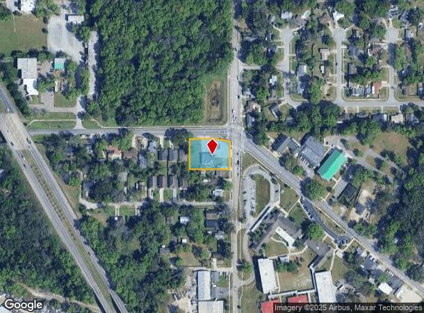
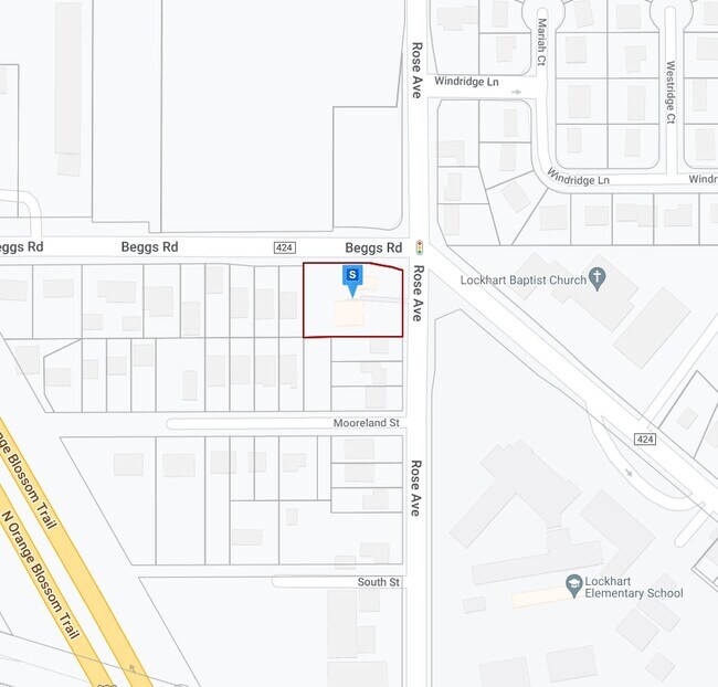
5500 Beggs Rd, Orlando, FL 32810

NEARBY LISTINGS FOR SALE OR LEASE
Property Detail
5500 Beggs Rd
Orlando-Kissimmee-Sanford, FL
Miller Sub (Lockhart)
31-2129-5644-00-010
MILLERS SUB L/68 PART OF LOTS 1 THROUGH 4 DESC AS BEG AT SW COR OF LOT 4 TH N0-2-57E 149.51 FT TH EAST 100 FT TO POINT O N A CURVE CONCAVE SWLY W/ RADIUS OF 312.25 FT CENTRAL ANGLE
Storebuilding
Orange
X
Florida
12095C0140F
1-4,4
2024
0.68 AC
2025
Apopka
015103
Orlando
3,960 SF
DEMOGRAPHICS near 5500 Beggs Rd
1 Mile
3 Mile
5 Mile
2024 Total Population
8,746
93,703
256,227
2029 Population
8,999
96,527
264,748
Pop Growth 2024-2029
+ 2.89%
+ 3.01%
+ 3.33%
Average Age
39
39
39
2024 Total Households
3,168
35,344
97,723
HH Growth 2024-2029
+ 2.97%
+ 3.14%
+ 3.51%
Median Household Inc
$66,330
$54,852
$55,765
Avg Household Size
2.60
2.60
2.50
2024 Avg HH Vehicles
2.00
2.00
2.00
Median Home Value
$257,388
$244,129
$263,189
Median Year Built
1987
1985
1983
Nearby Places
Map Layers
Map Styles
 Street
 Aerial
- Restaurants
- Banks
- Shops
- Fitness
- Groceries
PUBLIC TRANSPORTATION
COMMUTER RAIL
DRIVE
WALK
Distance
12 min
6.6 mi
DRIVE
WALK
Distance
14 min
6.7 mi
AIRPORT
Orlando International
DRIVE
WALK
Distance
Orlando International
33 min
20.6 mi
Orlando Sanford International
DRIVE
WALK
Distance
Orlando Sanford International
36 min
22.5 mi
Nearby Properties
Address
Land Use
TOTAL SIZE
Lot Size
Zoning
Address
Land Use
TOTAL SIZE
Lot Size
Zoning
1,009,074 SF
37.77 AC
PD
Address
Land Use
TOTAL SIZE
Lot Size
Zoning
630,861 SF
31.67 AC
PUDMO
Address
Land Use
TOTAL SIZE
Lot Size
Zoning
745,187 SF
18 AC
PUD
Address
Land Use
TOTAL SIZE
Lot Size
Zoning
34,430 SF
19.99 AC
Address
Land Use
TOTAL SIZE
Lot Size
Zoning
1,140,405 SF
78.07 AC
I-P/RP/W
Address
Land Use
TOTAL SIZE
Lot Size
Zoning
507,541 SF
49.48 AC
I-1
Address
Land Use
TOTAL SIZE
Lot Size
Zoning
1,674 SF
10.53 AC
R3
Address
Land Use
TOTAL SIZE
Lot Size
Zoning
357 SF
17.05 AC
Address
Land Use
TOTAL SIZE
Lot Size
Zoning
384,447 SF
10.70 AC
P-D
Address
Land Use
TOTAL SIZE
Lot Size
Zoning
468,719 SF
45.46 AC
PD
Address
Land Use
TOTAL SIZE
Lot Size
Zoning
373,462 SF
53.53 AC
IND-4
Address
Land Use
TOTAL SIZE
Lot Size
Zoning
381,557 SF
10.09 AC
PD
Address
Land Use
TOTAL SIZE
Lot Size
Zoning
11,392 SF
8.44 AC
Address
Land Use
TOTAL SIZE
Lot Size
Zoning
631,978 SF
7 AC
PD
Address
Land Use
TOTAL SIZE
Lot Size
Zoning
385,111 SF
12.39 AC
PD
Address
Land Use
TOTAL SIZE
Lot Size
Zoning
269,919 SF
24.44 AC
R-3
Address
Land Use
TOTAL SIZE
Lot Size
Zoning
779,046 SF
14.36 AC
PD
Address
Land Use
TOTAL SIZE
Lot Size
Zoning
447,386 SF
5.73 AC
PD
Address
Land Use
TOTAL SIZE
Lot Size
Zoning
539,186 SF
9.14 AC
PD
Address
Land Use
TOTAL SIZE
Lot Size
Zoning
560,422 SF
10 AC
PD
Address
Land Use
TOTAL SIZE
Lot Size
Zoning
243,228 SF
9.21 AC
PD
Address
Land Use
TOTAL SIZE
Lot Size
Zoning
226,171 SF
9.97 AC
PD
Address
Land Use
TOTAL SIZE
Lot Size
Zoning
220,883 SF
53.87 AC
IND-4
Address
Land Use
TOTAL SIZE
Lot Size
Zoning
259,990 SF
14.92 AC
R-3B/W/RP
Address
Land Use
TOTAL SIZE
Lot Size
Zoning
313,692 SF
16.37 AC
R-3A/W/RP
Address
Land Use
TOTAL SIZE
Lot Size
Zoning
375,987 SF
15.56 AC
I-L
Address
Land Use
TOTAL SIZE
Lot Size
Zoning
245,777 SF
9.97 AC
R-MF
Address
Land Use
TOTAL SIZE
Lot Size
Zoning
243,354 SF
10.45 AC
R-MF
Address
Land Use
TOTAL SIZE
Lot Size
Zoning
170,122 SF
28.09 AC
R-1A
Address
Land Use
TOTAL SIZE
Lot Size
Zoning
1,768 SF
20.77 AC
PUDMO
The World's #1 Commercial Real Estate Marketplace
Connect with us
© 2025 CoStar Group
The information above has been obtained from sources believed reliable. While we do not doubt its accuracy we have not verified it and make no guarantee, warranty or representation about it. It is your responsibility to independently confirm its accuracy and completeness. Any projections, opinions, assumptions, or estimates used are for example only and do not represent the current or future performance of the property. The value of this transaction to you depends on tax and other factors which should be evaluated by your tax, financial, and legal advisors. You and your advisors should conduct a careful, independent investigation of the property to determine to your satisfaction the suitability of the property for your needs.