Property Record
5500 Perkins Rd, Baton Rouge, LA 70808


NEARBY LISTINGS FOR SALE OR LEASE
Property Detail
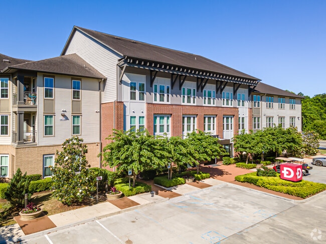
5500 Perkins Rd
Baton Rouge, LA
Moss Side Plantation
00563781
WARD: 1-3, SUBDIVISION: MOSS SIDE PLANTATION, LOT: CC. LOT CC, CONT. 10.649 ACRES MOSS SIDE PLANTATION BEING A CERTAIN TRACT OF LAND IN SEC. 43, T7S,R1E TAKEN FROM A 13.00 ACRE TRACT IN MOSS SIDE PLANTATION. 1955. 2012. MAP SHOWING RELOCATION & REVOC
Apartment
E Baton Rouge
AE
Louisiana
22033C0245E
cc
2024
10.65 AC
2024
Highlands/Perkins
002602
Baton Rouge
440,588 SF
DEMOGRAPHICS near 5500 Perkins Rd
1 Mile
3 Mile
5 Mile
2024 Total Population
5,424
74,779
199,558
2029 Population
5,293
73,505
196,983
Pop Growth 2024-2029
(2.42%)
(1.70%)
(1.29%)
Average Age
42
38
37
2024 Total Households
2,388
33,680
85,839
HH Growth 2024-2029
(2.22%)
(1.61%)
(1.27%)
Median Household Inc
$104,458
$60,272
$48,982
Avg Household Size
2.20
2.10
2.20
2024 Avg HH Vehicles
2.00
2.00
2.00
Median Home Value
$471,288
$338,913
$260,826
Median Year Built
1988
1981
1981
Nearby Places
Map Layers
Map Styles
 Street
 Aerial
- Restaurants
- Banks
- Shops
- Fitness
- Groceries
PUBLIC TRANSPORTATION
AIRPORT
Baton Rouge Metro Ryan Field
DRIVE
WALK
Distance
Baton Rouge Metro Ryan Field
18 min
12.1 mi
Freight Ports
Port of Greater Baton Rouge
DRIVE
WALK
Distance
Port of Greater Baton Rouge
14 min
7.3 mi
SALE & LEASE HISTORY
LISTING DATE
SALE/LEASE

Jul 02, 2025
For Sale
Nearby Properties
Address
Land Use
TOTAL SIZE
Lot Size
Zoning
Address
Land Use
TOTAL SIZE
Lot Size
Zoning
Address
Land Use
TOTAL SIZE
Lot Size
Zoning
937,594 SF
12.50 AC
Address
Land Use
TOTAL SIZE
Lot Size
Zoning
703,858 SF
26.97 AC
Address
Land Use
TOTAL SIZE
Lot Size
Zoning
Address
Land Use
TOTAL SIZE
Lot Size
Zoning
56.77 AC
Address
Land Use
TOTAL SIZE
Lot Size
Zoning
399,894 SF
37.86 AC
Address
Land Use
TOTAL SIZE
Lot Size
Zoning
5.31 AC
Address
Land Use
TOTAL SIZE
Lot Size
Zoning
303,139 SF
4.37 AC
Address
Land Use
TOTAL SIZE
Lot Size
Zoning
222,231 SF
236.72 AC
Address
Land Use
TOTAL SIZE
Lot Size
Zoning
14.27 AC
Address
Land Use
TOTAL SIZE
Lot Size
Zoning
357,357 SF
2.33 AC
Address
Land Use
TOTAL SIZE
Lot Size
Zoning
10.75 AC
Address
Land Use
TOTAL SIZE
Lot Size
Zoning
349,510 SF
10.48 AC
Address
Land Use
TOTAL SIZE
Lot Size
Zoning
234,743 SF
4.69 AC
Address
Land Use
TOTAL SIZE
Lot Size
Zoning
2.62 AC
Address
Land Use
TOTAL SIZE
Lot Size
Zoning
Address
Land Use
TOTAL SIZE
Lot Size
Zoning
76,498 SF
10.93 AC
Address
Land Use
TOTAL SIZE
Lot Size
Zoning
Address
Land Use
TOTAL SIZE
Lot Size
Zoning
107,326 SF
26.01 AC
Address
Land Use
TOTAL SIZE
Lot Size
Zoning
72,023 SF
10.93 AC
Address
Land Use
TOTAL SIZE
Lot Size
Zoning
Address
Land Use
TOTAL SIZE
Lot Size
Zoning
Address
Land Use
TOTAL SIZE
Lot Size
Zoning
286,287 SF
29.65 AC
Address
Land Use
TOTAL SIZE
Lot Size
Zoning
260,000 SF
7.48 AC
Address
Land Use
TOTAL SIZE
Lot Size
Zoning
417,209 SF
4.89 AC
Address
Land Use
TOTAL SIZE
Lot Size
Zoning
323,903 SF
41.99 AC
Address
Land Use
TOTAL SIZE
Lot Size
Zoning
1.61 AC
Address
Land Use
TOTAL SIZE
Lot Size
Zoning
102,161 SF
0.80 AC
Address
Land Use
TOTAL SIZE
Lot Size
Zoning
The World's #1 Commercial Real Estate Marketplace
Connect with us
© 2025 CoStar Group
The information above has been obtained from sources believed reliable. While we do not doubt its accuracy we have not verified it and make no guarantee, warranty or representation about it. It is your responsibility to independently confirm its accuracy and completeness. Any projections, opinions, assumptions, or estimates used are for example only and do not represent the current or future performance of the property. The value of this transaction to you depends on tax and other factors which should be evaluated by your tax, financial, and legal advisors. You and your advisors should conduct a careful, independent investigation of the property to determine to your satisfaction the suitability of the property for your needs.