Property Record
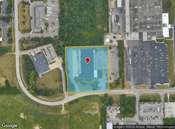
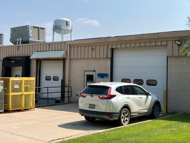
5500 S State Rd, Ann Arbor, MI 48108
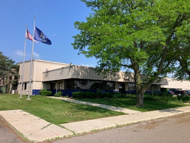
This Property Is For Sale
Current Lease Availabilities
NEARBY LISTINGS FOR SALE OR LEASE
Property Detail
5500 S State Rd
12-21-200-033
QCD L2990 P380 **FROM 1221200005 06/06/94 PI 21-17B-2 COM AT W 1/4 COR SEC 21, TH N 01-11-10 E 472.52 FT, TH S 88-50-40 E
Industrialgeneral
Washtenaw
X
Michigan
26161C0405E
4.31 AC
2025
Washtenaw W of 23
2025
Detroit
415600
Ann Arbor, MI
41,284 SF
DEMOGRAPHICS near 5500 S State Rd
1 Mile
3 Mile
5 Mile
2024 Total Population
1,902
33,831
130,881
2029 Population
1,906
33,498
129,392
Pop Growth 2024-2029
+ 0.21%
(0.98%)
(1.14%)
Average Age
39
41
37
2024 Total Households
654
14,812
52,406
HH Growth 2024-2029
+ 0.15%
(1.13%)
(1.20%)
Median Household Inc
$166,115
$92,518
$81,555
Avg Household Size
2.90
2.20
2.30
2024 Avg HH Vehicles
2.00
2.00
2.00
Median Home Value
$546,384
$388,037
$378,766
Median Year Built
2002
1991
1978
Nearby Places
Map Layers
Map Styles
 Street
 Aerial
- Restaurants
- Banks
- Shops
- Fitness
- Groceries
PUBLIC TRANSPORTATION
COMMUTER RAIL
DRIVE
WALK
Distance
15 min
6.0 mi
AIRPORT
Detroit Metro Wayne County
DRIVE
WALK
Distance
Detroit Metro Wayne County
37 min
27.1 mi
Freight Ports
DRIVE
WALK
Distance
74 min
56.1 mi
Nearby Properties
Address
Land Use
TOTAL SIZE
Lot Size
Zoning
Address
Land Use
TOTAL SIZE
Lot Size
Zoning
Address
Land Use
TOTAL SIZE
Lot Size
Zoning
315,108 SF
6.57 AC
C1B
Address
Land Use
TOTAL SIZE
Lot Size
Zoning
334,077 SF
20.41 AC
R4B
Address
Land Use
TOTAL SIZE
Lot Size
Zoning
357,978 SF
19.32 AC
R4B
Address
Land Use
TOTAL SIZE
Lot Size
Zoning
112,994 SF
45.12 AC
IH
Address
Land Use
TOTAL SIZE
Lot Size
Zoning
140,039 SF
Address
Land Use
TOTAL SIZE
Lot Size
Zoning
271,521 SF
15.11 AC
Address
Land Use
TOTAL SIZE
Lot Size
Zoning
214,559 SF
16.18 AC
PUD
Address
Land Use
TOTAL SIZE
Lot Size
Zoning
253,702 SF
30.23 AC
Address
Land Use
TOTAL SIZE
Lot Size
Zoning
111,435 SF
21.38 AC
R4B
Address
Land Use
TOTAL SIZE
Lot Size
Zoning
175,536 SF
12.98 AC
R4B
Address
Land Use
TOTAL SIZE
Lot Size
Zoning
88,460 SF
28.50 AC
DI
Address
Land Use
TOTAL SIZE
Lot Size
Zoning
192,726 SF
6.45 AC
O
Address
Land Use
TOTAL SIZE
Lot Size
Zoning
283,290 SF
10.42 AC
O
Address
Land Use
TOTAL SIZE
Lot Size
Zoning
137,182 SF
11.83 AC
R4C
Address
Land Use
TOTAL SIZE
Lot Size
Zoning
317,872 SF
11.79 AC
M1
Address
Land Use
TOTAL SIZE
Lot Size
Zoning
18,148 SF
21.62 AC
BI
Address
Land Use
TOTAL SIZE
Lot Size
Zoning
167,294 SF
40.67 AC
Address
Land Use
TOTAL SIZE
Lot Size
Zoning
159,558 SF
10.59 AC
R4B
Address
Land Use
TOTAL SIZE
Lot Size
Zoning
19,236 SF
17.79 AC
BI
Address
Land Use
TOTAL SIZE
Lot Size
Zoning
74,481 SF
3.40 AC
R5
Address
Land Use
TOTAL SIZE
Lot Size
Zoning
178,367 SF
10.70 AC
R5
Address
Land Use
TOTAL SIZE
Lot Size
Zoning
129,306 SF
8.65 AC
R4D
Address
Land Use
TOTAL SIZE
Lot Size
Zoning
159,947 SF
14.19 AC
Address
Land Use
TOTAL SIZE
Lot Size
Zoning
132,937 SF
13.92 AC
R4A
Address
Land Use
TOTAL SIZE
Lot Size
Zoning
216,900 SF
4.22 AC
O
Address
Land Use
TOTAL SIZE
Lot Size
Zoning
114,590 SF
7.39 AC
R4B
Address
Land Use
TOTAL SIZE
Lot Size
Zoning
105,615 SF
26.31 AC
Address
Land Use
TOTAL SIZE
Lot Size
Zoning
Address
Land Use
TOTAL SIZE
Lot Size
Zoning
121,136 SF
7.36 AC
ORL
The World's #1 Commercial Real Estate Marketplace
Connect with us
© 2025 CoStar Group
The information above has been obtained from sources believed reliable. While we do not doubt its accuracy we have not verified it and make no guarantee, warranty or representation about it. It is your responsibility to independently confirm its accuracy and completeness. Any projections, opinions, assumptions, or estimates used are for example only and do not represent the current or future performance of the property. The value of this transaction to you depends on tax and other factors which should be evaluated by your tax, financial, and legal advisors. You and your advisors should conduct a careful, independent investigation of the property to determine to your satisfaction the suitability of the property for your needs.