Property Record
5500 Stewart St, Milton, FL 32570

NEARBY LISTINGS FOR SALE OR LEASE
Property Detail
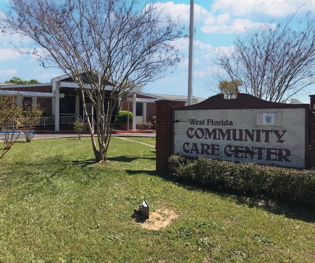
5500 Stewart St
34-2N-28-0000-17901-0000
**NEWLY DESCRIBED FOR 2024 ** 34-2N-28W: COM AT I/S OF N R/W CR191 & W R/W ABANDONED F&A RAILROAD, THN N22*2126E 164.33FT CHD ALNG CRV R=1959.86 TO POB, THN N88*2852W 80.06FT , THN N02*1512E 122.00FT , THN S88*2852E 135.94FT , THN S26*4353W 134.86FT
Hospitalpublic
Santa Rosa
X
Florida
12113C0320H
1
2024
3.72 AC
2025
Avalon Beach/Milton
010601
Pensacola
55,538 SF
Pensacola-Ferry Pass-Brent, FL
DEMOGRAPHICS near 5500 Stewart St
1 Mile
3 Mile
5 Mile
2024 Total Population
4,936
25,201
54,190
2029 Population
5,644
28,899
62,026
Pop Growth 2024-2029
+ 14.34%
+ 14.67%
+ 14.46%
Average Age
40
40
40
2024 Total Households
1,987
9,795
19,949
HH Growth 2024-2029
+ 14.80%
+ 15.05%
+ 15.09%
Median Household Inc
$51,341
$65,958
$71,327
Avg Household Size
2.40
2.50
2.50
2024 Avg HH Vehicles
1.00
2.00
2.00
Median Home Value
$145,328
$212,414
$227,644
Median Year Built
1980
1986
1991
Nearby Places
Map Layers
Map Styles
 Street
 Aerial
- Restaurants
- Banks
- Shops
- Fitness
- Groceries
PUBLIC TRANSPORTATION
AIRPORT
Pensacola International
DRIVE
WALK
Distance
Pensacola International
36 min
20.2 mi
Freight Ports
Port of Mobile
DRIVE
WALK
Distance
Port of Mobile
85 min
70.3 mi
SALE & LEASE HISTORY
LISTING DATE
SALE/LEASE

Jun 14, 2024
For Sale
Dec 01, 2025
For Sale
Apr 12, 2023
For Sale
Nearby Properties
Address
Land Use
TOTAL SIZE
Lot Size
Zoning
Address
Land Use
TOTAL SIZE
Lot Size
Zoning
173,250 SF
28.91 AC
C1
Address
Land Use
TOTAL SIZE
Lot Size
Zoning
80,314 SF
9.76 AC
C1
Address
Land Use
TOTAL SIZE
Lot Size
Zoning
8,223 SF
40 AC
Address
Land Use
TOTAL SIZE
Lot Size
Zoning
102,921 SF
5 AC
R3
Address
Land Use
TOTAL SIZE
Lot Size
Zoning
113,178 SF
8.61 AC
HCD
Address
Land Use
TOTAL SIZE
Lot Size
Zoning
151,842 SF
14.28 AC
C2
Address
Land Use
TOTAL SIZE
Lot Size
Zoning
113,652 SF
9.52 AC
C2
Address
Land Use
TOTAL SIZE
Lot Size
Zoning
82,878 SF
9.07 AC
HCD
Address
Land Use
TOTAL SIZE
Lot Size
Zoning
76.81 AC
R1
Address
Land Use
TOTAL SIZE
Lot Size
Zoning
98,250 SF
49.63 AC
HCD
Address
Land Use
TOTAL SIZE
Lot Size
Zoning
147,443 SF
11.44 AC
I1
Address
Land Use
TOTAL SIZE
Lot Size
Zoning
39,570 SF
0.36 AC
C1
Address
Land Use
TOTAL SIZE
Lot Size
Zoning
68,026 SF
2.07 AC
RC1
Address
Land Use
TOTAL SIZE
Lot Size
Zoning
48,210 SF
8.98 AC
C2
Address
Land Use
TOTAL SIZE
Lot Size
Zoning
16,903 SF
11 AC
AG-RR
Address
Land Use
TOTAL SIZE
Lot Size
Zoning
91,887 SF
10.83 AC
C1
Address
Land Use
TOTAL SIZE
Lot Size
Zoning
10 AC
R1A
Address
Land Use
TOTAL SIZE
Lot Size
Zoning
82,994 SF
6 AC
RR1
Address
Land Use
TOTAL SIZE
Lot Size
Zoning
49,540 SF
2.30 AC
HCD
Address
Land Use
TOTAL SIZE
Lot Size
Zoning
40,142 SF
5.28 AC
R3
Address
Land Use
TOTAL SIZE
Lot Size
Zoning
43,312 SF
15 AC
HCD
Address
Land Use
TOTAL SIZE
Lot Size
Zoning
46,613 SF
5.72 AC
C1
Address
Land Use
TOTAL SIZE
Lot Size
Zoning
72,208 SF
66.85 AC
C2
Address
Land Use
TOTAL SIZE
Lot Size
Zoning
60,717 SF
4.43 AC
HCD
Address
Land Use
TOTAL SIZE
Lot Size
Zoning
15 AC
R1A
Address
Land Use
TOTAL SIZE
Lot Size
Zoning
22.09 AC
PE
Address
Land Use
TOTAL SIZE
Lot Size
Zoning
35,405 SF
2.55 AC
R3
Address
Land Use
TOTAL SIZE
Lot Size
Zoning
48,463 SF
10.64 AC
R3
Address
Land Use
TOTAL SIZE
Lot Size
Zoning
77,589 SF
9.39 AC
HCD
The World's #1 Commercial Real Estate Marketplace
Connect with us
© 2026 CoStar Group
The information above has been obtained from sources believed reliable. While we do not doubt its accuracy we have not verified it and make no guarantee, warranty or representation about it. It is your responsibility to independently confirm its accuracy and completeness. Any projections, opinions, assumptions, or estimates used are for example only and do not represent the current or future performance of the property. The value of this transaction to you depends on tax and other factors which should be evaluated by your tax, financial, and legal advisors. You and your advisors should conduct a careful, independent investigation of the property to determine to your satisfaction the suitability of the property for your needs.