Property Record
5500 W Broadway Ave, Minneapolis, MN 55428
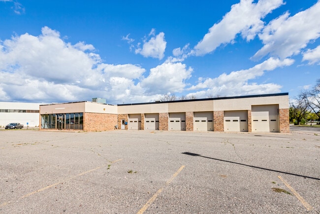

This Property Is For Sale
NEARBY LISTINGS FOR SALE OR LEASE
Property Detail
5500 W Broadway Ave
Minneapolis-St. Paul-Bloomington, MN-WI
Hra 3Rd Addn
05-118-21-44-0047
LOT 002 BLOCK 001 B HRA 3RD ADDN SW240X251X65X195
Commercialnec
Hennepin
X
Minnesota
27053C0211F
2
2024
0.68 AC
2024
Brookdale
020804
Minneapolis/St Paul
DEMOGRAPHICS near 5500 W Broadway Ave
1 Mile
3 Mile
5 Mile
2024 Total Population
12,263
108,125
267,496
2029 Population
12,068
105,978
262,537
Pop Growth 2024-2029
(1.59%)
(1.99%)
(1.85%)
Average Age
39
39
38
2024 Total Households
4,859
42,127
100,332
HH Growth 2024-2029
(1.85%)
(2.16%)
(1.98%)
Median Household Inc
$69,101
$68,926
$72,805
Avg Household Size
2.40
2.50
2.50
2024 Avg HH Vehicles
2.00
2.00
2.00
Median Home Value
$238,889
$253,132
$267,091
Median Year Built
1960
1965
1969
Nearby Places
Map Layers
Map Styles
 Street
 Aerial
- Restaurants
- Banks
- Shops
- Fitness
- Groceries
PUBLIC TRANSPORTATION
COMMUTER RAIL
Fridley Station (Northstar Corridor - Northstar Commuter Rail)
DRIVE
WALK
Distance
Fridley Station (Northstar Corridor - Northstar Commuter Rail)
12 min
7.4 mi
Target Field Station (Northstar Corridor - Northstar Commuter Rail)
DRIVE
WALK
Distance
Target Field Station (Northstar Corridor - Northstar Commuter Rail)
16 min
7.6 mi
AIRPORT
Minneapolis-St Paul International/Wold-Chamberlain
DRIVE
WALK
Distance
Minneapolis-St Paul International/Wold-Chamberlain
32 min
22.6 mi
Freight Ports
Port Milwaukee
DRIVE
WALK
Distance
Port Milwaukee
388 min
350.8 mi
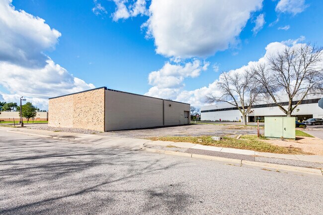
Nearby Properties
Address
Land Use
TOTAL SIZE
Lot Size
Zoning
Address
Land Use
TOTAL SIZE
Lot Size
Zoning
17.26 AC
Address
Land Use
TOTAL SIZE
Lot Size
Zoning
36.46 AC
Address
Land Use
TOTAL SIZE
Lot Size
Zoning
26.57 AC
Address
Land Use
TOTAL SIZE
Lot Size
Zoning
Address
Land Use
TOTAL SIZE
Lot Size
Zoning
Address
Land Use
TOTAL SIZE
Lot Size
Zoning
26.73 AC
Address
Land Use
TOTAL SIZE
Lot Size
Zoning
409,456 SF
12.40 AC
Address
Land Use
TOTAL SIZE
Lot Size
Zoning
Address
Land Use
TOTAL SIZE
Lot Size
Zoning
22.67 AC
Address
Land Use
TOTAL SIZE
Lot Size
Zoning
12.38 AC
Address
Land Use
TOTAL SIZE
Lot Size
Zoning
351,351 SF
17.98 AC
Address
Land Use
TOTAL SIZE
Lot Size
Zoning
20.48 AC
Address
Land Use
TOTAL SIZE
Lot Size
Zoning
19.10 AC
Address
Land Use
TOTAL SIZE
Lot Size
Zoning
Address
Land Use
TOTAL SIZE
Lot Size
Zoning
14.04 AC
Address
Land Use
TOTAL SIZE
Lot Size
Zoning
255,324 SF
15.22 AC
Address
Land Use
TOTAL SIZE
Lot Size
Zoning
106,897 SF
4.37 AC
Address
Land Use
TOTAL SIZE
Lot Size
Zoning
Address
Land Use
TOTAL SIZE
Lot Size
Zoning
26.26 AC
Address
Land Use
TOTAL SIZE
Lot Size
Zoning
Address
Land Use
TOTAL SIZE
Lot Size
Zoning
4.34 AC
Address
Land Use
TOTAL SIZE
Lot Size
Zoning
Address
Land Use
TOTAL SIZE
Lot Size
Zoning
Address
Land Use
TOTAL SIZE
Lot Size
Zoning
15.94 AC
Address
Land Use
TOTAL SIZE
Lot Size
Zoning
21.10 AC
Address
Land Use
TOTAL SIZE
Lot Size
Zoning
13.07 AC
Address
Land Use
TOTAL SIZE
Lot Size
Zoning
35,762 SF
4.48 AC
Address
Land Use
TOTAL SIZE
Lot Size
Zoning
18.26 AC
Address
Land Use
TOTAL SIZE
Lot Size
Zoning
9.89 AC
Address
Land Use
TOTAL SIZE
Lot Size
Zoning
14.87 AC
The World's #1 Commercial Real Estate Marketplace
Connect with us
© 2026 CoStar Group
The information above has been obtained from sources believed reliable. While we do not doubt its accuracy we have not verified it and make no guarantee, warranty or representation about it. It is your responsibility to independently confirm its accuracy and completeness. Any projections, opinions, assumptions, or estimates used are for example only and do not represent the current or future performance of the property. The value of this transaction to you depends on tax and other factors which should be evaluated by your tax, financial, and legal advisors. You and your advisors should conduct a careful, independent investigation of the property to determine to your satisfaction the suitability of the property for your needs.