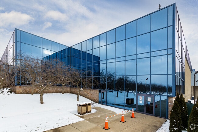
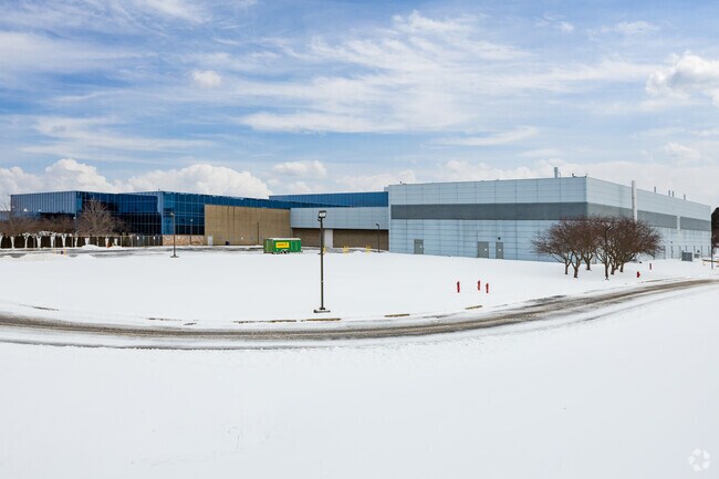
Property Record
5500 W Henrietta Rd, West Henrietta, NY 14586

NEARBY LISTINGS FOR SALE OR LEASE
Property Detail
5500 W Henrietta Rd
263200 189.01-1-19.1
Delphi Subdivision
Industrialgeneral
Monroe
X
New York
36055C0342G
19.110
2025
66.25 AC
2024
South Central
013207
Rochester
364,000 SF
Rochester, NY
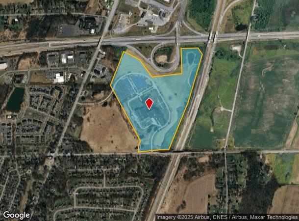
DEMOGRAPHICS near 5500 W Henrietta Rd
1 Mile
3 Mile
5 Mile
2024 Total Population
2,960
26,464
60,134
2029 Population
2,893
26,272
59,572
Pop Growth 2024-2029
(2.26%)
(0.73%)
(0.93%)
Average Age
40
40
38
2024 Total Households
1,139
10,756
22,006
HH Growth 2024-2029
(2.37%)
(0.76%)
(0.99%)
Median Household Inc
$106,228
$73,415
$72,276
Avg Household Size
2.50
2.40
2.40
2024 Avg HH Vehicles
2.00
2.00
2.00
Median Home Value
$187,882
$176,432
$179,887
Median Year Built
1988
1979
1974
Nearby Places
Map Layers
Map Styles
 Street
 Aerial
- Restaurants
- Banks
- Shops
- Fitness
- Groceries
PUBLIC TRANSPORTATION
AIRPORT
Frederick Douglass/Greater Rochester International
DRIVE
WALK
Distance
Frederick Douglass/Greater Rochester International
18 min
15.7 mi
Freight Ports
Albany, NY Port
DRIVE
WALK
Distance
Albany, NY Port
1 min
199.5 mi
SALE & LEASE HISTORY
LISTING DATE
SALE/LEASE

Sep 25, 2016
For Lease
Oct 29, 2019
For Sale
Nov 30, 2020
For Lease
Nearby Properties
Address
Land Use
TOTAL SIZE
Lot Size
Zoning
Address
Land Use
TOTAL SIZE
Lot Size
Zoning
216,267 SF
112.82 AC
02 - SINGL
Address
Land Use
TOTAL SIZE
Lot Size
Zoning
446,748 SF
14.10 AC
06 - INDUS
Address
Land Use
TOTAL SIZE
Lot Size
Zoning
2,440 SF
141.36 AC
06 - INDUS
Address
Land Use
TOTAL SIZE
Lot Size
Zoning
1,200 SF
34.17 AC
02 - SINGL
Address
Land Use
TOTAL SIZE
Lot Size
Zoning
323,859 SF
19.12 AC
05 - COMME
Address
Land Use
TOTAL SIZE
Lot Size
Zoning
1,772 SF
56.80 AC
02 - SINGL
Address
Land Use
TOTAL SIZE
Lot Size
Zoning
45,216 SF
12.42 AC
02 - SINGL
Address
Land Use
TOTAL SIZE
Lot Size
Zoning
37,632 SF
29.06 AC
06 - INDUS
Address
Land Use
TOTAL SIZE
Lot Size
Zoning
46,644 SF
26.60 AC
02 - SINGL
Address
Land Use
TOTAL SIZE
Lot Size
Zoning
11,108 SF
57.55 AC
06 - INDUS
Address
Land Use
TOTAL SIZE
Lot Size
Zoning
361,112 SF
54.84 AC
02 - SINGL
Address
Land Use
TOTAL SIZE
Lot Size
Zoning
156,248 SF
62.72 AC
06 - INDUS
Address
Land Use
TOTAL SIZE
Lot Size
Zoning
94,000 SF
15.49 AC
02 - SINGL
Address
Land Use
TOTAL SIZE
Lot Size
Zoning
36,972 SF
2.79 AC
02 - SINGL
Address
Land Use
TOTAL SIZE
Lot Size
Zoning
65.37 AC
02 - SINGL
Address
Land Use
TOTAL SIZE
Lot Size
Zoning
3,960 SF
98.15 AC
02 - SINGL
Address
Land Use
TOTAL SIZE
Lot Size
Zoning
404,630 SF
21.44 AC
06 - INDUS
Address
Land Use
TOTAL SIZE
Lot Size
Zoning
160,692 SF
12.05 AC
06 - INDUS
Address
Land Use
TOTAL SIZE
Lot Size
Zoning
6,751 SF
18.52 AC
02 - SINGL
Address
Land Use
TOTAL SIZE
Lot Size
Zoning
600 SF
446.14 AC
07 - MIXED
Address
Land Use
TOTAL SIZE
Lot Size
Zoning
270,000 SF
54.90 AC
02 - SINGL
Address
Land Use
TOTAL SIZE
Lot Size
Zoning
138,633 SF
16.80 AC
05 - COMME
Address
Land Use
TOTAL SIZE
Lot Size
Zoning
181,876 SF
11.64 AC
07 - MIXED
Address
Land Use
TOTAL SIZE
Lot Size
Zoning
53,750 SF
16.61 AC
06 - INDUS
Address
Land Use
TOTAL SIZE
Lot Size
Zoning
68,569 SF
42 AC
02 - SINGL
Address
Land Use
TOTAL SIZE
Lot Size
Zoning
42,881 SF
17.46 AC
02 - SINGL
Address
Land Use
TOTAL SIZE
Lot Size
Zoning
140,533 SF
63.50 AC
02 - SINGL
Address
Land Use
TOTAL SIZE
Lot Size
Zoning
42,948 SF
16.24 AC
02 - SINGL
Address
Land Use
TOTAL SIZE
Lot Size
Zoning
187,805 SF
19.93 AC
03
The World's #1 Commercial Real Estate Marketplace
Connect with us
© 2026 CoStar Group
The information above has been obtained from sources believed reliable. While we do not doubt its accuracy we have not verified it and make no guarantee, warranty or representation about it. It is your responsibility to independently confirm its accuracy and completeness. Any projections, opinions, assumptions, or estimates used are for example only and do not represent the current or future performance of the property. The value of this transaction to you depends on tax and other factors which should be evaluated by your tax, financial, and legal advisors. You and your advisors should conduct a careful, independent investigation of the property to determine to your satisfaction the suitability of the property for your needs.