Property Record
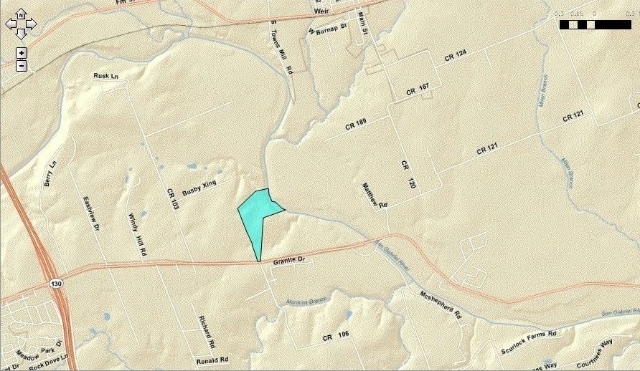
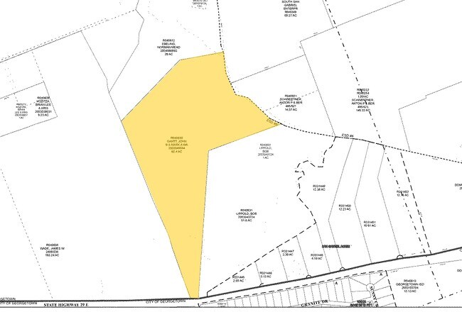
5501 E State Highway 29, Georgetown, TX 78626

Property Detail
5501 E State Highway 29
R040630
AW0556 AW0556 - STUBBLEFIELD, W. SUR., SERIAL # NOTAG09, TITLE # UNK, LABEL # UNK, ACRES 60.319, R512922/NON-F08
Taxexempt
WILLIAMSON
AE The base floodplain where base flood elevations are provided. AE Zones are now used on new format FIRMs instead of A1-A30 Zones.
Texas
2023
60.32 AC
2025
Georgetown
020822
Austin
87,071 SF
Austin-Round Rock-San Marcos, TX
NEARBY LISTINGS FOR SALE OR LEASE
DEMOGRAPHICS near 5501 E State Highway 29
1 mile
3 mile
5 mile
2025 Total Population
328
12,360
46,133
2030 Population
382
14,354
53,700
Pop Growth 2025-2030
+ 16.46%
+ 16.13%
+ 16.40%
Average Age
39
38
37
2025 Total Households
122
4,317
16,156
HH Growth 2025-2030
+ 17.21%
+ 16.82%
+ 17.06%
Median Household Inc
$87,500
$102,704
$97,547
Avg Household Size
2.60
2.80
2.70
2025 Avg HH Vehicles
2.00
2.00
2.00
Median Home Value
$314,286
$382,845
$393,923
Median Year Built
2009
2006
2008
Nearby Places
Map Layers
Map Styles
 Street
 Aerial
Transit
 Traffic
 Biking
Places
Listings with unknown addresses are not visible on the map
- Restaurants
- Banks
- Shops
- Fitness
- Groceries
Nearby Properties
Address
Land Use
TOTAL SIZE
Lot Size
Zoning
Address
Land Use
TOTAL SIZE
Lot Size
Zoning
252,492 SF
15.35 AC
Address
Land Use
TOTAL SIZE
Lot Size
Zoning
314,240 SF
16.03 AC
Address
Land Use
TOTAL SIZE
Lot Size
Zoning
116,641 SF
5.93 AC
Address
Land Use
TOTAL SIZE
Lot Size
Zoning
168,572 SF
10.73 AC
Address
Land Use
TOTAL SIZE
Lot Size
Zoning
27.61 AC
Address
Land Use
TOTAL SIZE
Lot Size
Zoning
131.22 AC
Address
Land Use
TOTAL SIZE
Lot Size
Zoning
124,742 SF
8.64 AC
Address
Land Use
TOTAL SIZE
Lot Size
Zoning
182,592 SF
11.20 AC
Address
Land Use
TOTAL SIZE
Lot Size
Zoning
2,400 SF
56.17 AC
Address
Land Use
TOTAL SIZE
Lot Size
Zoning
98,099 SF
5.13 AC
Address
Land Use
TOTAL SIZE
Lot Size
Zoning
111 SF
54.28 AC
Address
Land Use
TOTAL SIZE
Lot Size
Zoning
82.14 AC
Address
Land Use
TOTAL SIZE
Lot Size
Zoning
63,232 SF
15 AC
Address
Land Use
TOTAL SIZE
Lot Size
Zoning
25.57 AC
Address
Land Use
TOTAL SIZE
Lot Size
Zoning
120,582 SF
3.36 AC
Address
Land Use
TOTAL SIZE
Lot Size
Zoning
76,433 SF
4.50 AC
Address
Land Use
TOTAL SIZE
Lot Size
Zoning
82,484 SF
7.32 AC
Address
Land Use
TOTAL SIZE
Lot Size
Zoning
3,489 SF
11.16 AC
Address
Land Use
TOTAL SIZE
Lot Size
Zoning
130.98 AC
Address
Land Use
TOTAL SIZE
Lot Size
Zoning
53,794 SF
19.77 AC
Address
Land Use
TOTAL SIZE
Lot Size
Zoning
36,000 SF
2.46 AC
Address
Land Use
TOTAL SIZE
Lot Size
Zoning
864 SF
33.25 AC
Address
Land Use
TOTAL SIZE
Lot Size
Zoning
2,881 SF
5.61 AC
1-RS
Address
Land Use
TOTAL SIZE
Lot Size
Zoning
19,292 SF
8.32 AC
Address
Land Use
TOTAL SIZE
Lot Size
Zoning
34.31 AC
Address
Land Use
TOTAL SIZE
Lot Size
Zoning
12,431 SF
4.02 AC
Address
Land Use
TOTAL SIZE
Lot Size
Zoning
35,071 SF
15.30 AC
Address
Land Use
TOTAL SIZE
Lot Size
Zoning
Address
Land Use
TOTAL SIZE
Lot Size
Zoning
25.84 AC
The World's #1 Commercial Real Estate Marketplace
Connect with us
© 2026 CoStar Group
The information above has been obtained from sources believed reliable. While we do not doubt its accuracy we have not verified it and make no guarantee, warranty or representation about it. It is your responsibility to independently confirm its accuracy and completeness. Any projections, opinions, assumptions, or estimates used are for example only and do not represent the current or future performance of the property. The value of this transaction to you depends on tax and other factors which should be evaluated by your tax, financial, and legal advisors. You and your advisors should conduct a careful, independent investigation of the property to determine to your satisfaction the suitability of the property for your needs.