Property Record
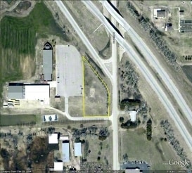
5501 N Maize Rd, Maize, KS 67101

Property Detail
5501 N Maize Rd
084-18-0-44-01-001.00
LOT 1 EXC PT ON E DED FOR ST ARK CHURCH ADD EXEMPT NO. 91-13205-TX
Religious
Sedgwick
SF-5
Kansas
AE The base floodplain where base flood elevations are provided. AE Zones are now used on new format FIRMs instead of A1-A30 Zones.
1
2024
14.91 AC
2025
Outlying Sedgwick County
010302
Wichita
36,818 SF
Wichita, KS
NEARBY LISTINGS FOR SALE OR LEASE
DEMOGRAPHICS near 5501 N Maize Rd
1 mile
3 mile
5 mile
2025 Total Population
2,330
12,452
42,738
2030 Population
2,414
12,937
43,626
Pop Growth 2025-2030
+ 3.61%
+ 3.89%
+ 2.08%
Average Age
35
37
40
2025 Total Households
836
4,419
15,504
HH Growth 2025-2030
+ 3.59%
+ 4.01%
+ 2.16%
Median Household Inc
$87,941
$107,310
$106,366
Avg Household Size
2.70
2.80
2.70
2025 Avg HH Vehicles
2.00
2.00
2.00
Median Home Value
$227,206
$333,490
$292,142
Median Year Built
1998
2010
1997
Nearby Places
Map Layers
Map Styles
 Street
 Aerial
Layers
 Traffic
 Biking
Places
Listings with unknown addresses are not visible on the map
- Restaurants
- Banks
- Shops
- Fitness
- Groceries
PUBLIC TRANSPORTATION
AIRPORT
Wichita Dwight D Eisenhower Ntl
Drive
Walk
Distance
Wichita Dwight D Eisenhower Ntl
19 min
10.5 mi
Freight Ports
Tulsa Port Of Catoosa
Drive
Walk
Distance
Tulsa Port Of Catoosa
220 min
205.7 mi
Nearby Properties
Address
Land Use
TOTAL SIZE
Lot Size
Zoning
Address
Land Use
TOTAL SIZE
Lot Size
Zoning
662,237 SF
179.74 AC
SF-5
Address
Land Use
TOTAL SIZE
Lot Size
Zoning
558,228 SF
126.95 AC
SF-5
Address
Land Use
TOTAL SIZE
Lot Size
Zoning
160,112 SF
58.49 AC
AA
Address
Land Use
TOTAL SIZE
Lot Size
Zoning
175,639 SF
22.91 AC
SF-5
Address
Land Use
TOTAL SIZE
Lot Size
Zoning
104,252 SF
7.24 AC
SF-5
Address
Land Use
TOTAL SIZE
Lot Size
Zoning
89,126 SF
34.29 AC
R6
Address
Land Use
TOTAL SIZE
Lot Size
Zoning
38,927 SF
5 AC
LC
Address
Land Use
TOTAL SIZE
Lot Size
Zoning
77,159 SF
5.97 AC
SF-5
Address
Land Use
TOTAL SIZE
Lot Size
Zoning
84,317 SF
7.18 AC
SF-5
Address
Land Use
TOTAL SIZE
Lot Size
Zoning
68,496 SF
18.11 AC
LC
Address
Land Use
TOTAL SIZE
Lot Size
Zoning
34,963 SF
6.13 AC
Address
Land Use
TOTAL SIZE
Lot Size
Zoning
24,134 SF
8.78 AC
B1
Address
Land Use
TOTAL SIZE
Lot Size
Zoning
54,158 SF
6.74 AC
RR
Address
Land Use
TOTAL SIZE
Lot Size
Zoning
18,125 SF
5.91 AC
SF-5
Address
Land Use
TOTAL SIZE
Lot Size
Zoning
70,160 SF
13.48 AC
AA
Address
Land Use
TOTAL SIZE
Lot Size
Zoning
22,644 SF
3.50 AC
Address
Land Use
TOTAL SIZE
Lot Size
Zoning
171,301 SF
22.05 AC
Address
Land Use
TOTAL SIZE
Lot Size
Zoning
183,905 SF
18.93 AC
GC,LC
Address
Land Use
TOTAL SIZE
Lot Size
Zoning
18,410 SF
10.41 AC
LC
Address
Land Use
TOTAL SIZE
Lot Size
Zoning
53,446 SF
6.67 AC
LC
Address
Land Use
TOTAL SIZE
Lot Size
Zoning
34,983 SF
4.51 AC
LC
Address
Land Use
TOTAL SIZE
Lot Size
Zoning
8,796 SF
1.71 AC
LC
Address
Land Use
TOTAL SIZE
Lot Size
Zoning
29,299 SF
2.35 AC
LC
Address
Land Use
TOTAL SIZE
Lot Size
Zoning
70,165 SF
4.73 AC
LC
Address
Land Use
TOTAL SIZE
Lot Size
Zoning
46,450 SF
10.33 AC
LI
Address
Land Use
TOTAL SIZE
Lot Size
Zoning
14,234 SF
1.06 AC
LC
Address
Land Use
TOTAL SIZE
Lot Size
Zoning
32,063 SF
3.44 AC
LC
Address
Land Use
TOTAL SIZE
Lot Size
Zoning
2,205 SF
143.84 AC
SF-5
Address
Land Use
TOTAL SIZE
Lot Size
Zoning
13,755 SF
1.62 AC
B1
The World's #1 Commercial Real Estate Marketplace
Connect with us
© 2026 CoStar Group
The information above has been obtained from sources believed reliable. While we do not doubt its accuracy we have not verified it and make no guarantee, warranty or representation about it. It is your responsibility to independently confirm its accuracy and completeness. Any projections, opinions, assumptions, or estimates used are for example only and do not represent the current or future performance of the property. The value of this transaction to you depends on tax and other factors which should be evaluated by your tax, financial, and legal advisors. You and your advisors should conduct a careful, independent investigation of the property to determine to your satisfaction the suitability of the property for your needs.