Property Record
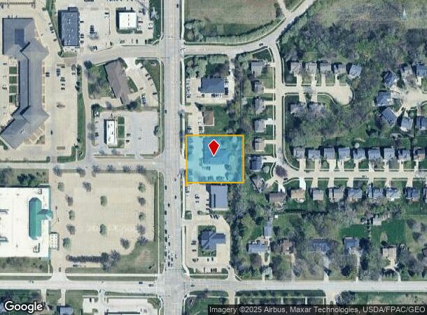
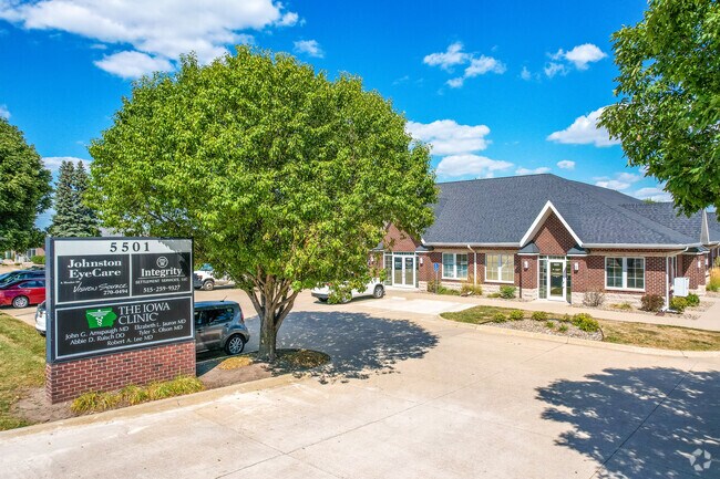
5501 Nw 86Th St, Johnston, IA 50131

NEARBY LISTINGS FOR SALE OR LEASE
Property Detail
5501 Nw 86Th St
Des Moines-West Des Moines, IA
Glendale Oaks Plat 2
241-00523020001
LOT 1 GLENDALE OAKS PLAT 2
Officebuilding
Polk
X
Iowa
19153C0186F
1
2024
1.08 AC
2025
Western Suburbs
011704
Des Moines
10,132 SF
DEMOGRAPHICS near 5501 Nw 86Th St
1 Mile
3 Mile
5 Mile
2024 Total Population
5,793
56,492
132,945
2029 Population
5,930
58,445
138,736
Pop Growth 2024-2029
+ 2.36%
+ 3.46%
+ 4.36%
Average Age
41
39
39
2024 Total Households
2,132
22,904
53,917
HH Growth 2024-2029
+ 2.49%
+ 3.68%
+ 4.44%
Median Household Inc
$128,440
$84,780
$84,201
Avg Household Size
2.70
2.40
2.40
2024 Avg HH Vehicles
2.00
2.00
2.00
Median Home Value
$293,576
$254,817
$249,882
Median Year Built
1996
1991
1982
Nearby Places
Map Layers
Map Styles
 Street
 Aerial
- Restaurants
- Banks
- Shops
- Fitness
- Groceries
PUBLIC TRANSPORTATION
AIRPORT
Des Moines International
DRIVE
WALK
Distance
Des Moines International
24 min
11.9 mi
SALE & LEASE HISTORY
LISTING DATE
SALE/LEASE

Sep 25, 2016
For Lease
Jan 20, 2021
For Lease
Nearby Properties
Address
Land Use
TOTAL SIZE
Lot Size
Zoning
Address
Land Use
TOTAL SIZE
Lot Size
Zoning
486,792 SF
38.70 AC
PC
Address
Land Use
TOTAL SIZE
Lot Size
Zoning
627,104 SF
40.09 AC
Address
Land Use
TOTAL SIZE
Lot Size
Zoning
330,704 SF
15.86 AC
Address
Land Use
TOTAL SIZE
Lot Size
Zoning
386,976 SF
30 AC
Address
Land Use
TOTAL SIZE
Lot Size
Zoning
407,183 SF
17.02 AC
PUD
Address
Land Use
TOTAL SIZE
Lot Size
Zoning
415,320 SF
51.16 AC
PUD
Address
Land Use
TOTAL SIZE
Lot Size
Zoning
59,496 SF
9.34 AC
Address
Land Use
TOTAL SIZE
Lot Size
Zoning
197,658 SF
15.91 AC
Address
Land Use
TOTAL SIZE
Lot Size
Zoning
184,658 SF
14.61 AC
Address
Land Use
TOTAL SIZE
Lot Size
Zoning
300,000 SF
17.51 AC
Address
Land Use
TOTAL SIZE
Lot Size
Zoning
572,809 SF
42.13 AC
M-2
Address
Land Use
TOTAL SIZE
Lot Size
Zoning
367,386 SF
24.31 AC
PUD
Address
Land Use
TOTAL SIZE
Lot Size
Zoning
270,000 SF
19.10 AC
Address
Land Use
TOTAL SIZE
Lot Size
Zoning
133,256 SF
15.93 AC
Address
Land Use
TOTAL SIZE
Lot Size
Zoning
260,000 SF
14.32 AC
Address
Land Use
TOTAL SIZE
Lot Size
Zoning
166,160 SF
11.88 AC
Address
Land Use
TOTAL SIZE
Lot Size
Zoning
287,228 SF
27.32 AC
A-R
Address
Land Use
TOTAL SIZE
Lot Size
Zoning
260,000 SF
18.45 AC
Address
Land Use
TOTAL SIZE
Lot Size
Zoning
250,000 SF
13.93 AC
Address
Land Use
TOTAL SIZE
Lot Size
Zoning
245,520 SF
19.33 AC
Address
Land Use
TOTAL SIZE
Lot Size
Zoning
307,734 SF
23.59 AC
R-3
Address
Land Use
TOTAL SIZE
Lot Size
Zoning
71,938 SF
8.23 AC
C-O
Address
Land Use
TOTAL SIZE
Lot Size
Zoning
212,500 SF
10.20 AC
Address
Land Use
TOTAL SIZE
Lot Size
Zoning
101,592 SF
7.79 AC
PUD
Address
Land Use
TOTAL SIZE
Lot Size
Zoning
127,869 SF
6.70 AC
Address
Land Use
TOTAL SIZE
Lot Size
Zoning
219,950 SF
22.57 AC
Address
Land Use
TOTAL SIZE
Lot Size
Zoning
181,984 SF
16.42 AC
Address
Land Use
TOTAL SIZE
Lot Size
Zoning
386,236 SF
9.62 AC
C-4
Address
Land Use
TOTAL SIZE
Lot Size
Zoning
141,377 SF
3.16 AC
Address
Land Use
TOTAL SIZE
Lot Size
Zoning
225,000 SF
16.42 AC
The World's #1 Commercial Real Estate Marketplace
Connect with us
© 2025 CoStar Group
The information above has been obtained from sources believed reliable. While we do not doubt its accuracy we have not verified it and make no guarantee, warranty or representation about it. It is your responsibility to independently confirm its accuracy and completeness. Any projections, opinions, assumptions, or estimates used are for example only and do not represent the current or future performance of the property. The value of this transaction to you depends on tax and other factors which should be evaluated by your tax, financial, and legal advisors. You and your advisors should conduct a careful, independent investigation of the property to determine to your satisfaction the suitability of the property for your needs.