Property Record
5501 Sandshell Dr, Fort Worth, TX 76137


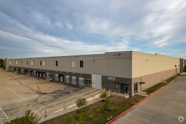
Property Detail
5501 Sandshell Dr
Dallas-Fort Worth-Arlington, TX
JDA FOSSIL CREEK BLOCK A LOT 1
42307692
Tarrant
Commercialnec
Texas
B and X Area of moderate flood hazard, usually the area between the limits of the 100-year and 500-year floods.
1
2024
10.59 AC
2025
Meacham Fld/Fossil Cr
105007
Dallas/Ft Worth
213,089 SF
NEARBY LISTINGS FOR SALE OR LEASE
DEMOGRAPHICS near 5501 Sandshell Dr
1 mile
3 mile
5 mile
2025 Total Population
7,976
91,888
300,485
2030 Population
8,417
96,289
315,761
Pop Growth 2025-2030
+ 5.53%
+ 4.79%
+ 5.08%
Average Age
36
36
36
2025 Total Households
3,688
32,707
102,224
HH Growth 2025-2030
+ 5.86%
+ 4.91%
+ 5.27%
Median Household Inc
$75,158
$74,846
$80,277
Avg Household Size
2.20
2.80
2.90
2025 Avg HH Vehicles
2.00
2.00
2.00
Median Home Value
$353,469
$283,042
$292,547
Median Year Built
2005
1994
1993
Nearby Places
Map Layers
Map Styles
 Street
 Aerial
Transit
 Traffic
 Biking
Places
Listings with unknown addresses are not visible on the map
- Restaurants
- Banks
- Shops
- Fitness
- Groceries
PUBLIC TRANSPORTATION
COMMUTER RAIL
Drive
Walk
Distance
16 min
9.3 mi
Drive
Walk
Distance
14 min
9.5 mi
AIRPORT
Dallas-Fort Worth International
Drive
Walk
Distance
Dallas-Fort Worth International
32 min
21.9 mi
Dallas Love Field
Drive
Walk
Distance
Dallas Love Field
43 min
30.5 mi
SALE & LEASE HISTORY
LISTING DATE
SALE/LEASE

Oct 16, 2017
For Lease
Oct 13, 2017
For Lease
May 23, 2025
For Lease
Mar 14, 2024
For Lease
Feb 05, 2025
For Lease
Nearby Properties
Address
Land Use
TOTAL SIZE
Lot Size
Zoning
Address
Land Use
TOTAL SIZE
Lot Size
Zoning
547,836 SF
2 AC
Address
Land Use
TOTAL SIZE
Lot Size
Zoning
1,291,500 SF
61.22 AC
Address
Land Use
TOTAL SIZE
Lot Size
Zoning
1,440,000 SF
73.42 AC
Address
Land Use
TOTAL SIZE
Lot Size
Zoning
332,094 SF
19.33 AC
Address
Land Use
TOTAL SIZE
Lot Size
Zoning
473,562 SF
24.63 AC
Address
Land Use
TOTAL SIZE
Lot Size
Zoning
1,020,300 SF
64.61 AC
Address
Land Use
TOTAL SIZE
Lot Size
Zoning
352,354 SF
17.02 AC
Address
Land Use
TOTAL SIZE
Lot Size
Zoning
1,009,800 SF
49.98 AC
Address
Land Use
TOTAL SIZE
Lot Size
Zoning
433,894 SF
18.99 AC
Address
Land Use
TOTAL SIZE
Lot Size
Zoning
935,532 SF
95.08 AC
Address
Land Use
TOTAL SIZE
Lot Size
Zoning
699,246 SF
40.69 AC
Address
Land Use
TOTAL SIZE
Lot Size
Zoning
385,697 SF
15.94 AC
Address
Land Use
TOTAL SIZE
Lot Size
Zoning
810,978 SF
45.84 AC
Address
Land Use
TOTAL SIZE
Lot Size
Zoning
715,000 SF
47.87 AC
Address
Land Use
TOTAL SIZE
Lot Size
Zoning
697,140 SF
37.84 AC
Address
Land Use
TOTAL SIZE
Lot Size
Zoning
278,292 SF
16.35 AC
Address
Land Use
TOTAL SIZE
Lot Size
Zoning
344,992 SF
17.49 AC
Address
Land Use
TOTAL SIZE
Lot Size
Zoning
312,219 SF
17.82 AC
Address
Land Use
TOTAL SIZE
Lot Size
Zoning
248,993 SF
15.40 AC
Address
Land Use
TOTAL SIZE
Lot Size
Zoning
263,411 SF
7.32 AC
Address
Land Use
TOTAL SIZE
Lot Size
Zoning
293,972 SF
17.30 AC
Address
Land Use
TOTAL SIZE
Lot Size
Zoning
656,390 SF
33.33 AC
Address
Land Use
TOTAL SIZE
Lot Size
Zoning
269,995 SF
14.72 AC
Address
Land Use
TOTAL SIZE
Lot Size
Zoning
329,091 SF
21.73 AC
Address
Land Use
TOTAL SIZE
Lot Size
Zoning
251,933 SF
86.07 AC
Address
Land Use
TOTAL SIZE
Lot Size
Zoning
266,403 SF
16.67 AC
Address
Land Use
TOTAL SIZE
Lot Size
Zoning
270,394 SF
16.43 AC
Address
Land Use
TOTAL SIZE
Lot Size
Zoning
566,816 SF
32.79 AC
Address
Land Use
TOTAL SIZE
Lot Size
Zoning
359,411 SF
17.77 AC
Address
Land Use
TOTAL SIZE
Lot Size
Zoning
689,600 SF
47.04 AC
The World's #1 Commercial Real Estate Marketplace
Connect with us
© 2026 CoStar Group
The information above has been obtained from sources believed reliable. While we do not doubt its accuracy we have not verified it and make no guarantee, warranty or representation about it. It is your responsibility to independently confirm its accuracy and completeness. Any projections, opinions, assumptions, or estimates used are for example only and do not represent the current or future performance of the property. The value of this transaction to you depends on tax and other factors which should be evaluated by your tax, financial, and legal advisors. You and your advisors should conduct a careful, independent investigation of the property to determine to your satisfaction the suitability of the property for your needs.