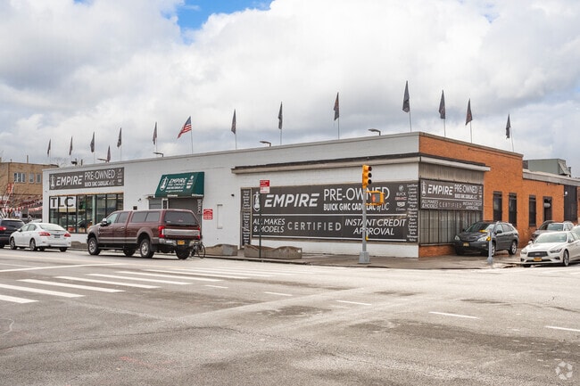
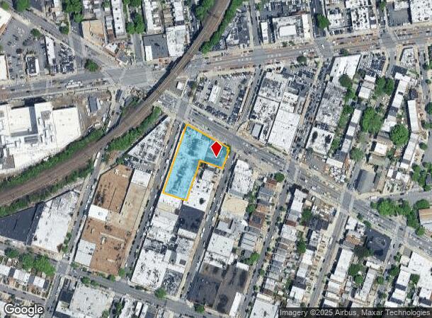
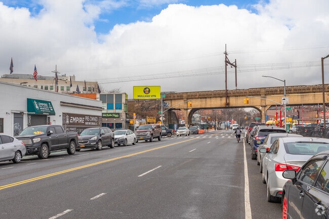
Property Record
5502 Broadway, Woodside, NY 11377
NEARBY LISTINGS FOR SALE OR LEASE
Property Detail
5502 Broadway
01194-0032
Hitchcocks Plan For Homes At Woodside
Warehouse
Queens
X
New York
3604970094F
32
2024
0.88 AC
2025
Northwest Queens
025500
Long Island (New York)
31,675 SF
New York-Jersey City-White Plains, NY-NJ
DEMOGRAPHICS near 5502 Broadway
1 mile
3 mile
5 mile
2024 Total Population
142,542
911,971
2,879,363
2029 Population
134,660
855,151
2,688,783
Pop Growth 2024-2029
(5.53%)
(6.23%)
(6.62%)
Average Age
41
40
40
2024 Total Households
55,400
361,732
1,209,766
HH Growth 2024-2029
(5.68%)
(6.31%)
(6.91%)
Median Household Inc
$69,941
$80,477
$78,140
Avg Household Size
2.50
2.40
2.30
2024 Avg HH Vehicles
1.00
1.00
.00
Median Home Value
$636,933
$750,942
$823,070
Median Year Built
1950
1954
1955
Nearby Places
Map Layers
Map Styles
 Street
 Aerial
Transit
 Traffic
 Biking
Places
Listings with unknown addresses are not visible on the map
- Restaurants
- Banks
- Shops
- Fitness
- Groceries
PUBLIC TRANSPORTATION
TRANSIT/SUBWAY
Northern Boulevard (E - New York MTA Subway (The Subway), M - New York MTA Subway (The Subway), R - New York MTA Subway (The Subway))
Drive
Walk
Distance
Northern Boulevard (E - New York MTA Subway (The Subway), M - New York MTA Subway (The Subway), R - New York MTA Subway (The Subway))
2 min
3 min
0.1 mi
65 Street (E - New York MTA Subway (The Subway), M - New York MTA Subway (The Subway), R - New York MTA Subway (The Subway))
Drive
Walk
Distance
65 Street (E - New York MTA Subway (The Subway), M - New York MTA Subway (The Subway), R - New York MTA Subway (The Subway))
2 min
10 min
0.5 mi
46 Street (E - New York MTA Subway (The Subway), M - New York MTA Subway (The Subway), R - New York MTA Subway (The Subway))
Drive
Walk
Distance
46 Street (E - New York MTA Subway (The Subway), M - New York MTA Subway (The Subway), R - New York MTA Subway (The Subway))
3 min
10 min
0.5 mi
Woodside-61 Street (7 - New York MTA Subway (The Subway))
Drive
Walk
Distance
Woodside-61 Street (7 - New York MTA Subway (The Subway))
3 min
12 min
0.6 mi
Woodside Station (Babylon Branch - Long Island Rail Road, Far Rockaway Branch - Long Island Rail Road, Hempstead Branch - Long Island Rail Road, Long Beach Branch - Long Island Rail Road, Montauk Branch - Long Island Rail Road, Port Jefferson Branch - Long Island Rail Road, Port Washington Branch - Long Island Rail Road, Ronkonkoma Branch - Long Island Rail Road)
Drive
Walk
Distance
Woodside Station (Babylon Branch - Long Island Rail Road, Far Rockaway Branch - Long Island Rail Road, Hempstead Branch - Long Island Rail Road, Long Beach Branch - Long Island Rail Road, Montauk Branch - Long Island Rail Road, Port Jefferson Branch - Long Island Rail Road, Port Washington Branch - Long Island Rail Road, Ronkonkoma Branch - Long Island Rail Road)
3 min
12 min
0.6 mi
COMMUTER RAIL
Woodside Station (Babylon Branch - Long Island Rail Road, Far Rockaway Branch - Long Island Rail Road, Hempstead Branch - Long Island Rail Road, Long Beach Branch - Long Island Rail Road, Montauk Branch - Long Island Rail Road, Port Jefferson Branch - Long Island Rail Road, Port Washington Branch - Long Island Rail Road, Ronkonkoma Branch - Long Island Rail Road)
Drive
Walk
Distance
Woodside Station (Babylon Branch - Long Island Rail Road, Far Rockaway Branch - Long Island Rail Road, Hempstead Branch - Long Island Rail Road, Long Beach Branch - Long Island Rail Road, Montauk Branch - Long Island Rail Road, Port Jefferson Branch - Long Island Rail Road, Port Washington Branch - Long Island Rail Road, Ronkonkoma Branch - Long Island Rail Road)
3 min
12 min
0.6 mi
Hunterspoint Avenue Station (Hempstead Branch - Long Island Rail Road, Oyster Bay Branch - Long Island Rail Road)
Drive
Walk
Distance
Hunterspoint Avenue Station (Hempstead Branch - Long Island Rail Road, Oyster Bay Branch - Long Island Rail Road)
8 min
2.8 mi
AIRPORT
LaGuardia
Drive
Walk
Distance
LaGuardia
8 min
3.0 mi
John F Kennedy International
Drive
Walk
Distance
John F Kennedy International
20 min
13.1 mi
Newark Liberty International
Drive
Walk
Distance
Newark Liberty International
32 min
20.6 mi
Freight Ports
NY - Red Hook Container Terminal
Drive
Walk
Distance
NY - Red Hook Container Terminal
18 min
9.4 mi
SALE & LEASE HISTORY
LISTING DATE
SALE/LEASE

Sep 25, 2016
For Lease
Mar 25, 2021
For Lease
Aug 14, 2024
For Lease
Nearby Properties
Address
Land Use
TOTAL SIZE
Lot Size
Zoning
Address
Land Use
TOTAL SIZE
Lot Size
Zoning
97.14 AC
R7-2
Address
Land Use
TOTAL SIZE
Lot Size
Zoning
1.22 AC
R7-2
Address
Land Use
TOTAL SIZE
Lot Size
Zoning
0.92 AC
R7-2
Address
Land Use
TOTAL SIZE
Lot Size
Zoning
97.14 AC
R7-2
Address
Land Use
TOTAL SIZE
Lot Size
Zoning
4,380,201 SF
97.06 AC
R7-2
Address
Land Use
TOTAL SIZE
Lot Size
Zoning
2,230,742 SF
6.33 AC
R9
Address
Land Use
TOTAL SIZE
Lot Size
Zoning
988,829 SF
1.44 AC
R10
Address
Land Use
TOTAL SIZE
Lot Size
Zoning
988,829 SF
1.44 AC
R10
Address
Land Use
TOTAL SIZE
Lot Size
Zoning
988,829 SF
1.44 AC
R10
Address
Land Use
TOTAL SIZE
Lot Size
Zoning
988,829 SF
1.44 AC
R10
Address
Land Use
TOTAL SIZE
Lot Size
Zoning
988,829 SF
1.44 AC
R10
Address
Land Use
TOTAL SIZE
Lot Size
Zoning
988,829 SF
1.44 AC
R10
Address
Land Use
TOTAL SIZE
Lot Size
Zoning
988,829 SF
1.44 AC
R10
Address
Land Use
TOTAL SIZE
Lot Size
Zoning
988,829 SF
1.44 AC
R10
Address
Land Use
TOTAL SIZE
Lot Size
Zoning
988,829 SF
1.44 AC
R10
Address
Land Use
TOTAL SIZE
Lot Size
Zoning
988,829 SF
1.44 AC
R10
Address
Land Use
TOTAL SIZE
Lot Size
Zoning
988,829 SF
1.44 AC
R10
Address
Land Use
TOTAL SIZE
Lot Size
Zoning
988,829 SF
1.44 AC
R10
Address
Land Use
TOTAL SIZE
Lot Size
Zoning
988,829 SF
1.44 AC
R10
Address
Land Use
TOTAL SIZE
Lot Size
Zoning
988,829 SF
1.44 AC
R10
Address
Land Use
TOTAL SIZE
Lot Size
Zoning
988,829 SF
1.44 AC
R10
Address
Land Use
TOTAL SIZE
Lot Size
Zoning
988,829 SF
1.44 AC
R10
Address
Land Use
TOTAL SIZE
Lot Size
Zoning
988,829 SF
1.44 AC
R10
Address
Land Use
TOTAL SIZE
Lot Size
Zoning
988,829 SF
1.44 AC
R10
Address
Land Use
TOTAL SIZE
Lot Size
Zoning
988,829 SF
1.44 AC
R10
Address
Land Use
TOTAL SIZE
Lot Size
Zoning
988,829 SF
1.44 AC
R10
Address
Land Use
TOTAL SIZE
Lot Size
Zoning
988,829 SF
1.44 AC
R10
Address
Land Use
TOTAL SIZE
Lot Size
Zoning
988,829 SF
1.44 AC
R10
Address
Land Use
TOTAL SIZE
Lot Size
Zoning
988,829 SF
1.44 AC
R10
Address
Land Use
TOTAL SIZE
Lot Size
Zoning
988,829 SF
1.44 AC
R10
The World's #1 Commercial Real Estate Marketplace
Connect with us
© 2026 CoStar Group
The information above has been obtained from sources believed reliable. While we do not doubt its accuracy we have not verified it and make no guarantee, warranty or representation about it. It is your responsibility to independently confirm its accuracy and completeness. Any projections, opinions, assumptions, or estimates used are for example only and do not represent the current or future performance of the property. The value of this transaction to you depends on tax and other factors which should be evaluated by your tax, financial, and legal advisors. You and your advisors should conduct a careful, independent investigation of the property to determine to your satisfaction the suitability of the property for your needs.