Property Record
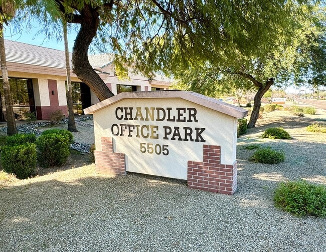
5505 W Chandler Blvd, Chandler, AZ 85226

Current Lease Availabilities
NEARBY LISTINGS FOR SALE OR LEASE
Property Detail
5505 W Chandler Blvd
Phoenix-Mesa-Scottsdale, AZ
Chandler Office Park Condominium
308-04-945
CHANDLER OFFICE PARK CONDOMINIUM MCR 578-49
Officecondo
Maricopa
X
Arizona
04013C2720L
b5
2025
0.06 AC
2025
South Tempe/Ahwatukee
810900
Phoenix
10,424 SF
DEMOGRAPHICS near 5505 W Chandler Blvd
1 Mile
3 Mile
5 Mile
2024 Total Population
13,829
69,967
218,736
2029 Population
14,858
75,088
235,263
Pop Growth 2024-2029
+ 7.44%
+ 7.32%
+ 7.56%
Average Age
40
39
39
2024 Total Households
5,337
27,904
87,676
HH Growth 2024-2029
+ 7.49%
+ 7.40%
+ 7.67%
Median Household Inc
$106,948
$100,486
$92,439
Avg Household Size
2.50
2.40
2.40
2024 Avg HH Vehicles
2.00
2.00
2.00
Median Home Value
$388,862
$435,330
$400,841
Median Year Built
1991
1992
1990
Nearby Places
Map Layers
Map Styles
 Street
 Aerial
- Restaurants
- Banks
- Shops
- Fitness
- Groceries
PUBLIC TRANSPORTATION
AIRPORT
Phoenix Sky Harbor International
DRIVE
WALK
Distance
Phoenix Sky Harbor International
22 min
14.0 mi
Phoenix-Mesa Gateway
DRIVE
WALK
Distance
Phoenix-Mesa Gateway
27 min
17.9 mi
Freight Ports
Port of San Diego
DRIVE
WALK
Distance
Port of San Diego
395 min
360.6 mi
Nearby Properties
Address
Land Use
TOTAL SIZE
Lot Size
Zoning
Address
Land Use
TOTAL SIZE
Lot Size
Zoning
136,458 SF
7.85 AC
PAD
Address
Land Use
TOTAL SIZE
Lot Size
Zoning
128,194 SF
8.58 AC
PAD
Address
Land Use
TOTAL SIZE
Lot Size
Zoning
724,125 SF
41.62 AC
PAD
Address
Land Use
TOTAL SIZE
Lot Size
Zoning
1,149,733 SF
70.56 AC
PAD
Address
Land Use
TOTAL SIZE
Lot Size
Zoning
724,125 SF
39.23 AC
Address
Land Use
TOTAL SIZE
Lot Size
Zoning
14.98 AC
I-1
Address
Land Use
TOTAL SIZE
Lot Size
Zoning
774,482 SF
25.50 AC
PAD
Address
Land Use
TOTAL SIZE
Lot Size
Zoning
656,241 SF
29.09 AC
PAD
Address
Land Use
TOTAL SIZE
Lot Size
Zoning
1,085,359 SF
74.95 AC
PAD
Address
Land Use
TOTAL SIZE
Lot Size
Zoning
2.57 AC
Address
Land Use
TOTAL SIZE
Lot Size
Zoning
395,055 SF
8.33 AC
PAD
Address
Land Use
TOTAL SIZE
Lot Size
Zoning
442,642 SF
35.15 AC
GID
Address
Land Use
TOTAL SIZE
Lot Size
Zoning
393,258 SF
49.79 AC
AG
Address
Land Use
TOTAL SIZE
Lot Size
Zoning
412,062 SF
21.84 AC
C-C
Address
Land Use
TOTAL SIZE
Lot Size
Zoning
249,019 SF
23.96 AC
AG
Address
Land Use
TOTAL SIZE
Lot Size
Zoning
713,461 SF
38.66 AC
I-1
Address
Land Use
TOTAL SIZE
Lot Size
Zoning
283,782 SF
25.29 AC
I-1
Address
Land Use
TOTAL SIZE
Lot Size
Zoning
409,148 SF
29.15 AC
I-1
Address
Land Use
TOTAL SIZE
Lot Size
Zoning
301,597 SF
10.79 AC
PAD
Address
Land Use
TOTAL SIZE
Lot Size
Zoning
244,900 SF
38.47 AC
PF
Address
Land Use
TOTAL SIZE
Lot Size
Zoning
326,158 SF
7.35 AC
PAD
Address
Land Use
TOTAL SIZE
Lot Size
Zoning
379,460 SF
11.40 AC
PAD
Address
Land Use
TOTAL SIZE
Lot Size
Zoning
300,965 SF
13.37 AC
PAD
Address
Land Use
TOTAL SIZE
Lot Size
Zoning
229,469 SF
23.78 AC
PAD
Address
Land Use
TOTAL SIZE
Lot Size
Zoning
313,144 SF
8.62 AC
PAD
Address
Land Use
TOTAL SIZE
Lot Size
Zoning
214,126 SF
11.42 AC
Address
Land Use
TOTAL SIZE
Lot Size
Zoning
453,582 SF
21.58 AC
PAD
Address
Land Use
TOTAL SIZE
Lot Size
Zoning
240,814 SF
22.70 AC
C2
Address
Land Use
TOTAL SIZE
Lot Size
Zoning
260,717 SF
17.31 AC
PAD
Address
Land Use
TOTAL SIZE
Lot Size
Zoning
480,044 SF
20.47 AC
R-3A
The World's #1 Commercial Real Estate Marketplace
Connect with us
© 2026 CoStar Group
The information above has been obtained from sources believed reliable. While we do not doubt its accuracy we have not verified it and make no guarantee, warranty or representation about it. It is your responsibility to independently confirm its accuracy and completeness. Any projections, opinions, assumptions, or estimates used are for example only and do not represent the current or future performance of the property. The value of this transaction to you depends on tax and other factors which should be evaluated by your tax, financial, and legal advisors. You and your advisors should conduct a careful, independent investigation of the property to determine to your satisfaction the suitability of the property for your needs.