Property Record
551 Mayer St, Bridgeville, PA 15017


NEARBY LISTINGS FOR SALE OR LEASE
Property Detail
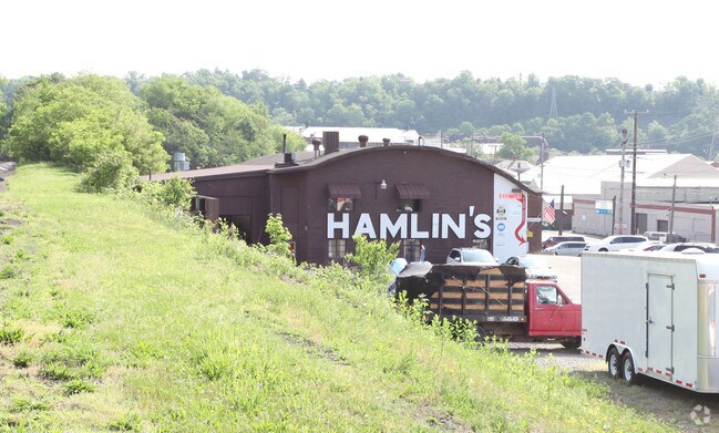
551 Mayer St
Pittsburgh, PA
Tremonti Plan
0196-S-00006-0000-00
TREMONTI PLAN #1 IRREG LOT = 190.18X 219.52X156.60 (.874 ALD) MAYER ST 1 STY METAL CLAD BLDG
Autorepair
Allegheny
X
Pennsylvania
42125C0205E
6
2024
3.60 AC
2025
South Pittsburgh/I-79
458001
Pittsburgh
DEMOGRAPHICS near 551 Mayer St
1 mile
3 mile
5 mile
2024 Total Population
6,722
59,633
169,709
2029 Population
6,546
58,184
165,593
Pop Growth 2024-2029
(2.62%)
(2.43%)
(2.43%)
Average Age
45
44
43
2024 Total Households
3,191
24,634
72,680
HH Growth 2024-2029
(2.70%)
(2.52%)
(2.52%)
Median Household Inc
$70,541
$97,934
$91,791
Avg Household Size
2.00
2.30
2.30
2024 Avg HH Vehicles
2.00
2.00
2.00
Median Home Value
$175,384
$280,612
$250,883
Median Year Built
1954
1962
1959
Nearby Places
Map Layers
Map Styles
 Street
 Aerial
Transit
 Traffic
 Biking
Places
Listings with unknown addresses are not visible on the map
- Restaurants
- Banks
- Shops
- Fitness
- Groceries
PUBLIC TRANSPORTATION
AIRPORT
Pittsburgh International
Drive
Walk
Distance
Pittsburgh International
25 min
15.3 mi
Nearby Properties
Address
Land Use
TOTAL SIZE
Lot Size
Zoning
Address
Land Use
TOTAL SIZE
Lot Size
Zoning
Address
Land Use
TOTAL SIZE
Lot Size
Zoning
62.76 AC
Address
Land Use
TOTAL SIZE
Lot Size
Zoning
Address
Land Use
TOTAL SIZE
Lot Size
Zoning
28.59 AC
Address
Land Use
TOTAL SIZE
Lot Size
Zoning
31.68 AC
Address
Land Use
TOTAL SIZE
Lot Size
Zoning
40.46 AC
Address
Land Use
TOTAL SIZE
Lot Size
Zoning
15.88 AC
Address
Land Use
TOTAL SIZE
Lot Size
Zoning
239.25 AC
Address
Land Use
TOTAL SIZE
Lot Size
Zoning
14.32 AC
Address
Land Use
TOTAL SIZE
Lot Size
Zoning
21.38 AC
Address
Land Use
TOTAL SIZE
Lot Size
Zoning
Address
Land Use
TOTAL SIZE
Lot Size
Zoning
Address
Land Use
TOTAL SIZE
Lot Size
Zoning
24.33 AC
Address
Land Use
TOTAL SIZE
Lot Size
Zoning
12.68 AC
Address
Land Use
TOTAL SIZE
Lot Size
Zoning
17.50 AC
Address
Land Use
TOTAL SIZE
Lot Size
Zoning
Address
Land Use
TOTAL SIZE
Lot Size
Zoning
5.29 AC
Address
Land Use
TOTAL SIZE
Lot Size
Zoning
Address
Land Use
TOTAL SIZE
Lot Size
Zoning
17.04 AC
Address
Land Use
TOTAL SIZE
Lot Size
Zoning
Address
Land Use
TOTAL SIZE
Lot Size
Zoning
15.26 AC
Address
Land Use
TOTAL SIZE
Lot Size
Zoning
37.96 AC
Address
Land Use
TOTAL SIZE
Lot Size
Zoning
16.70 AC
Address
Land Use
TOTAL SIZE
Lot Size
Zoning
12.03 AC
Address
Land Use
TOTAL SIZE
Lot Size
Zoning
15.53 AC
Address
Land Use
TOTAL SIZE
Lot Size
Zoning
0.12 AC
Address
Land Use
TOTAL SIZE
Lot Size
Zoning
0.12 AC
Address
Land Use
TOTAL SIZE
Lot Size
Zoning
Address
Land Use
TOTAL SIZE
Lot Size
Zoning
Address
Land Use
TOTAL SIZE
Lot Size
Zoning
The World's #1 Commercial Real Estate Marketplace
Connect with us
© 2026 CoStar Group
The information above has been obtained from sources believed reliable. While we do not doubt its accuracy we have not verified it and make no guarantee, warranty or representation about it. It is your responsibility to independently confirm its accuracy and completeness. Any projections, opinions, assumptions, or estimates used are for example only and do not represent the current or future performance of the property. The value of this transaction to you depends on tax and other factors which should be evaluated by your tax, financial, and legal advisors. You and your advisors should conduct a careful, independent investigation of the property to determine to your satisfaction the suitability of the property for your needs.