Property Record
5511 Bankhead Hwy, Birmingham, AL 35210

NEARBY LISTINGS FOR SALE OR LEASE
Property Detail
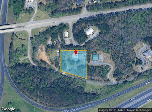
5511 Bankhead Hwy
Birmingham-Hoover, AL
United Ch Of God One Lto
24-00-15-3-000-002.018
LOT 1 UNITED CHURCH OF GODS ONE LOT SUB PB 190 PG 60
Commercialnec
Jefferson
X
Alabama
01073C0417H
1
2023
2.50 AC
2024
Trussville
012701
Birmingham
3,500 SF
DEMOGRAPHICS near 5511 Bankhead Hwy
1 Mile
3 Mile
5 Mile
2024 Total Population
1,043
6,266
52,149
2029 Population
1,016
6,141
50,966
Pop Growth 2024-2029
(2.59%)
(1.99%)
(2.27%)
Average Age
41
43
40
2024 Total Households
391
2,525
20,478
HH Growth 2024-2029
(2.56%)
(2.14%)
(2.35%)
Median Household Inc
$57,793
$66,364
$62,910
Avg Household Size
2.50
2.30
2.40
2024 Avg HH Vehicles
2.00
2.00
2.00
Median Home Value
$198,226
$216,518
$194,232
Median Year Built
1977
1978
1974
Nearby Places
Map Layers
Map Styles
 Street
 Aerial
- Restaurants
- Banks
- Shops
- Fitness
- Groceries
PUBLIC TRANSPORTATION
AIRPORT
Birmingham-Shuttlesworth International
DRIVE
WALK
Distance
Birmingham-Shuttlesworth International
14 min
8.7 mi
SALE & LEASE HISTORY
LISTING DATE
SALE/LEASE

Sep 23, 2016
For Sale
Nearby Properties
Address
Land Use
TOTAL SIZE
Lot Size
Zoning
Address
Land Use
TOTAL SIZE
Lot Size
Zoning
174,247 SF
46.70 AC
INST
Address
Land Use
TOTAL SIZE
Lot Size
Zoning
356,967 SF
34.71 AC
I3S&
Address
Land Use
TOTAL SIZE
Lot Size
Zoning
146,331 SF
161 AC
I3S&
Address
Land Use
TOTAL SIZE
Lot Size
Zoning
158,161 SF
15.48 AC
C1
Address
Land Use
TOTAL SIZE
Lot Size
Zoning
125,324 SF
53 AC
INST
Address
Land Use
TOTAL SIZE
Lot Size
Zoning
146,749 SF
23.99 AC
B2
Address
Land Use
TOTAL SIZE
Lot Size
Zoning
137,168 SF
63 AC
A1
Address
Land Use
TOTAL SIZE
Lot Size
Zoning
168,744 SF
8.46 AC
I1
Address
Land Use
TOTAL SIZE
Lot Size
Zoning
43,566 SF
18.99 AC
C1
Address
Land Use
TOTAL SIZE
Lot Size
Zoning
52,416 SF
7 AC
A1
Address
Land Use
TOTAL SIZE
Lot Size
Zoning
194,730 SF
25 AC
I-1
Address
Land Use
TOTAL SIZE
Lot Size
Zoning
113,014 SF
8 AC
I1
Address
Land Use
TOTAL SIZE
Lot Size
Zoning
47,720 SF
5.21 AC
QB2
Address
Land Use
TOTAL SIZE
Lot Size
Zoning
28,666 SF
4.41 AC
B2
Address
Land Use
TOTAL SIZE
Lot Size
Zoning
64,859 SF
105 AC
INST
Address
Land Use
TOTAL SIZE
Lot Size
Zoning
97,021 SF
17.50 AC
R1
Address
Land Use
TOTAL SIZE
Lot Size
Zoning
170,992 SF
10 AC
C1
Address
Land Use
TOTAL SIZE
Lot Size
Zoning
76,037 SF
32.40 AC
A1
Address
Land Use
TOTAL SIZE
Lot Size
Zoning
14,432 SF
38.50 AC
I1
Address
Land Use
TOTAL SIZE
Lot Size
Zoning
170,783 SF
105 AC
PR1
Address
Land Use
TOTAL SIZE
Lot Size
Zoning
40,759 SF
5.40 AC
C-1
Address
Land Use
TOTAL SIZE
Lot Size
Zoning
22,866 SF
4.41 AC
A1
Address
Land Use
TOTAL SIZE
Lot Size
Zoning
22.57 AC
I3
Address
Land Use
TOTAL SIZE
Lot Size
Zoning
31,128 SF
6.32 AC
C1
Address
Land Use
TOTAL SIZE
Lot Size
Zoning
89,670 SF
7 AC
C-2
Address
Land Use
TOTAL SIZE
Lot Size
Zoning
46,981 SF
92 AC
I3S&
Address
Land Use
TOTAL SIZE
Lot Size
Zoning
58,200 SF
7.20 AC
I1
Address
Land Use
TOTAL SIZE
Lot Size
Zoning
108,922 SF
7.70 AC
QM-1
Address
Land Use
TOTAL SIZE
Lot Size
Zoning
94,513 SF
9.57 AC
C1
Address
Land Use
TOTAL SIZE
Lot Size
Zoning
29,057 SF
103 AC
A1
The World's #1 Commercial Real Estate Marketplace
Connect with us
© 2025 CoStar Group
The information above has been obtained from sources believed reliable. While we do not doubt its accuracy we have not verified it and make no guarantee, warranty or representation about it. It is your responsibility to independently confirm its accuracy and completeness. Any projections, opinions, assumptions, or estimates used are for example only and do not represent the current or future performance of the property. The value of this transaction to you depends on tax and other factors which should be evaluated by your tax, financial, and legal advisors. You and your advisors should conduct a careful, independent investigation of the property to determine to your satisfaction the suitability of the property for your needs.