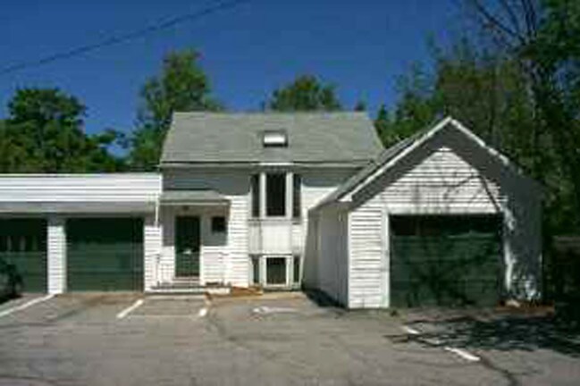
Property Record
552 Center Rd, Hillsborough, NH 03244

NEARBY LISTINGS FOR SALE OR LEASE
-
-
View all Hillsborough listings for sale on LoopNet.com
Property Detail
552 Center Rd
Sfr
Hillsborough
X
New Hampshire
33013C0470E
6.50 AC
2024
Hillsborough
2024
Boston
025502
Manchester-Nashua, NH
2,251 SF
HLBO-000008-000039
DEMOGRAPHICS near 552 Center Rd
1 mile
3 mile
5 mile
2024 Total Population
184
5,193
7,972
2029 Population
189
5,283
8,148
Pop Growth 2024-2029
+ 2.72%
+ 1.73%
+ 2.21%
Average Age
43
42
43
2024 Total Households
72
2,084
3,212
HH Growth 2024-2029
+ 2.78%
+ 1.58%
+ 2.12%
Median Household Inc
$105,555
$89,737
$89,752
Avg Household Size
2.50
2.40
2.40
2024 Avg HH Vehicles
2.00
2.00
2.00
Median Home Value
$273,683
$254,466
$272,854
Median Year Built
1982
1977
1976
Nearby Places
Map Layers
Map Styles
 Street
 Aerial
Transit
 Traffic
 Biking
Places
Listings with unknown addresses are not visible on the map
- Restaurants
- Banks
- Shops
- Fitness
- Groceries
PUBLIC TRANSPORTATION
AIRPORT
Manchester Boston Regional
Drive
Walk
Distance
Manchester Boston Regional
70 min
46.6 mi
Nearby Properties
Address
Land Use
TOTAL SIZE
Lot Size
Zoning
Address
Land Use
TOTAL SIZE
Lot Size
Zoning
87,818 SF
19.80 AC
COMM-W
Address
Land Use
TOTAL SIZE
Lot Size
Zoning
44,806 SF
17.40 AC
COMM-W
Address
Land Use
TOTAL SIZE
Lot Size
Zoning
83,825 SF
18.90 AC
COMM-W
Address
Land Use
TOTAL SIZE
Lot Size
Zoning
63,191 SF
11.23 AC
COMM-W
Address
Land Use
TOTAL SIZE
Lot Size
Zoning
0.93 AC
COMM-W
Address
Land Use
TOTAL SIZE
Lot Size
Zoning
3,877 SF
7.20 AC
COMM-W
Address
Land Use
TOTAL SIZE
Lot Size
Zoning
23,006 SF
5.17 AC
COMM-W
Address
Land Use
TOTAL SIZE
Lot Size
Zoning
1,504 SF
8.40 AC
COMM-W
Address
Land Use
TOTAL SIZE
Lot Size
Zoning
2,610 SF
3.30 AC
RURAL-
Address
Land Use
TOTAL SIZE
Lot Size
Zoning
12,149 SF
6.60 AC
COMM-W
Address
Land Use
TOTAL SIZE
Lot Size
Zoning
4,985 SF
23.11 AC
RURAL
Address
Land Use
TOTAL SIZE
Lot Size
Zoning
11,388 SF
7.80 AC
COMM-W
Address
Land Use
TOTAL SIZE
Lot Size
Zoning
21,476 SF
5.88 AC
COMM-N
Address
Land Use
TOTAL SIZE
Lot Size
Zoning
538 SF
3 AC
COMM-W
Address
Land Use
TOTAL SIZE
Lot Size
Zoning
11,327 SF
1.50 AC
COMM-W
Address
Land Use
TOTAL SIZE
Lot Size
Zoning
1.40 AC
COMM-W
Address
Land Use
TOTAL SIZE
Lot Size
Zoning
21,846 SF
6.50 AC
COMM-W
Address
Land Use
TOTAL SIZE
Lot Size
Zoning
11,778 SF
2.20 AC
COMM-N
Address
Land Use
TOTAL SIZE
Lot Size
Zoning
26,075 SF
0.30 AC
COMM-W
Address
Land Use
TOTAL SIZE
Lot Size
Zoning
3,325 SF
1.60 AC
COMM-W
Address
Land Use
TOTAL SIZE
Lot Size
Zoning
2,475 SF
53.90 AC
COMM-W
Address
Land Use
TOTAL SIZE
Lot Size
Zoning
1,717 SF
87.60 AC
RURAL
Address
Land Use
TOTAL SIZE
Lot Size
Zoning
10 AC
COMM-W
Address
Land Use
TOTAL SIZE
Lot Size
Zoning
11,686 SF
1.20 AC
COMM-W
Address
Land Use
TOTAL SIZE
Lot Size
Zoning
18,484 SF
0.30 AC
COMM-W
Address
Land Use
TOTAL SIZE
Lot Size
Zoning
7,711 SF
126.54 AC
RURAL
Address
Land Use
TOTAL SIZE
Lot Size
Zoning
25,823 SF
1.90 AC
COMM-W
Address
Land Use
TOTAL SIZE
Lot Size
Zoning
3,798 SF
3 AC
COMM-W
Address
Land Use
TOTAL SIZE
Lot Size
Zoning
2,752 SF
478.40 AC
RURAL
Address
Land Use
TOTAL SIZE
Lot Size
Zoning
7,764 SF
2 AC
COMM-N
The World's #1 Commercial Real Estate Marketplace
Connect with us
© 2026 CoStar Group
The information above has been obtained from sources believed reliable. While we do not doubt its accuracy we have not verified it and make no guarantee, warranty or representation about it. It is your responsibility to independently confirm its accuracy and completeness. Any projections, opinions, assumptions, or estimates used are for example only and do not represent the current or future performance of the property. The value of this transaction to you depends on tax and other factors which should be evaluated by your tax, financial, and legal advisors. You and your advisors should conduct a careful, independent investigation of the property to determine to your satisfaction the suitability of the property for your needs.