Property Record
552 Sumner Rd, Wauchula, FL 33873
NEARBY LISTINGS FOR SALE OR LEASE
-
-
View all Wauchula listings for sale on LoopNet.com
Property Detail
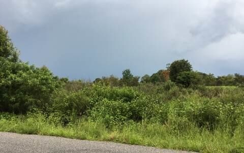
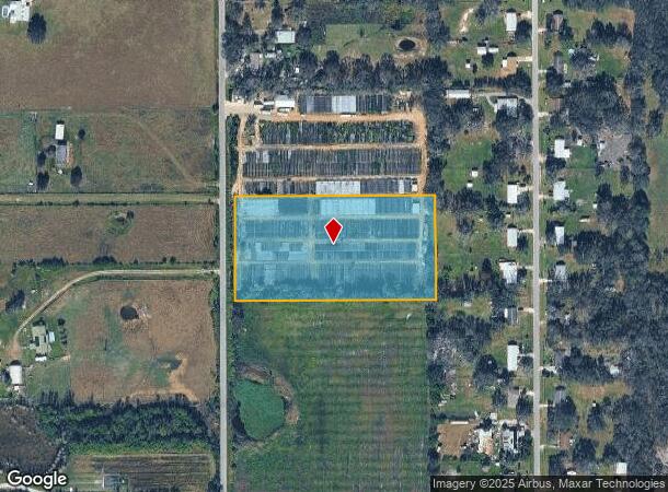
552 Sumner Rd
3633-25-0000-07680-0000
5 AC S1/2 OF SW1/4 OF NW1/4 OF SE1/4 36-33S-25E OR468P308 518P349 548P695 568P695 579P614 656P237 200725007729-EASE 200925006811
Horticulturegrowinghousesagricultural
Hardee
A
Florida
12049C0184D
5 AC
2025
Florida Central South Area
2025
Other Market Areas
970101
Wauchula, FL
DEMOGRAPHICS near 552 Sumner Rd
1 Mile
3 Mile
5 Mile
2024 Total Population
470
4,216
13,673
2029 Population
477
4,292
13,926
Pop Growth 2024-2029
+ 1.49%
+ 1.80%
+ 1.85%
Average Age
39
36
37
2024 Total Households
143
1,370
4,584
HH Growth 2024-2029
+ 1.40%
+ 1.90%
+ 1.99%
Median Household Inc
$81,250
$32,702
$38,951
Avg Household Size
3.00
3.00
2.90
2024 Avg HH Vehicles
3.00
2.00
2.00
Median Home Value
$301,389
$163,580
$146,061
Median Year Built
1978
1978
1979
Nearby Places
Map Layers
Map Styles
 Street
 Aerial
- Restaurants
- Banks
- Shops
- Fitness
- Groceries
SALE & LEASE HISTORY
LISTING DATE
SALE/LEASE

Dec 05, 2017
For Sale
Nearby Properties
Address
Land Use
TOTAL SIZE
Lot Size
Zoning
Address
Land Use
TOTAL SIZE
Lot Size
Zoning
1,447.86 AC
A-1
Address
Land Use
TOTAL SIZE
Lot Size
Zoning
50,071 SF
9.78 AC
C-2
Address
Land Use
TOTAL SIZE
Lot Size
Zoning
107,610 SF
14.32 AC
C-1
Address
Land Use
TOTAL SIZE
Lot Size
Zoning
45,018 SF
17.48 AC
P-SP
Address
Land Use
TOTAL SIZE
Lot Size
Zoning
104,690 SF
9.96 AC
F-R
Address
Land Use
TOTAL SIZE
Lot Size
Zoning
54,007 SF
9 AC
P-SP
Address
Land Use
TOTAL SIZE
Lot Size
Zoning
13.28 AC
F-R
Address
Land Use
TOTAL SIZE
Lot Size
Zoning
197.66 AC
A-1
Address
Land Use
TOTAL SIZE
Lot Size
Zoning
432 SF
9.75 AC
P-SP
Address
Land Use
TOTAL SIZE
Lot Size
Zoning
581.63 AC
A-1
Address
Land Use
TOTAL SIZE
Lot Size
Zoning
2,708 SF
225.32 AC
A-1
Address
Land Use
TOTAL SIZE
Lot Size
Zoning
60,546 SF
14.57 AC
R-3
Address
Land Use
TOTAL SIZE
Lot Size
Zoning
1,415 SF
166.35 AC
A-1
Address
Land Use
TOTAL SIZE
Lot Size
Zoning
35,140 SF
2.02 AC
P-SP
Address
Land Use
TOTAL SIZE
Lot Size
Zoning
425.01 AC
A-1
Address
Land Use
TOTAL SIZE
Lot Size
Zoning
288.71 AC
A-1
Address
Land Use
TOTAL SIZE
Lot Size
Zoning
122.34 AC
A-1
Address
Land Use
TOTAL SIZE
Lot Size
Zoning
5,938 SF
68.61 AC
A-1
Address
Land Use
TOTAL SIZE
Lot Size
Zoning
27,168 SF
3.62 AC
C-1
Address
Land Use
TOTAL SIZE
Lot Size
Zoning
29,145 SF
0.80 AC
HC-1
Address
Land Use
TOTAL SIZE
Lot Size
Zoning
97,776 SF
6.29 AC
I
Address
Land Use
TOTAL SIZE
Lot Size
Zoning
62.17 AC
A-1
Address
Land Use
TOTAL SIZE
Lot Size
Zoning
15,172 SF
97.50 AC
A-1
Address
Land Use
TOTAL SIZE
Lot Size
Zoning
36,279 SF
13.22 AC
A-1
Address
Land Use
TOTAL SIZE
Lot Size
Zoning
5,495 SF
269.87 AC
A-1
Address
Land Use
TOTAL SIZE
Lot Size
Zoning
196.63 AC
A-1
Address
Land Use
TOTAL SIZE
Lot Size
Zoning
28,174 SF
5.05 AC
C-2
Address
Land Use
TOTAL SIZE
Lot Size
Zoning
23,747 SF
7.28 AC
R-3
Address
Land Use
TOTAL SIZE
Lot Size
Zoning
12,170 SF
1.11 AC
P-SP
Address
Land Use
TOTAL SIZE
Lot Size
Zoning
14,632 SF
2.92 AC
P-SP
The World's #1 Commercial Real Estate Marketplace
Connect with us
© 2025 CoStar Group
The information above has been obtained from sources believed reliable. While we do not doubt its accuracy we have not verified it and make no guarantee, warranty or representation about it. It is your responsibility to independently confirm its accuracy and completeness. Any projections, opinions, assumptions, or estimates used are for example only and do not represent the current or future performance of the property. The value of this transaction to you depends on tax and other factors which should be evaluated by your tax, financial, and legal advisors. You and your advisors should conduct a careful, independent investigation of the property to determine to your satisfaction the suitability of the property for your needs.