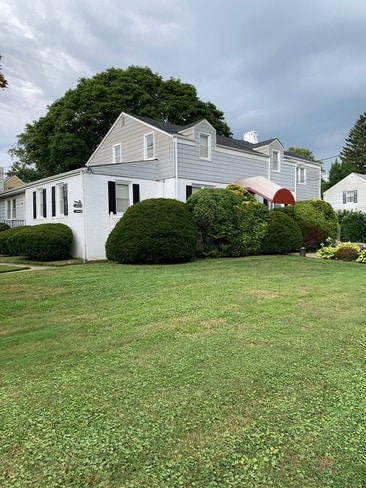
Property Record
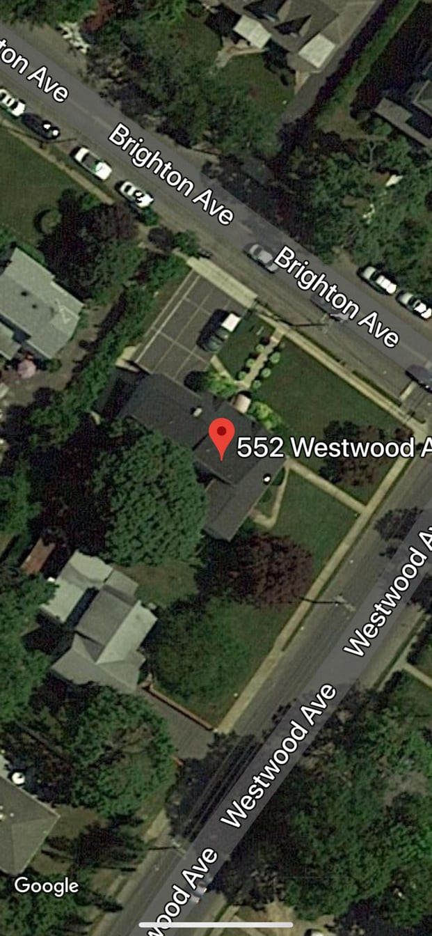
552 Westwood Ave, Long Branch, NJ 07740
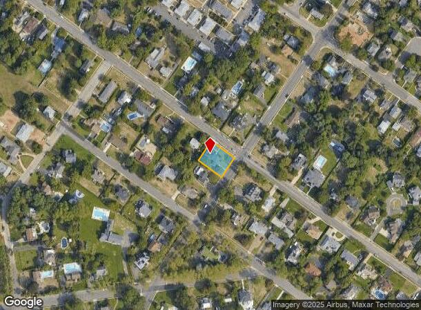
NEARBY LISTINGS FOR SALE OR LEASE
Property Detail
552 Westwood Ave
New York-Jersey City-White Plains, NY-NJ
Monmouth
27-00107-0000-00006
New Jersey
Sfr
0.29 AC
X
Eastern Monmouth
34025C0211F
Northern New Jersey
3,298 SF
DEMOGRAPHICS near 552 Westwood Ave
1 Mile
3 Mile
5 Mile
2024 Total Population
19,302
65,349
128,231
2029 Population
19,489
65,862
128,871
Pop Growth 2024-2029
+ 0.97%
+ 0.79%
+ 0.50%
Average Age
39
40
42
2024 Total Households
7,186
24,393
51,648
HH Growth 2024-2029
+ 1.36%
+ 0.84%
+ 0.46%
Median Household Inc
$65,341
$79,821
$89,182
Avg Household Size
2.40
2.50
2.40
2024 Avg HH Vehicles
2.00
2.00
2.00
Median Home Value
$514,351
$553,318
$593,203
Median Year Built
1962
1968
1969
Nearby Places
- Restaurants
- Banks
- Shops
- Fitness
- Groceries
PUBLIC TRANSPORTATION
COMMUTER RAIL
Long Branch (North Jersey Coast Line - NJ Transit Commuter Rail (NJ Transit))
DRIVE
WALK
Distance
Long Branch (North Jersey Coast Line - NJ Transit Commuter Rail (NJ Transit))
3 min
20 min
1.1 mi
Elberon (North Jersey Coast Line - NJ Transit Commuter Rail (NJ Transit))
DRIVE
WALK
Distance
Elberon (North Jersey Coast Line - NJ Transit Commuter Rail (NJ Transit))
4 min
1.7 mi
AIRPORT
Newark Liberty International
DRIVE
WALK
Distance
Newark Liberty International
61 min
48.7 mi
Freight Ports
New York Container Terminal
DRIVE
WALK
Distance
New York Container Terminal
55 min
40.8 mi
SALE & LEASE HISTORY
LISTING DATE
SALE/LEASE

Jan 23, 2024
For Sale
Aug 15, 2019
For Lease
Nearby Properties
Address
Land Use
TOTAL SIZE
Lot Size
Zoning
Address
Land Use
TOTAL SIZE
Lot Size
Zoning
13.75 AC
M
Address
Land Use
TOTAL SIZE
Lot Size
Zoning
75.16 AC
R-7
Address
Land Use
TOTAL SIZE
Lot Size
Zoning
7,819 SF
28.41 AC
R-1
Address
Land Use
TOTAL SIZE
Lot Size
Zoning
89,939 SF
51.49 AC
I
Address
Land Use
TOTAL SIZE
Lot Size
Zoning
279,346 SF
3.59 AC
P/VC
Address
Land Use
TOTAL SIZE
Lot Size
Zoning
267,887 SF
13.45 AC
HC
Address
Land Use
TOTAL SIZE
Lot Size
Zoning
136.40 AC
B2
Address
Land Use
TOTAL SIZE
Lot Size
Zoning
22,877 SF
10.35 AC
IC
Address
Land Use
TOTAL SIZE
Lot Size
Zoning
194,784 SF
2.88 AC
P/VC
Address
Land Use
TOTAL SIZE
Lot Size
Zoning
2,446 SF
21.62 AC
R-5
Address
Land Use
TOTAL SIZE
Lot Size
Zoning
293,262 SF
28.40 AC
HC
Address
Land Use
TOTAL SIZE
Lot Size
Zoning
314,569 SF
22.05 AC
R-4
Address
Land Use
TOTAL SIZE
Lot Size
Zoning
79,391 SF
9.17 AC
C-4
Address
Land Use
TOTAL SIZE
Lot Size
Zoning
5,904 SF
29.80 AC
S-2
Address
Land Use
TOTAL SIZE
Lot Size
Zoning
194,812 SF
55.01 AC
R-4
Address
Land Use
TOTAL SIZE
Lot Size
Zoning
2.19 AC
BG
Address
Land Use
TOTAL SIZE
Lot Size
Zoning
16.49 AC
R-2
Address
Land Use
TOTAL SIZE
Lot Size
Zoning
137,672 SF
2.79 AC
BS
Address
Land Use
TOTAL SIZE
Lot Size
Zoning
121,272 SF
3.93 AC
C-4
Address
Land Use
TOTAL SIZE
Lot Size
Zoning
14.23 AC
R-4
Address
Land Use
TOTAL SIZE
Lot Size
Zoning
77.36 AC
B2
Address
Land Use
TOTAL SIZE
Lot Size
Zoning
157,580 SF
14.95 AC
R-4
Address
Land Use
TOTAL SIZE
Lot Size
Zoning
0.13 AC
BS
Address
Land Use
TOTAL SIZE
Lot Size
Zoning
40.82 AC
I
Address
Land Use
TOTAL SIZE
Lot Size
Zoning
108,629 SF
12.05 AC
HC
Address
Land Use
TOTAL SIZE
Lot Size
Zoning
22,522 SF
6.25 AC
I
Address
Land Use
TOTAL SIZE
Lot Size
Zoning
89,775 SF
7.05 AC
PBO
Address
Land Use
TOTAL SIZE
Lot Size
Zoning
10.47 AC
R-7
Address
Land Use
TOTAL SIZE
Lot Size
Zoning
2,788 SF
1.55 AC
R-1
Address
Land Use
TOTAL SIZE
Lot Size
Zoning
1.53 AC
R-1
The World's #1 Commercial Real Estate Marketplace
Connect with us
© 2025 CoStar Group
The information above has been obtained from sources believed reliable. While we do not doubt its accuracy we have not verified it and make no guarantee, warranty or representation about it. It is your responsibility to independently confirm its accuracy and completeness. Any projections, opinions, assumptions, or estimates used are for example only and do not represent the current or future performance of the property. The value of this transaction to you depends on tax and other factors which should be evaluated by your tax, financial, and legal advisors. You and your advisors should conduct a careful, independent investigation of the property to determine to your satisfaction the suitability of the property for your needs.