Property Record
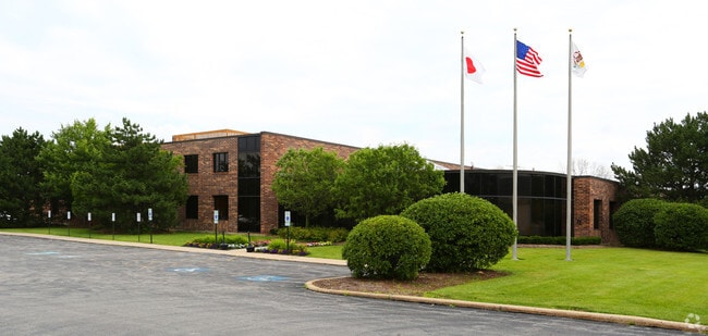
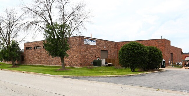
5520 Meadowbrook Ct, Rolling Meadows, IL 60008

Property Detail
5520 Meadowbrook Ct
08-08-301-065-0000
COOK
Industrialgeneral
Illinois
AE The base floodplain where base flood elevations are provided. AE Zones are now used on new format FIRMs instead of A1-A30 Zones.
3.56 AC
2023
Northwest Cook
2025
Chicago
804000
Chicago-Naperville-Elgin, IL-IN
35,760 SF
NEARBY LISTINGS FOR SALE OR LEASE
DEMOGRAPHICS near 5520 Meadowbrook Ct
1 mile
3 mile
5 mile
2025 Total Population
10,576
96,096
296,961
2030 Population
10,686
96,835
299,038
Pop Growth 2025-2030
+ 1.04%
+ 0.77%
+ 0.70%
Average Age
41
41
42
2025 Total Households
4,159
39,303
116,513
HH Growth 2025-2030
+ 0.79%
+ 0.61%
+ 0.50%
Median Household Inc
$82,827
$102,515
$103,600
Avg Household Size
2.50
2.40
2.50
2025 Avg HH Vehicles
2.00
2.00
2.00
Median Home Value
$250,129
$356,684
$361,210
Median Year Built
1973
1972
1972
Nearby Places
Map Layers
Map Styles
 Street
 Aerial
Transit
 Traffic
 Biking
Places
Listings with unknown addresses are not visible on the map
- Restaurants
- Banks
- Shops
- Fitness
- Groceries
PUBLIC TRANSPORTATION
COMMUTER RAIL
Arlington Park Station (Union Pacific Northwest Line - Northeast Illinois Regional Commuter Railroad (Metra))
Drive
Walk
Distance
Arlington Park Station (Union Pacific Northwest Line - Northeast Illinois Regional Commuter Railroad (Metra))
9 min
3.4 mi
Arlington Heights Station (Union Pacific Northwest Line - Northeast Illinois Regional Commuter Railroad (Metra))
Drive
Walk
Distance
Arlington Heights Station (Union Pacific Northwest Line - Northeast Illinois Regional Commuter Railroad (Metra))
9 min
3.9 mi
AIRPORT
Chicago O'Hare International
Drive
Walk
Distance
Chicago O'Hare International
37 min
13.6 mi
Chicago Midway International
Drive
Walk
Distance
Chicago Midway International
52 min
30.2 mi
Nearby Properties
Address
Land Use
TOTAL SIZE
Lot Size
Zoning
Address
Land Use
TOTAL SIZE
Lot Size
Zoning
42.14 AC
Address
Land Use
TOTAL SIZE
Lot Size
Zoning
32.56 AC
Address
Land Use
TOTAL SIZE
Lot Size
Zoning
782,746 SF
12.44 AC
Address
Land Use
TOTAL SIZE
Lot Size
Zoning
300,000 SF
9.29 AC
Address
Land Use
TOTAL SIZE
Lot Size
Zoning
875,776 SF
8.73 AC
Address
Land Use
TOTAL SIZE
Lot Size
Zoning
12.66 AC
Address
Land Use
TOTAL SIZE
Lot Size
Zoning
Address
Land Use
TOTAL SIZE
Lot Size
Zoning
961,890 SF
42.21 AC
Address
Land Use
TOTAL SIZE
Lot Size
Zoning
Address
Land Use
TOTAL SIZE
Lot Size
Zoning
165,128 SF
Address
Land Use
TOTAL SIZE
Lot Size
Zoning
Address
Land Use
TOTAL SIZE
Lot Size
Zoning
510,788 SF
39.93 AC
Address
Land Use
TOTAL SIZE
Lot Size
Zoning
748,059 SF
7.36 AC
Address
Land Use
TOTAL SIZE
Lot Size
Zoning
Address
Land Use
TOTAL SIZE
Lot Size
Zoning
338,694 SF
12.18 AC
Address
Land Use
TOTAL SIZE
Lot Size
Zoning
490,458 SF
13.52 AC
Address
Land Use
TOTAL SIZE
Lot Size
Zoning
365,253 SF
31.07 AC
Address
Land Use
TOTAL SIZE
Lot Size
Zoning
427,761 SF
30.41 AC
Address
Land Use
TOTAL SIZE
Lot Size
Zoning
Address
Land Use
TOTAL SIZE
Lot Size
Zoning
300,686 SF
8.47 AC
Address
Land Use
TOTAL SIZE
Lot Size
Zoning
544,744 SF
14.87 AC
Address
Land Use
TOTAL SIZE
Lot Size
Zoning
Address
Land Use
TOTAL SIZE
Lot Size
Zoning
332,283 SF
Address
Land Use
TOTAL SIZE
Lot Size
Zoning
24.55 AC
Address
Land Use
TOTAL SIZE
Lot Size
Zoning
28,913 SF
6.63 AC
Address
Land Use
TOTAL SIZE
Lot Size
Zoning
642,049 SF
33.14 AC
Address
Land Use
TOTAL SIZE
Lot Size
Zoning
211,275 SF
21.67 AC
Address
Land Use
TOTAL SIZE
Lot Size
Zoning
369,303 SF
29.96 AC
Address
Land Use
TOTAL SIZE
Lot Size
Zoning
325,470 SF
22.20 AC
Address
Land Use
TOTAL SIZE
Lot Size
Zoning
303,671 SF
10.94 AC
The World's #1 Commercial Real Estate Marketplace
Connect with us
© 2026 CoStar Group
The information above has been obtained from sources believed reliable. While we do not doubt its accuracy we have not verified it and make no guarantee, warranty or representation about it. It is your responsibility to independently confirm its accuracy and completeness. Any projections, opinions, assumptions, or estimates used are for example only and do not represent the current or future performance of the property. The value of this transaction to you depends on tax and other factors which should be evaluated by your tax, financial, and legal advisors. You and your advisors should conduct a careful, independent investigation of the property to determine to your satisfaction the suitability of the property for your needs.