Property Record
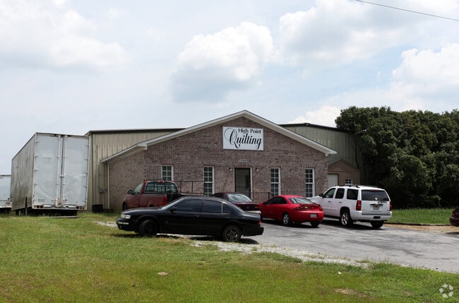
5522 Uwharrie Rd, High Point, NC 27263


Property Detail
5522 Uwharrie Rd
7708-04-6306
RANDOLPH IND PARK;L1 PL:PB21-P24
Warehouse
Randolph
HI
North Carolina
B and X Area of moderate flood hazard, usually the area between the limits of the 100-year and 500-year floods.
1
2025
1.02 AC
2025
NW Randolph Cnty/Archdale
031601
Greensboro/Winston-Salem
14,864 SF
Greensboro-High Point, NC
NEARBY LISTINGS FOR SALE OR LEASE
DEMOGRAPHICS near 5522 Uwharrie Rd
1 mile
3 mile
5 mile
2025 Total Population
1,204
24,399
86,664
2030 Population
1,260
25,141
90,139
Pop Growth 2025-2030
+ 4.65%
+ 3.04%
+ 4.01%
Average Age
42
40
40
2025 Total Households
467
10,064
33,935
HH Growth 2025-2030
+ 4.71%
+ 3.06%
+ 4.16%
Median Household Inc
$66,547
$52,621
$53,590
Avg Household Size
2.40
2.40
2.40
2025 Avg HH Vehicles
2.00
2.00
2.00
Median Home Value
$252,631
$179,423
$195,185
Median Year Built
1990
1978
1974
Nearby Places
Map Layers
Map Styles
 Street
 Aerial
Transit
 Traffic
 Biking
Places
Listings with unknown addresses are not visible on the map
- Restaurants
- Banks
- Shops
- Fitness
- Groceries
PUBLIC TRANSPORTATION
COMMUTER RAIL
High Point Station (Piedmont - North Carolina by Train (NC Train))
Drive
Walk
Distance
High Point Station (Piedmont - North Carolina by Train (NC Train))
13 min
5.3 mi
AIRPORT
Piedmont Triad International
Drive
Walk
Distance
Piedmont Triad International
36 min
17.6 mi
SALE & LEASE HISTORY
LISTING DATE
SALE/LEASE

Feb 13, 2023
For Sale
Nearby Properties
Address
Land Use
TOTAL SIZE
Lot Size
Zoning
Address
Land Use
TOTAL SIZE
Lot Size
Zoning
355,633 SF
63.42 AC
HI
Address
Land Use
TOTAL SIZE
Lot Size
Zoning
204,276 SF
68.51 AC
M-2
Address
Land Use
TOTAL SIZE
Lot Size
Zoning
196,353 SF
13.76 AC
RC
Address
Land Use
TOTAL SIZE
Lot Size
Zoning
156,010 SF
36.21 AC
M-1
Address
Land Use
TOTAL SIZE
Lot Size
Zoning
351,736 SF
34.77 AC
HI
Address
Land Use
TOTAL SIZE
Lot Size
Zoning
127,800 SF
57.35 AC
M-1
Address
Land Use
TOTAL SIZE
Lot Size
Zoning
245,194 SF
23.44 AC
LI
Address
Land Use
TOTAL SIZE
Lot Size
Zoning
107,417 SF
6.46 AC
RM-26
Address
Land Use
TOTAL SIZE
Lot Size
Zoning
101,612 SF
15.82 AC
RM-16
Address
Land Use
TOTAL SIZE
Lot Size
Zoning
426,585 SF
27.46 AC
HI
Address
Land Use
TOTAL SIZE
Lot Size
Zoning
170,516 SF
17.08 AC
RC
Address
Land Use
TOTAL SIZE
Lot Size
Zoning
223,806 SF
12.60 AC
HI
Address
Land Use
TOTAL SIZE
Lot Size
Zoning
82,160 SF
23.62 AC
C2
Address
Land Use
TOTAL SIZE
Lot Size
Zoning
10,810 SF
158.27 AC
PNR
Address
Land Use
TOTAL SIZE
Lot Size
Zoning
7,680 SF
9.95 AC
GRD
Address
Land Use
TOTAL SIZE
Lot Size
Zoning
27,310 SF
20.06 AC
HI
Address
Land Use
TOTAL SIZE
Lot Size
Zoning
109,950 SF
28.29 AC
M-1
Address
Land Use
TOTAL SIZE
Lot Size
Zoning
28.20 AC
RR
Address
Land Use
TOTAL SIZE
Lot Size
Zoning
121,473 SF
32.77 AC
RM-16
Address
Land Use
TOTAL SIZE
Lot Size
Zoning
108,429 SF
14.43 AC
RC
Address
Land Use
TOTAL SIZE
Lot Size
Zoning
98,287 SF
14.50 AC
RM-16
Address
Land Use
TOTAL SIZE
Lot Size
Zoning
52,061 SF
3.03 AC
LI
Address
Land Use
TOTAL SIZE
Lot Size
Zoning
60,183 SF
8.63 AC
C-2
Address
Land Use
TOTAL SIZE
Lot Size
Zoning
7,168 SF
7.51 AC
GRD
Address
Land Use
TOTAL SIZE
Lot Size
Zoning
45,224 SF
8.03 AC
OI
Address
Land Use
TOTAL SIZE
Lot Size
Zoning
104,623 SF
55.13 AC
RR
Address
Land Use
TOTAL SIZE
Lot Size
Zoning
43,000 SF
15.06 AC
HI
Address
Land Use
TOTAL SIZE
Lot Size
Zoning
234,080 SF
14.88 AC
HI
Address
Land Use
TOTAL SIZE
Lot Size
Zoning
9.70 AC
RR
Address
Land Use
TOTAL SIZE
Lot Size
Zoning
303,233 SF
7.11 AC
HI
The World's #1 Commercial Real Estate Marketplace
Connect with us
© 2026 CoStar Group
The information above has been obtained from sources believed reliable. While we do not doubt its accuracy we have not verified it and make no guarantee, warranty or representation about it. It is your responsibility to independently confirm its accuracy and completeness. Any projections, opinions, assumptions, or estimates used are for example only and do not represent the current or future performance of the property. The value of this transaction to you depends on tax and other factors which should be evaluated by your tax, financial, and legal advisors. You and your advisors should conduct a careful, independent investigation of the property to determine to your satisfaction the suitability of the property for your needs.