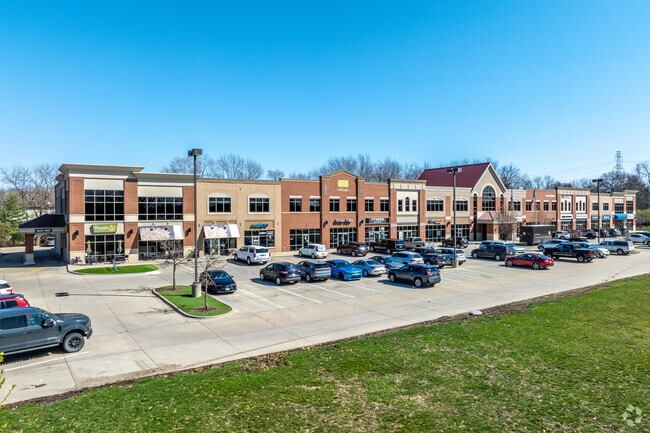
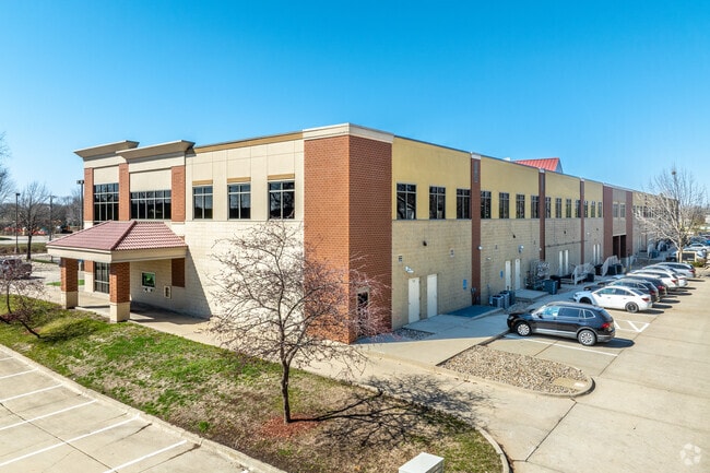
Property Record
5525 Merle Hay Rd, Johnston, IA 50131
NEARBY LISTINGS FOR SALE OR LEASE
Property Detail
5525 Merle Hay Rd
Des Moines-West Des Moines, IA
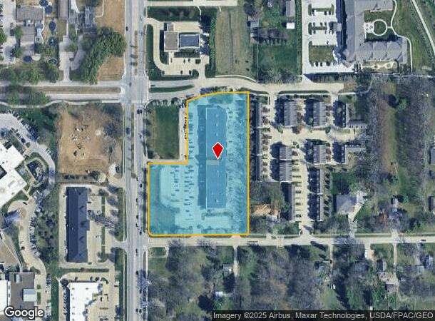
Johnston Station Plat 2
241-00747802011
LOT 1 JOHNSTON STATION PLAT 2
Officebuilding
Polk
X
Iowa
19153C0187F
1
2024
4.40 AC
2025
Western Suburbs
011702
Des Moines
95,400 SF
DEMOGRAPHICS near 5525 Merle Hay Rd
1 Mile
3 Mile
5 Mile
2024 Total Population
4,954
52,087
152,533
2029 Population
5,181
53,695
158,153
Pop Growth 2024-2029
+ 4.58%
+ 3.09%
+ 3.68%
Average Age
43
40
38
2024 Total Households
2,243
21,095
61,172
HH Growth 2024-2029
+ 4.99%
+ 3.33%
+ 3.84%
Median Household Inc
$74,548
$79,288
$75,422
Avg Household Size
2.10
2.40
2.40
2024 Avg HH Vehicles
2.00
2.00
2.00
Median Home Value
$249,144
$234,856
$227,429
Median Year Built
1993
1978
1974
Nearby Places
Map Layers
Map Styles
 Street
 Aerial
- Restaurants
- Banks
- Shops
- Fitness
- Groceries
PUBLIC TRANSPORTATION
AIRPORT
Des Moines International
DRIVE
WALK
Distance
Des Moines International
24 min
11.2 mi
SALE & LEASE HISTORY
LISTING DATE
SALE/LEASE

Oct 18, 2016
For Lease
Jun 25, 2020
For Lease
Nearby Properties
Address
Land Use
TOTAL SIZE
Lot Size
Zoning
Address
Land Use
TOTAL SIZE
Lot Size
Zoning
486,792 SF
38.70 AC
PC
Address
Land Use
TOTAL SIZE
Lot Size
Zoning
627,104 SF
40.09 AC
Address
Land Use
TOTAL SIZE
Lot Size
Zoning
197,658 SF
15.91 AC
Address
Land Use
TOTAL SIZE
Lot Size
Zoning
184,658 SF
14.61 AC
Address
Land Use
TOTAL SIZE
Lot Size
Zoning
133,256 SF
15.93 AC
Address
Land Use
TOTAL SIZE
Lot Size
Zoning
166,160 SF
11.88 AC
Address
Land Use
TOTAL SIZE
Lot Size
Zoning
287,228 SF
27.32 AC
A-R
Address
Land Use
TOTAL SIZE
Lot Size
Zoning
307,734 SF
23.59 AC
R-3
Address
Land Use
TOTAL SIZE
Lot Size
Zoning
71,938 SF
8.23 AC
C-O
Address
Land Use
TOTAL SIZE
Lot Size
Zoning
101,592 SF
7.79 AC
PUD
Address
Land Use
TOTAL SIZE
Lot Size
Zoning
386,236 SF
9.62 AC
C-4
Address
Land Use
TOTAL SIZE
Lot Size
Zoning
141,377 SF
3.16 AC
Address
Land Use
TOTAL SIZE
Lot Size
Zoning
363,736 SF
25.79 AC
M-1
Address
Land Use
TOTAL SIZE
Lot Size
Zoning
188,453 SF
14.20 AC
R-3
Address
Land Use
TOTAL SIZE
Lot Size
Zoning
146,025 SF
9.59 AC
PUD
Address
Land Use
TOTAL SIZE
Lot Size
Zoning
91,985 SF
13.11 AC
PUD
Address
Land Use
TOTAL SIZE
Lot Size
Zoning
223,876 SF
15.01 AC
Address
Land Use
TOTAL SIZE
Lot Size
Zoning
143,831 SF
16.12 AC
PUD
Address
Land Use
TOTAL SIZE
Lot Size
Zoning
95,039 SF
4.52 AC
PUD
Address
Land Use
TOTAL SIZE
Lot Size
Zoning
120,808 SF
4.41 AC
PUD
Address
Land Use
TOTAL SIZE
Lot Size
Zoning
56,478 SF
5.86 AC
Address
Land Use
TOTAL SIZE
Lot Size
Zoning
115,000 SF
3.69 AC
Address
Land Use
TOTAL SIZE
Lot Size
Zoning
158,256 SF
8.87 AC
R-3
Address
Land Use
TOTAL SIZE
Lot Size
Zoning
130,686 SF
1.23 AC
Address
Land Use
TOTAL SIZE
Lot Size
Zoning
130,136 SF
6.77 AC
PARKVIEW P
Address
Land Use
TOTAL SIZE
Lot Size
Zoning
203,062 SF
17.82 AC
C-2
Address
Land Use
TOTAL SIZE
Lot Size
Zoning
92,392 SF
12.40 AC
C-2
Address
Land Use
TOTAL SIZE
Lot Size
Zoning
59,590 SF
6.05 AC
Address
Land Use
TOTAL SIZE
Lot Size
Zoning
63,201 SF
3.67 AC
Address
Land Use
TOTAL SIZE
Lot Size
Zoning
78,354 SF
6.16 AC
R1-60
The World's #1 Commercial Real Estate Marketplace
Connect with us
© 2025 CoStar Group
The information above has been obtained from sources believed reliable. While we do not doubt its accuracy we have not verified it and make no guarantee, warranty or representation about it. It is your responsibility to independently confirm its accuracy and completeness. Any projections, opinions, assumptions, or estimates used are for example only and do not represent the current or future performance of the property. The value of this transaction to you depends on tax and other factors which should be evaluated by your tax, financial, and legal advisors. You and your advisors should conduct a careful, independent investigation of the property to determine to your satisfaction the suitability of the property for your needs.